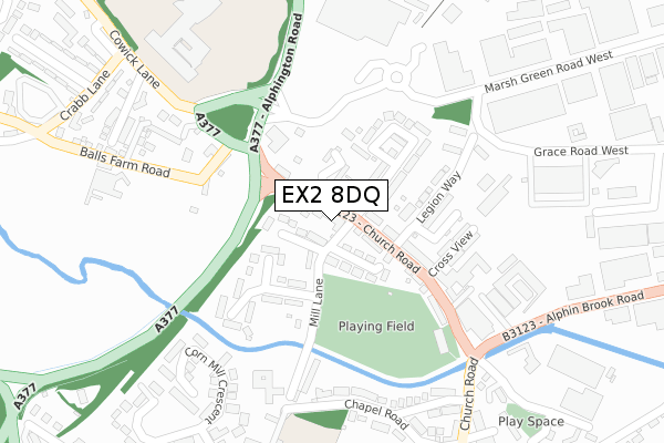
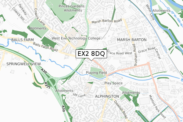
EX2 8DQ is located in the Alphington electoral ward, within the local authority district of Exeter and the English Parliamentary constituency of Exeter. The Sub Integrated Care Board (ICB) Location is NHS Devon ICB - 15N and the police force is Devon & Cornwall. This postcode has been in use since February 2020.


GetTheData
Source: OS Open Zoomstack (Ordnance Survey)
Licence: Open Government Licence (requires attribution)
Attribution: Contains OS data © Crown copyright and database right 2025
Source: Open Postcode Geo
Licence: Open Government Licence (requires attribution)
Attribution: Contains OS data © Crown copyright and database right 2025; Contains Royal Mail data © Royal Mail copyright and database right 2025; Source: Office for National Statistics licensed under the Open Government Licence v.3.0
| Easting | 291582 |
| Northing | 90483 |
| Latitude | 50.703835 |
| Longitude | -3.536702 |
GetTheData
Source: Open Postcode Geo
Licence: Open Government Licence
| Country | England |
| Postcode District | EX2 |
➜ See where EX2 is on a map ➜ Where is Exeter? | |
GetTheData
Source: Land Registry Price Paid Data
Licence: Open Government Licence
| Ward | Alphington |
| Constituency | Exeter |
GetTheData
Source: ONS Postcode Database
Licence: Open Government Licence
| Garage (Church Road) | Alphington | 30m |
| Garage (Church Road) | Alphington | 58m |
| Legion Way (Church Road) | Alphington | 107m |
| Bakers Yard (Church Road) | Alphington | 240m |
| Sainsburys (Alphington Road) | Alphington | 286m |
| Exeter St Thomas Station | 1.5km |
| Exeter Central Station | 2.5km |
| Exeter St Davids Station | 2.9km |
GetTheData
Source: NaPTAN
Licence: Open Government Licence
GetTheData
Source: ONS Postcode Database
Licence: Open Government Licence


➜ Get more ratings from the Food Standards Agency
GetTheData
Source: Food Standards Agency
Licence: FSA terms & conditions
| Last Collection | |||
|---|---|---|---|
| Location | Mon-Fri | Sat | Distance |
| Hatherleigh Road | 17:45 | 12:00 | 557m |
| Grace Road | 19:15 | 12:45 | 631m |
| Princes Road East | 17:45 | 12:00 | 963m |
GetTheData
Source: Dracos
Licence: Creative Commons Attribution-ShareAlike
The below table lists the International Territorial Level (ITL) codes (formerly Nomenclature of Territorial Units for Statistics (NUTS) codes) and Local Administrative Units (LAU) codes for EX2 8DQ:
| ITL 1 Code | Name |
|---|---|
| TLK | South West (England) |
| ITL 2 Code | Name |
| TLK4 | Devon |
| ITL 3 Code | Name |
| TLK43 | Devon CC |
| LAU 1 Code | Name |
| E07000041 | Exeter |
GetTheData
Source: ONS Postcode Directory
Licence: Open Government Licence
The below table lists the Census Output Area (OA), Lower Layer Super Output Area (LSOA), and Middle Layer Super Output Area (MSOA) for EX2 8DQ:
| Code | Name | |
|---|---|---|
| OA | E00101083 | |
| LSOA | E01019969 | Exeter 014B |
| MSOA | E02004162 | Exeter 014 |
GetTheData
Source: ONS Postcode Directory
Licence: Open Government Licence
| EX2 8FX | The Halt | 52m |
| EX2 8SB | Church Road | 66m |
| EX2 8SF | Mandrake Close | 72m |
| EX2 8SH | Church Road | 74m |
| EX2 8SR | Fairfax Gardens | 85m |
| EX2 8SD | Blenheim Road | 104m |
| EX2 8SA | Alphington Road | 120m |
| EX2 8SJ | Church Road | 127m |
| EX2 8SQ | Mandrake Road | 152m |
| EX2 8SG | Mill Lane | 159m |
GetTheData
Source: Open Postcode Geo; Land Registry Price Paid Data
Licence: Open Government Licence