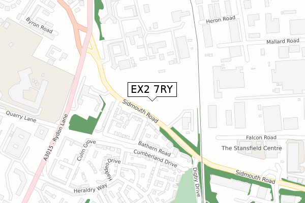
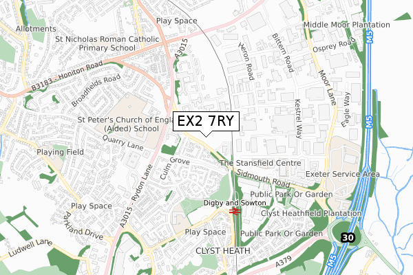
EX2 7RY is located in the St Loyes electoral ward, within the local authority district of Exeter and the English Parliamentary constituency of East Devon. The Sub Integrated Care Board (ICB) Location is NHS Devon ICB - 15N and the police force is Devon & Cornwall. This postcode has been in use since January 2020.


GetTheData
Source: OS Open Zoomstack (Ordnance Survey)
Licence: Open Government Licence (requires attribution)
Attribution: Contains OS data © Crown copyright and database right 2025
Source: Open Postcode Geo
Licence: Open Government Licence (requires attribution)
Attribution: Contains OS data © Crown copyright and database right 2025; Contains Royal Mail data © Royal Mail copyright and database right 2025; Source: Office for National Statistics licensed under the Open Government Licence v.3.0
| Easting | 295844 |
| Northing | 91983 |
| Latitude | 50.718100 |
| Longitude | -3.476792 |
GetTheData
Source: Open Postcode Geo
Licence: Open Government Licence
| Country | England |
| Postcode District | EX2 |
➜ See where EX2 is on a map ➜ Where is Exeter? | |
GetTheData
Source: Land Registry Price Paid Data
Licence: Open Government Licence
| Ward | St Loyes |
| Constituency | East Devon |
GetTheData
Source: ONS Postcode Database
Licence: Open Government Licence
| Middlemoor (Sidmouth Road) | Digby | 116m |
| Middlemoor (Sidmouth Road) | Digby | 136m |
| Digby Arch (Sidmouth Road) | Digby | 243m |
| Digby Arch (Sidmouth Road) | Digby | 252m |
| Ringswell Park (Sidmouth Road) | Digby | 401m |
| Digby & Sowton Station | 0.5km |
| Newcourt Station | 1.5km |
| Pinhoe Station | 2.3km |
GetTheData
Source: NaPTAN
Licence: Open Government Licence
GetTheData
Source: ONS Postcode Database
Licence: Open Government Licence


➜ Get more ratings from the Food Standards Agency
GetTheData
Source: Food Standards Agency
Licence: FSA terms & conditions
| Last Collection | |||
|---|---|---|---|
| Location | Mon-Fri | Sat | Distance |
| Honiton Road | 18:15 | 12:30 | 602m |
| Wilton Way | 18:15 | 13:00 | 652m |
| Sowton Industrial Estate | 19:00 | 12:30 | 690m |
GetTheData
Source: Dracos
Licence: Creative Commons Attribution-ShareAlike
The below table lists the International Territorial Level (ITL) codes (formerly Nomenclature of Territorial Units for Statistics (NUTS) codes) and Local Administrative Units (LAU) codes for EX2 7RY:
| ITL 1 Code | Name |
|---|---|
| TLK | South West (England) |
| ITL 2 Code | Name |
| TLK4 | Devon |
| ITL 3 Code | Name |
| TLK43 | Devon CC |
| LAU 1 Code | Name |
| E07000041 | Exeter |
GetTheData
Source: ONS Postcode Directory
Licence: Open Government Licence
The below table lists the Census Output Area (OA), Lower Layer Super Output Area (LSOA), and Middle Layer Super Output Area (MSOA) for EX2 7RY:
| Code | Name | |
|---|---|---|
| OA | E00101374 | |
| LSOA | E01033234 | Exeter 011G |
| MSOA | E02004159 | Exeter 011 |
GetTheData
Source: ONS Postcode Directory
Licence: Open Government Licence
| EX2 7QE | Bathern Road | 141m |
| EX2 7RD | Barle Close | 151m |
| EX2 7QF | Dart Walk | 206m |
| EX2 7RF | Cumberland Drive | 246m |
| EX2 7PE | Haddeo Drive | 272m |
| EX2 7RL | Edwards Court | 284m |
| EX2 7QX | Culm Grove | 295m |
| EX2 7PQ | Norman Place | 311m |
| EX2 5SG | Badger Close | 330m |
| EX2 7RJ | Norman Mews | 337m |
GetTheData
Source: Open Postcode Geo; Land Registry Price Paid Data
Licence: Open Government Licence