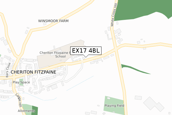
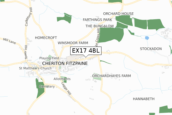
EX17 4BL is located in the Way electoral ward, within the local authority district of Mid Devon and the English Parliamentary constituency of Central Devon. The Sub Integrated Care Board (ICB) Location is NHS Devon ICB - 15N and the police force is Devon & Cornwall. This postcode has been in use since September 2019.


GetTheData
Source: OS Open Zoomstack (Ordnance Survey)
Licence: Open Government Licence (requires attribution)
Attribution: Contains OS data © Crown copyright and database right 2025
Source: Open Postcode Geo
Licence: Open Government Licence (requires attribution)
Attribution: Contains OS data © Crown copyright and database right 2025; Contains Royal Mail data © Royal Mail copyright and database right 2025; Source: Office for National Statistics licensed under the Open Government Licence v.3.0
| Easting | 287479 |
| Northing | 106342 |
| Latitude | 50.845615 |
| Longitude | -3.599640 |
GetTheData
Source: Open Postcode Geo
Licence: Open Government Licence
| Country | England |
| Postcode District | EX17 |
➜ See where EX17 is on a map ➜ Where is Cheriton Fitzpaine? | |
GetTheData
Source: Land Registry Price Paid Data
Licence: Open Government Licence
| Ward | Way |
| Constituency | Central Devon |
GetTheData
Source: ONS Postcode Database
Licence: Open Government Licence
2024 13 DEC £422,000 |
16, SANDERS LEA, CHERITON FITZPAINE, CREDITON, EX17 4BL 2021 9 APR £345,000 |
2, SANDERS LEA, CHERITON FITZPAINE, CREDITON, EX17 4BL 2021 4 FEB £405,000 |
31, SANDERS LEA, CHERITON FITZPAINE, CREDITON, EX17 4BL 2021 29 JAN £415,000 |
25, SANDERS LEA, CHERITON FITZPAINE, CREDITON, EX17 4BL 2020 23 OCT £340,000 |
23, SANDERS LEA, CHERITON FITZPAINE, CREDITON, EX17 4BL 2020 9 OCT £275,000 |
6, SANDERS LEA, CHERITON FITZPAINE, CREDITON, EX17 4BL 2020 25 SEP £380,000 |
4, SANDERS LEA, CHERITON FITZPAINE, CREDITON, EX17 4BL 2020 18 SEP £340,000 |
2020 1 SEP £375,500 |
29, SANDERS LEA, CHERITON FITZPAINE, CREDITON, EX17 4BL 2020 3 JUL £380,000 |
➜ Cheriton Fitzpaine house prices
GetTheData
Source: HM Land Registry Price Paid Data
Licence: Contains HM Land Registry data © Crown copyright and database right 2025. This data is licensed under the Open Government Licence v3.0.
| White Cross | Cheriton Fitzpaine | 167m |
| White Cross | Cheriton Fitzpaine | 171m |
| Shelter | Cheriton Fitzpaine | 457m |
| Half Moon Inn | Cheriton Fitzpaine | 468m |
GetTheData
Source: NaPTAN
Licence: Open Government Licence
GetTheData
Source: ONS Postcode Database
Licence: Open Government Licence
The below table lists the International Territorial Level (ITL) codes (formerly Nomenclature of Territorial Units for Statistics (NUTS) codes) and Local Administrative Units (LAU) codes for EX17 4BL:
| ITL 1 Code | Name |
|---|---|
| TLK | South West (England) |
| ITL 2 Code | Name |
| TLK4 | Devon |
| ITL 3 Code | Name |
| TLK43 | Devon CC |
| LAU 1 Code | Name |
| E07000042 | Mid Devon |
GetTheData
Source: ONS Postcode Directory
Licence: Open Government Licence
The below table lists the Census Output Area (OA), Lower Layer Super Output Area (LSOA), and Middle Layer Super Output Area (MSOA) for EX17 4BL:
| Code | Name | |
|---|---|---|
| OA | E00101661 | |
| LSOA | E01020077 | Mid Devon 001D |
| MSOA | E02004164 | Mid Devon 001 |
GetTheData
Source: ONS Postcode Directory
Licence: Open Government Licence
| EX17 4HA | Landboat Cottages | 51m |
| EX17 4HB | White Cross | 115m |
| EX17 4HE | 169m | |
| EX17 4JX | Cherry Meadow | 212m |
| EX17 4HD | 229m | |
| EX17 4JN | 311m | |
| EX17 4LJ | Barnshill Close | 338m |
| EX17 4HY | Cherry Close | 338m |
| EX17 4HX | Barnshill Court | 353m |
| EX17 4JL | Landboat View | 357m |
GetTheData
Source: Open Postcode Geo; Land Registry Price Paid Data
Licence: Open Government Licence