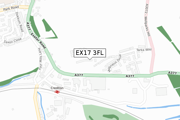
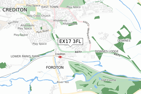
EX17 3FL is located in the Crediton Boniface electoral ward, within the local authority district of Mid Devon and the English Parliamentary constituency of Central Devon. The Sub Integrated Care Board (ICB) Location is NHS Devon ICB - 15N and the police force is Devon & Cornwall. This postcode has been in use since November 2019.


GetTheData
Source: OS Open Zoomstack (Ordnance Survey)
Licence: Open Government Licence (requires attribution)
Attribution: Contains OS data © Crown copyright and database right 2025
Source: Open Postcode Geo
Licence: Open Government Licence (requires attribution)
Attribution: Contains OS data © Crown copyright and database right 2025; Contains Royal Mail data © Royal Mail copyright and database right 2025; Source: Office for National Statistics licensed under the Open Government Licence v.3.0
| Easting | 284249 |
| Northing | 99711 |
| Latitude | 50.785372 |
| Longitude | -3.643406 |
GetTheData
Source: Open Postcode Geo
Licence: Open Government Licence
| Country | England |
| Postcode District | EX17 |
➜ See where EX17 is on a map ➜ Where is Crediton? | |
GetTheData
Source: Land Registry Price Paid Data
Licence: Open Government Licence
| Ward | Crediton Boniface |
| Constituency | Central Devon |
GetTheData
Source: ONS Postcode Database
Licence: Open Government Licence
27, YEO CRESCENT, CREDITON, EX17 3FL 2022 29 APR £442,950 |
21, YEO CRESCENT, CREDITON, EX17 3FL 2022 29 APR £449,950 |
19, YEO CRESCENT, CREDITON, EX17 3FL 2022 25 MAR £459,950 |
17, YEO CRESCENT, CREDITON, EX17 3FL 2021 21 DEC £444,950 |
15, YEO CRESCENT, CREDITON, EX17 3FL 2021 17 DEC £429,950 |
13, YEO CRESCENT, CREDITON, EX17 3FL 2021 17 DEC £444,950 |
10, YEO CRESCENT, CREDITON, EX17 3FL 2021 25 OCT £399,950 |
8, YEO CRESCENT, CREDITON, EX17 3FL 2021 31 AUG £399,950 |
11, YEO CRESCENT, CREDITON, EX17 3FL 2021 30 JUL £324,950 |
6, YEO CRESCENT, CREDITON, EX17 3FL 2021 30 JUN £372,450 |
GetTheData
Source: HM Land Registry Price Paid Data
Licence: Contains HM Land Registry data © Crown copyright and database right 2025. This data is licensed under the Open Government Licence v3.0.
| Wellparks Farm (A377) | Crediton | 206m |
| Tesco | Fordton | 249m |
| Wellparks Farm (A377) | Crediton | 252m |
| Station Cross (Exeter Road) | Crediton | 266m |
| Station Cross (Exeter Road) | Crediton | 267m |
| Crediton Station | 0.3km |
| Newton St Cyres Station | 3.9km |
GetTheData
Source: NaPTAN
Licence: Open Government Licence
GetTheData
Source: ONS Postcode Database
Licence: Open Government Licence


➜ Get more ratings from the Food Standards Agency
GetTheData
Source: Food Standards Agency
Licence: FSA terms & conditions
| Last Collection | |||
|---|---|---|---|
| Location | Mon-Fri | Sat | Distance |
| Railway Station | 16:45 | 12:00 | 321m |
| Exeter Road Post Office | 16:45 | 12:00 | 443m |
| Crediton Delivery Office | 18:15 | 12:30 | 612m |
GetTheData
Source: Dracos
Licence: Creative Commons Attribution-ShareAlike
The below table lists the International Territorial Level (ITL) codes (formerly Nomenclature of Territorial Units for Statistics (NUTS) codes) and Local Administrative Units (LAU) codes for EX17 3FL:
| ITL 1 Code | Name |
|---|---|
| TLK | South West (England) |
| ITL 2 Code | Name |
| TLK4 | Devon |
| ITL 3 Code | Name |
| TLK43 | Devon CC |
| LAU 1 Code | Name |
| E07000042 | Mid Devon |
GetTheData
Source: ONS Postcode Directory
Licence: Open Government Licence
The below table lists the Census Output Area (OA), Lower Layer Super Output Area (LSOA), and Middle Layer Super Output Area (MSOA) for EX17 3FL:
| Code | Name | |
|---|---|---|
| OA | E00101454 | |
| LSOA | E01020041 | Mid Devon 011A |
| MSOA | E02004174 | Mid Devon 011 |
GetTheData
Source: ONS Postcode Directory
Licence: Open Government Licence
| EX17 3BN | Exeter Road | 187m |
| EX17 3BL | Exeter Road | 273m |
| EX17 3BT | Four Mills Lane | 307m |
| EX17 3BU | Taw Vale Terrace | 322m |
| EX17 3BX | Station Road | 343m |
| EX17 3PP | Station Approach | 350m |
| EX17 3BW | Exeter Road | 356m |
| EX17 3BZ | Fordton Trading Estate | 389m |
| EX17 3BJ | Exeter Road | 399m |
| EX17 3BH | Exeter Road | 412m |
GetTheData
Source: Open Postcode Geo; Land Registry Price Paid Data
Licence: Open Government Licence