EX17 1FE maps, stats, and open data
EX17 1FE is located in the Crediton Boniface electoral ward, within the local authority district of Mid Devon and the English Parliamentary constituency of Central Devon. The Sub Integrated Care Board (ICB) Location is NHS Devon ICB - 15N and the police force is Devon & Cornwall. This postcode has been in use since July 2018.
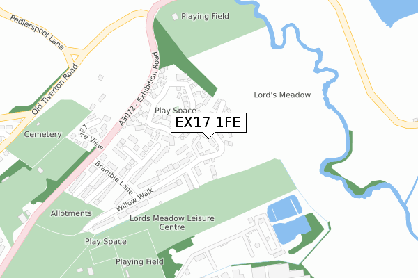
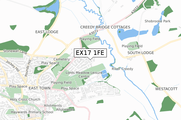
EX17 1FE maps


Licence: Open Government Licence (requires attribution)
Attribution: Contains OS data © Crown copyright and database right 2025
Source: Open Postcode Geo
Licence: Open Government Licence (requires attribution)
Attribution: Contains OS data © Crown copyright and database right 2025; Contains Royal Mail data © Royal Mail copyright and database right 2025; Source: Office for National Statistics licensed under the Open Government Licence v.3.0
EX17 1FE geodata
| Easting | 284538 |
| Northing | 100752 |
| Latitude | 50.794787 |
| Longitude | -3.639635 |
Where is EX17 1FE?
| Country | England |
| Postcode District | EX17 |
Politics
| Ward | Crediton Boniface |
|---|---|
| Constituency | Central Devon |
House Prices
Sales of detached houses in EX17 1FE
2024 28 MAY £320,000 |
2022 8 NOV £395,000 |
2022 15 JUN £352,500 |
2022 18 JAN £360,000 |
2021 21 JAN £315,000 |
60, WILLOW WALK, CREDITON, EX17 1FE 2019 13 DEC £269,995 |
2019 28 JUN £309,995 |
127, WILLOW WALK, CREDITON, EX17 1FE 2019 28 JUN £279,995 |
105, WILLOW WALK, CREDITON, EX17 1FE 2019 28 JUN £309,995 |
2019 31 MAY £282,995 |
Licence: Contains HM Land Registry data © Crown copyright and database right 2025. This data is licensed under the Open Government Licence v3.0.
Transport
Nearest bus stops to EX17 1FE
| Willow Walk (Bramble Lane) | Crediton | 233m |
| Bramble Lane (Exhibition Road) | Crediton | 291m |
| Bramble Lane (Exhibition Road) | Crediton | 296m |
| Old Tiverton Road | Crediton | 459m |
| Creedy Bridge | Crediton | 488m |
Nearest railway stations to EX17 1FE
| Crediton Station | 1.4km |
| Newton St Cyres Station | 4km |
Broadband
Broadband access in EX17 1FE (2020 data)
| Percentage of properties with Next Generation Access | 100.0% |
| Percentage of properties with Superfast Broadband | 100.0% |
| Percentage of properties with Ultrafast Broadband | 0.0% |
| Percentage of properties with Full Fibre Broadband | 0.0% |
Superfast Broadband is between 30Mbps and 300Mbps
Ultrafast Broadband is > 300Mbps
Broadband limitations in EX17 1FE (2020 data)
| Percentage of properties unable to receive 2Mbps | 0.0% |
| Percentage of properties unable to receive 5Mbps | 0.0% |
| Percentage of properties unable to receive 10Mbps | 0.0% |
| Percentage of properties unable to receive 30Mbps | 0.0% |
Deprivation
10.5% of English postcodes are less deprived than EX17 1FE:Food Standards Agency
Three nearest food hygiene ratings to EX17 1FE (metres)


➜ Get more ratings from the Food Standards Agency
Nearest post box to EX17 1FE
| Last Collection | |||
|---|---|---|---|
| Location | Mon-Fri | Sat | Distance |
| Crediton Delivery Office | 18:15 | 12:30 | 723m |
| Blagdon | 17:15 | 12:00 | 969m |
| Exeter Road Post Office | 16:45 | 12:00 | 1,031m |
EX17 1FE ITL and EX17 1FE LAU
The below table lists the International Territorial Level (ITL) codes (formerly Nomenclature of Territorial Units for Statistics (NUTS) codes) and Local Administrative Units (LAU) codes for EX17 1FE:
| ITL 1 Code | Name |
|---|---|
| TLK | South West (England) |
| ITL 2 Code | Name |
| TLK4 | Devon |
| ITL 3 Code | Name |
| TLK43 | Devon CC |
| LAU 1 Code | Name |
| E07000042 | Mid Devon |
EX17 1FE census areas
The below table lists the Census Output Area (OA), Lower Layer Super Output Area (LSOA), and Middle Layer Super Output Area (MSOA) for EX17 1FE:
| Code | Name | |
|---|---|---|
| OA | E00101457 | |
| LSOA | E01020042 | Mid Devon 011B |
| MSOA | E02004174 | Mid Devon 011 |
Nearest postcodes to EX17 1FE
| EX17 1JZ | Cromwells Meadow | 106m |
| EX17 1BZ | Primrose Way | 165m |
| EX17 1DD | Willow Walk | 185m |
| EX17 1DE | Elder Grove | 216m |
| EX17 1DA | Bramble Lane | 240m |
| EX17 1BX | Exhibition Road | 258m |
| EX17 1DW | Lake View | 289m |
| EX17 1DB | Hedgerow Close | 294m |
| EX17 1BY | Exhibition Road | 322m |
| EX17 1DN | Marsh End | 411m |