Property/Postcode Data Search:
EX16 9FF maps, stats, and open data
EX16 9FF is located in the Clare & Shuttern electoral ward, within the local authority district of Mid Devon and the English Parliamentary constituency of Tiverton and Honiton. The Sub Integrated Care Board (ICB) Location is NHS Devon ICB - 15N and the police force is Devon & Cornwall. This postcode has been in use since September 2019.
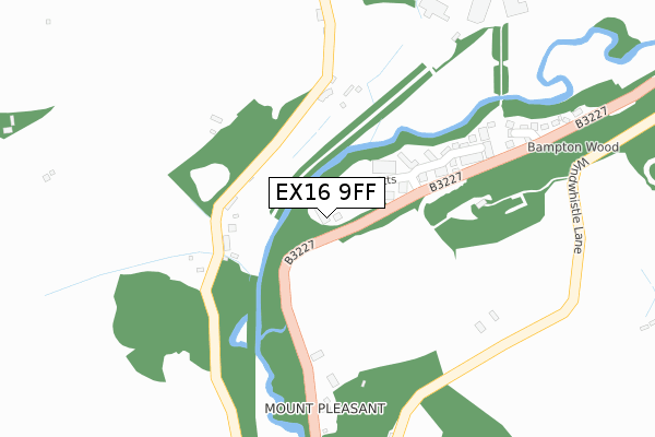
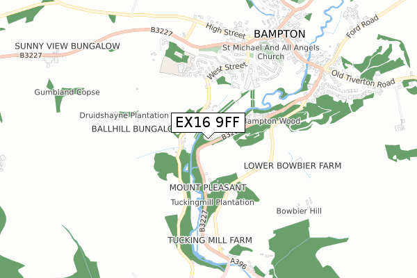
EX16 9FF maps


Source: OS Open Zoomstack (Ordnance Survey)
Licence: Open Government Licence (requires attribution)
Attribution: Contains OS data © Crown copyright and database right 2025
Source: Open Postcode Geo
Licence: Open Government Licence (requires attribution)
Attribution: Contains OS data © Crown copyright and database right 2025; Contains Royal Mail data © Royal Mail copyright and database right 2025; Source: Office for National Statistics licensed under the Open Government Licence v.3.0
Licence: Open Government Licence (requires attribution)
Attribution: Contains OS data © Crown copyright and database right 2025
Source: Open Postcode Geo
Licence: Open Government Licence (requires attribution)
Attribution: Contains OS data © Crown copyright and database right 2025; Contains Royal Mail data © Royal Mail copyright and database right 2025; Source: Office for National Statistics licensed under the Open Government Licence v.3.0
EX16 9FF geodata
| Easting | 295352 |
| Northing | 121685 |
| Latitude | 50.985021 |
| Longitude | -3.492258 |
Where is EX16 9FF?
| Country | England |
| Postcode District | EX16 |
Politics
| Ward | Clare & Shuttern |
|---|---|
| Constituency | Tiverton And Honiton |
House Prices
Sales of detached houses in EX16 9FF
12, QUARRYMAN CLOSE, BAMPTON, TIVERTON, EX16 9FF 2023 11 SEP £349,000 |
11, QUARRYMAN CLOSE, BAMPTON, TIVERTON, EX16 9FF 2022 11 MAR £375,000 |
10, QUARRYMAN CLOSE, BAMPTON, TIVERTON, EX16 9FF 2021 16 APR £315,000 |
9, QUARRYMAN CLOSE, BAMPTON, TIVERTON, EX16 9FF 2021 16 FEB £315,000 |
8, QUARRYMAN CLOSE, BAMPTON, TIVERTON, EX16 9FF 2020 2 OCT £335,000 |
Source: HM Land Registry Price Paid Data
Licence: Contains HM Land Registry data © Crown copyright and database right 2025. This data is licensed under the Open Government Licence v3.0.
Licence: Contains HM Land Registry data © Crown copyright and database right 2025. This data is licensed under the Open Government Licence v3.0.
Transport
Nearest bus stops to EX16 9FF
| War Memorial (B3227) | Bampton | 628m |
| War Memorial (High Street) | Bampton | 653m |
| Brook Street | Bampton | 731m |
| Brook Street | Bampton | 733m |
| Exeter Inn (A396) | Bampton | 777m |
Deprivation
57.8% of English postcodes are less deprived than EX16 9FF:Food Standards Agency
Three nearest food hygiene ratings to EX16 9FF (metres)
Bampton C of E Primary School

School Close
459m
The Swan

Station Road
617m
Bampton Delicatssen

11 Newton Square
685m
➜ Get more ratings from the Food Standards Agency
Nearest post box to EX16 9FF
| Last Collection | |||
|---|---|---|---|
| Location | Mon-Fri | Sat | Distance |
| Bampton Post Office | 16:45 | 12:15 | 693m |
| Morebath Post Office | 15:30 | 10:30 | 3,315m |
| Oakford Post Office | 14:30 | 07:00 | 4,396m |
EX16 9FF ITL and EX16 9FF LAU
The below table lists the International Territorial Level (ITL) codes (formerly Nomenclature of Territorial Units for Statistics (NUTS) codes) and Local Administrative Units (LAU) codes for EX16 9FF:
| ITL 1 Code | Name |
|---|---|
| TLK | South West (England) |
| ITL 2 Code | Name |
| TLK4 | Devon |
| ITL 3 Code | Name |
| TLK43 | Devon CC |
| LAU 1 Code | Name |
| E07000042 | Mid Devon |
EX16 9FF census areas
The below table lists the Census Output Area (OA), Lower Layer Super Output Area (LSOA), and Middle Layer Super Output Area (MSOA) for EX16 9FF:
| Code | Name | |
|---|---|---|
| OA | E00101502 | |
| LSOA | E01020050 | Mid Devon 001C |
| MSOA | E02004164 | Mid Devon 001 |
Nearest postcodes to EX16 9FF
| EX16 9NL | 168m | |
| EX16 9DN | Woodland Close | 186m |
| EX16 9FB | Batherm Close | 328m |
| EX16 9NP | Meadow View | 412m |
| EX16 9NY | Lords Meadow Lane | 423m |
| EX16 9NJ | West Street | 424m |
| EX16 9GA | Elizabeth Penton Way | 432m |
| EX16 9NN | School Close | 466m |
| EX16 9NG | Station Road | 492m |
| EX16 9DX | 529m |