Property/Postcode Data Search:
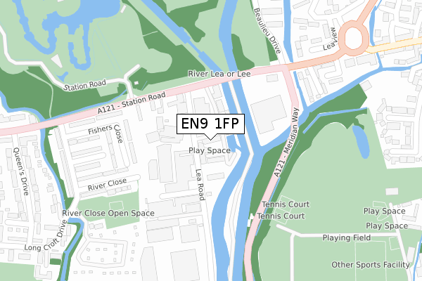
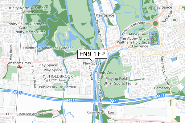
EN9 1FP maps, stats, and open data
EN9 1FP is located in the Waltham Cross electoral ward, within the local authority district of Broxbourne and the English Parliamentary constituency of Broxbourne. The Sub Integrated Care Board (ICB) Location is NHS Hertfordshire and West Essex ICB - 06K and the police force is Hertfordshire. This postcode has been in use since February 2020.
EN9 1FP maps


Source: OS Open Zoomstack (Ordnance Survey)
Licence: Open Government Licence (requires attribution)
Attribution: Contains OS data © Crown copyright and database right 2025
Source: Open Postcode Geo
Licence: Open Government Licence (requires attribution)
Attribution: Contains OS data © Crown copyright and database right 2025; Contains Royal Mail data © Royal Mail copyright and database right 2025; Source: Office for National Statistics licensed under the Open Government Licence v.3.0
Licence: Open Government Licence (requires attribution)
Attribution: Contains OS data © Crown copyright and database right 2025
Source: Open Postcode Geo
Licence: Open Government Licence (requires attribution)
Attribution: Contains OS data © Crown copyright and database right 2025; Contains Royal Mail data © Royal Mail copyright and database right 2025; Source: Office for National Statistics licensed under the Open Government Licence v.3.0
EN9 1FP geodata
| Easting | 537519 |
| Northing | 200390 |
| Latitude | 51.685439 |
| Longitude | -0.012078 |
Where is EN9 1FP?
| Country | England |
| Postcode District | EN9 |
Politics
| Ward | Waltham Cross |
|---|---|
| Constituency | Broxbourne |
Transport
Nearest bus stops to EN9 1FP
| Lea Road (Station Road) | Waltham Cross | 159m |
| Lea Road (Station Road) | Waltham Cross | 177m |
| Mcdonalds (Highbridge Street) | Waltham Abbey | 274m |
| Long Croft Drive | Waltham Cross | 364m |
| Long Croft Drive | Waltham Cross | 370m |
Nearest railway stations to EN9 1FP
| Waltham Cross Station | 1km |
| Theobalds Grove Station | 1.8km |
| Enfield Lock Station | 2km |
Deprivation
87.1% of English postcodes are less deprived than EN9 1FP:Food Standards Agency
Three nearest food hygiene ratings to EN9 1FP (metres)
Lea Valley Café

Miller House
74m
Blue Ice Machines Ltd
Unit G
97m
Home Bargains
Unit 2
159m
➜ Get more ratings from the Food Standards Agency
Nearest post box to EN9 1FP
| Last Collection | |||
|---|---|---|---|
| Location | Mon-Fri | Sat | Distance |
| Highbridge Street | 17:30 | 11:30 | 324m |
| Greenyard | 17:30 | 11:30 | 562m |
| Waltham Abbey P.o | 18:30 | 12:00 | 788m |
EN9 1FP ITL and EN9 1FP LAU
The below table lists the International Territorial Level (ITL) codes (formerly Nomenclature of Territorial Units for Statistics (NUTS) codes) and Local Administrative Units (LAU) codes for EN9 1FP:
| ITL 1 Code | Name |
|---|---|
| TLH | East |
| ITL 2 Code | Name |
| TLH2 | Bedfordshire and Hertfordshire |
| ITL 3 Code | Name |
| TLH23 | Hertfordshire CC |
| LAU 1 Code | Name |
| E07000095 | Broxbourne |
EN9 1FP census areas
The below table lists the Census Output Area (OA), Lower Layer Super Output Area (LSOA), and Middle Layer Super Output Area (MSOA) for EN9 1FP:
| Code | Name | |
|---|---|---|
| OA | E00118557 | |
| LSOA | E01023338 | Broxbourne 013C |
| MSOA | E02004855 | Broxbourne 013 |
Nearest postcodes to EN9 1FP
| EN9 1AE | Lea Road | 98m |
| EN9 1AN | Lea Road | 126m |
| EN9 1AA | Station Road | 149m |
| EN8 7NN | Fishers Close | 199m |
| EN9 1BH | Highbridge Street | 208m |
| EN9 1AJ | Lea Road | 215m |
| EN8 7NW | Fishers Close | 268m |
| EN8 7QR | River Close | 272m |
| EN8 7QP | Barbel Close | 297m |
| EN8 7NL | Fishers Close | 309m |