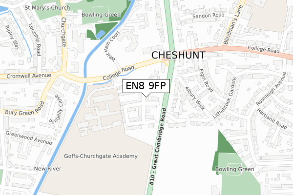
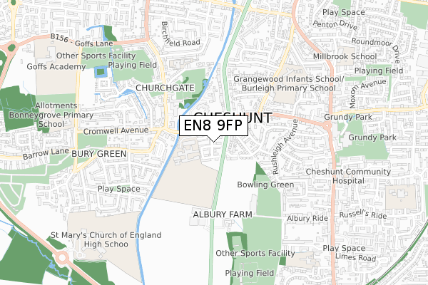
EN8 9FP is located in the Rosedale and Bury Green electoral ward, within the local authority district of Broxbourne and the English Parliamentary constituency of Broxbourne. The Sub Integrated Care Board (ICB) Location is NHS Hertfordshire and West Essex ICB - 06K and the police force is Hertfordshire. This postcode has been in use since August 2017.


GetTheData
Source: OS Open Zoomstack (Ordnance Survey)
Licence: Open Government Licence (requires attribution)
Attribution: Contains OS data © Crown copyright and database right 2025
Source: Open Postcode Geo
Licence: Open Government Licence (requires attribution)
Attribution: Contains OS data © Crown copyright and database right 2025; Contains Royal Mail data © Royal Mail copyright and database right 2025; Source: Office for National Statistics licensed under the Open Government Licence v.3.0
| Easting | 535240 |
| Northing | 202098 |
| Latitude | 51.701340 |
| Longitude | -0.044362 |
GetTheData
Source: Open Postcode Geo
Licence: Open Government Licence
| Country | England |
| Postcode District | EN8 |
➜ See where EN8 is on a map ➜ Where is Cheshunt? | |
GetTheData
Source: Land Registry Price Paid Data
Licence: Open Government Licence
| Ward | Rosedale And Bury Green |
| Constituency | Broxbourne |
GetTheData
Source: ONS Postcode Database
Licence: Open Government Licence
2024 1 NOV £420,000 |
2023 19 OCT £750,000 |
2023 10 JUL £650,000 |
2022 21 NOV £660,000 |
2022 4 FEB £587,500 |
2021 26 FEB £530,000 |
2020 21 DEC £517,000 |
2020 2 MAR £383,000 |
2018 7 SEP £500,000 |
83, MARKWICK AVENUE, CHESHUNT, WALTHAM CROSS, EN8 9FP 2018 21 AUG £535,000 |
GetTheData
Source: HM Land Registry Price Paid Data
Licence: Contains HM Land Registry data © Crown copyright and database right 2025. This data is licensed under the Open Government Licence v3.0.
| The Crocodile Ph (College Road) | Cheshunt | 121m |
| Elgin Road (College Road) | Cheshunt | 226m |
| Bishops' College (College Road) | Cheshunt | 264m |
| Elgin Road (College Road) | Cheshunt | 274m |
| Bishops' College (Churchgate) | Cheshunt | 304m |
| Theobalds Grove Station | 1.2km |
| Cheshunt Station | 1.4km |
| Waltham Cross Station | 2.2km |
GetTheData
Source: NaPTAN
Licence: Open Government Licence
| Percentage of properties with Next Generation Access | 100.0% |
| Percentage of properties with Superfast Broadband | 100.0% |
| Percentage of properties with Ultrafast Broadband | 0.0% |
| Percentage of properties with Full Fibre Broadband | 0.0% |
Superfast Broadband is between 30Mbps and 300Mbps
Ultrafast Broadband is > 300Mbps
| Median download speed | 57.2Mbps |
| Average download speed | 47.8Mbps |
| Maximum download speed | 76.12Mbps |
| Median upload speed | 14.9Mbps |
| Average upload speed | 13.1Mbps |
| Maximum upload speed | 20.00Mbps |
| Percentage of properties unable to receive 2Mbps | 0.0% |
| Percentage of properties unable to receive 5Mbps | 0.0% |
| Percentage of properties unable to receive 10Mbps | 0.0% |
| Percentage of properties unable to receive 30Mbps | 0.0% |
GetTheData
Source: Ofcom
Licence: Ofcom Terms of Use (requires attribution)
GetTheData
Source: ONS Postcode Database
Licence: Open Government Licence


➜ Get more ratings from the Food Standards Agency
GetTheData
Source: Food Standards Agency
Licence: FSA terms & conditions
| Last Collection | |||
|---|---|---|---|
| Location | Mon-Fri | Sat | Distance |
| Council Offices Churchgate | 18:15 | 11:30 | 340m |
| Churchgate | 17:30 | 11:30 | 442m |
| Blindmans Lane | 17:30 | 11:30 | 539m |
GetTheData
Source: Dracos
Licence: Creative Commons Attribution-ShareAlike
The below table lists the International Territorial Level (ITL) codes (formerly Nomenclature of Territorial Units for Statistics (NUTS) codes) and Local Administrative Units (LAU) codes for EN8 9FP:
| ITL 1 Code | Name |
|---|---|
| TLH | East |
| ITL 2 Code | Name |
| TLH2 | Bedfordshire and Hertfordshire |
| ITL 3 Code | Name |
| TLH23 | Hertfordshire CC |
| LAU 1 Code | Name |
| E07000095 | Broxbourne |
GetTheData
Source: ONS Postcode Directory
Licence: Open Government Licence
The below table lists the Census Output Area (OA), Lower Layer Super Output Area (LSOA), and Middle Layer Super Output Area (MSOA) for EN8 9FP:
| Code | Name | |
|---|---|---|
| OA | E00118353 | |
| LSOA | E01023294 | Broxbourne 011B |
| MSOA | E02004853 | Broxbourne 011 |
GetTheData
Source: ONS Postcode Directory
Licence: Open Government Licence
| EN8 8NY | Great Cambridge Road | 102m |
| EN8 8PD | Farm Close | 141m |
| EN8 9LY | College Road | 155m |
| EN8 8PB | Albury Walk | 157m |
| EN8 8QP | Tyfield Close | 164m |
| EN8 8NZ | Great Cambridge Road | 168m |
| EN8 8QW | Manston Close | 189m |
| EN8 8QL | Elgin Road | 193m |
| EN8 8QJ | Woodcote Close | 201m |
| EN8 9LX | College Road | 204m |
GetTheData
Source: Open Postcode Geo; Land Registry Price Paid Data
Licence: Open Government Licence