Property/Postcode Data Search:
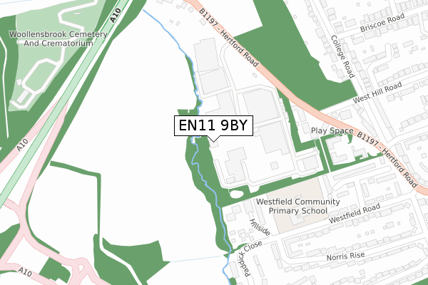
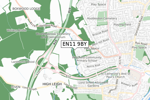
EN11 9BY maps, stats, and open data
EN11 9BY is located in the Hoddesdon North electoral ward, within the local authority district of Broxbourne and the English Parliamentary constituency of Broxbourne. The Sub Integrated Care Board (ICB) Location is NHS Hertfordshire and West Essex ICB - 06K and the police force is Hertfordshire. This postcode has been in use since September 2018.
EN11 9BY maps


Source: OS Open Zoomstack (Ordnance Survey)
Licence: Open Government Licence (requires attribution)
Attribution: Contains OS data © Crown copyright and database right 2025
Source: Open Postcode Geo
Licence: Open Government Licence (requires attribution)
Attribution: Contains OS data © Crown copyright and database right 2025; Contains Royal Mail data © Royal Mail copyright and database right 2025; Source: Office for National Statistics licensed under the Open Government Licence v.3.0
Licence: Open Government Licence (requires attribution)
Attribution: Contains OS data © Crown copyright and database right 2025
Source: Open Postcode Geo
Licence: Open Government Licence (requires attribution)
Attribution: Contains OS data © Crown copyright and database right 2025; Contains Royal Mail data © Royal Mail copyright and database right 2025; Source: Office for National Statistics licensed under the Open Government Licence v.3.0
EN11 9BY geodata
| Easting | 536675 |
| Northing | 209499 |
| Latitude | 51.767499 |
| Longitude | -0.020706 |
Where is EN11 9BY?
| Country | England |
| Postcode District | EN11 |
Politics
| Ward | Hoddesdon North |
|---|---|
| Constituency | Broxbourne |
Transport
Nearest bus stops to EN11 9BY
| Merck Sharpe & Dohme (Hertford Road) | Hoddesdon | 52m |
| Merck Sharpe & Dohme (Hertford Road) | Hoddesdon | 86m |
| College Road (Hertford Road) | Hoddesdon | 327m |
| Briscoe Road (Ware Road) | Hoddesdon | 523m |
| Briscoe Road (Ware Road) | Hoddesdon | 555m |
Nearest railway stations to EN11 9BY
| Rye House Station | 1.8km |
| Broxbourne Station | 2.4km |
| St Margarets (Herts) Station | 2.7km |
Deprivation
49.8% of English postcodes are less deprived than EN11 9BY:Food Standards Agency
Three nearest food hygiene ratings to EN11 9BY (metres)
Copleys Food Ltd, Staff Restaurant, Pharmaron Uk Ltd

West Hill Innovation Park
168m
Westfield Pre-School

Westfield Community Primary School
314m
HCL@Westfield Jmi School

Westfield Community Primary School
314m
➜ Get more ratings from the Food Standards Agency
Nearest post box to EN11 9BY
| Last Collection | |||
|---|---|---|---|
| Location | Mon-Fri | Sat | Distance |
| Norris Lane/Hertford Road | 17:30 | 11:00 | 428m |
| Briscoe Road | 18:00 | 11:00 | 551m |
| Roselands | 18:00 | 11:00 | 568m |
EN11 9BY ITL and EN11 9BY LAU
The below table lists the International Territorial Level (ITL) codes (formerly Nomenclature of Territorial Units for Statistics (NUTS) codes) and Local Administrative Units (LAU) codes for EN11 9BY:
| ITL 1 Code | Name |
|---|---|
| TLH | East |
| ITL 2 Code | Name |
| TLH2 | Bedfordshire and Hertfordshire |
| ITL 3 Code | Name |
| TLH23 | Hertfordshire CC |
| LAU 1 Code | Name |
| E07000095 | Broxbourne |
EN11 9BY census areas
The below table lists the Census Output Area (OA), Lower Layer Super Output Area (LSOA), and Middle Layer Super Output Area (MSOA) for EN11 9BY:
| Code | Name | |
|---|---|---|
| OA | E00118478 | |
| LSOA | E01023322 | Broxbourne 003C |
| MSOA | E02004845 | Broxbourne 003 |
Nearest postcodes to EN11 9BY
| EN11 9DT | Woollens Grove | 127m |
| EN11 9DL | West Hill Road | 196m |
| EN11 9DF | College Road | 199m |
| EN11 9JX | Waterfall Close | 239m |
| EN11 9DJ | College Road | 252m |
| EN11 8RW | Hillside | 257m |
| EN11 9DP | College Road | 263m |
| EN11 9DW | Hertford Road | 275m |
| EN11 9BS | Hertford Road | 282m |
| EN11 9DE | Appleford Close | 282m |