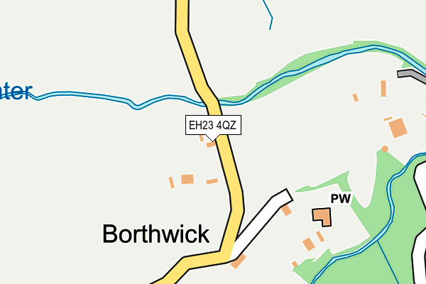
EH23 4QZ is located in the Midlothian South electoral ward, within the council area of Midlothian and the Scottish Parliamentary constituency of Midlothian. The Community Health Partnership is Midlothian Community Health Partnership and the police force is Scotland. This postcode has been in use since January 1980.


GetTheData
Source: OS OpenMap – Local (Ordnance Survey)
Source: OS VectorMap District (Ordnance Survey)
Licence: Open Government Licence (requires attribution)
| Easting | 336727 |
| Northing | 659711 |
| Latitude | 55.826475 |
| Longitude | -3.011553 |
GetTheData
Source: Open Postcode Geo
Licence: Open Government Licence
| Country | Scotland |
| Postcode District | EH23 |
➜ See where EH23 is on a map ➜ Where is Borthwick? | |
GetTheData
Source: Land Registry Price Paid Data
Licence: Open Government Licence
| Ward | Midlothian South |
| Constituency | Midlothian |
GetTheData
Source: ONS Postcode Database
Licence: Open Government Licence
| Middleton (A7) | North Middleton | 1,200m |
| Middleton (A7) | North Middleton | 1,233m |
| Borthwick Castle Road (A7) | North Middleton | 1,320m |
| Borthwick Castle Road (A7) | North Middleton | 1,340m |
| Gorebridge Station | 2.7km |
| Newtongrange Station | 5.8km |
GetTheData
Source: NaPTAN
Licence: Open Government Licence
| Percentage of properties with Next Generation Access | 100.0% |
| Percentage of properties with Superfast Broadband | 0.0% |
| Percentage of properties with Ultrafast Broadband | 0.0% |
| Percentage of properties with Full Fibre Broadband | 0.0% |
Superfast Broadband is between 30Mbps and 300Mbps
Ultrafast Broadband is > 300Mbps
| Percentage of properties unable to receive 2Mbps | 0.0% |
| Percentage of properties unable to receive 5Mbps | 66.7% |
| Percentage of properties unable to receive 10Mbps | 100.0% |
| Percentage of properties unable to receive 30Mbps | 100.0% |
GetTheData
Source: Ofcom
Licence: Ofcom Terms of Use (requires attribution)
GetTheData
Source: ONS Postcode Database
Licence: Open Government Licence


➜ Get more ratings from the Food Standards Agency
GetTheData
Source: Food Standards Agency
Licence: FSA terms & conditions
| Last Collection | |||
|---|---|---|---|
| Location | Mon-Fri | Sat | Distance |
| Borthwick | 15:45 | 08:45 | 139m |
| South Middleton | 15:30 | 08:00 | 1,770m |
| Gorebridge Post Office | 17:30 | 12:00 | 2,820m |
GetTheData
Source: Dracos
Licence: Creative Commons Attribution-ShareAlike
The below table lists the International Territorial Level (ITL) codes (formerly Nomenclature of Territorial Units for Statistics (NUTS) codes) and Local Administrative Units (LAU) codes for EH23 4QZ:
| ITL 1 Code | Name |
|---|---|
| TLM | Scotland |
| ITL 2 Code | Name |
| TLM7 | Eastern Scotland |
| ITL 3 Code | Name |
| TLM73 | East Lothian and Midlothian |
| LAU 1 Code | Name |
| S30000006 | Midlothian |
GetTheData
Source: ONS Postcode Directory
Licence: Open Government Licence
The below table lists the Census Output Area (OA), Lower Layer Super Output Area (LSOA), and Middle Layer Super Output Area (MSOA) for EH23 4QZ:
| Code | Name | |
|---|---|---|
| OA | S00120972 | |
| LSOA | S01011019 | Pathhead and Rural East Midlothian - 06 |
| MSOA | S02002067 | Pathhead and Rural East Midlothian |
GetTheData
Source: ONS Postcode Directory
Licence: Open Government Licence