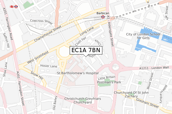
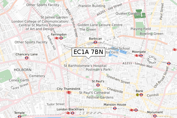
EC1A 7BN is located in the Farringdon Within electoral ward, within the London borough of City of London and the English Parliamentary constituency of Cities of London and Westminster. The Sub Integrated Care Board (ICB) Location is NHS North East London ICB - A3A8R and the police force is City of London. This postcode has been in use since November 2018.


GetTheData
Source: OS Open Zoomstack (Ordnance Survey)
Licence: Open Government Licence (requires attribution)
Attribution: Contains OS data © Crown copyright and database right 2025
Source: Open Postcode Geo
Licence: Open Government Licence (requires attribution)
Attribution: Contains OS data © Crown copyright and database right 2025; Contains Royal Mail data © Royal Mail copyright and database right 2025; Source: Office for National Statistics licensed under the Open Government Licence v.3.0
| Easting | 531970 |
| Northing | 181628 |
| Latitude | 51.518166 |
| Longitude | -0.099352 |
GetTheData
Source: Open Postcode Geo
Licence: Open Government Licence
| Country | England |
| Postcode District | EC1A |
➜ See where EC1A is on a map ➜ Where is City of London? | |
GetTheData
Source: Land Registry Price Paid Data
Licence: Open Government Licence
| Ward | Farringdon Within |
| Constituency | Cities Of London And Westminster |
GetTheData
Source: ONS Postcode Database
Licence: Open Government Licence
| Little Britain | City Of London | 109m |
| St. Bartholomews Hospital (West Smithfield) | City Of London | 146m |
| Museum Of London (Aldersgate Street) | City Of London | 157m |
| Museum Of London (Aldersgate Street) | City Of London | 180m |
| King Edward St Little Britain | City Of London | 187m |
| Barbican Underground Station | Barbican | 254m |
| St. Paul's Underground Station | St Pauls | 381m |
| Farringdon Underground Station | Farringdon | 449m |
| Moorgate Underground Station | Moorgate | 767m |
| Mansion House Underground Station | Mansion House | 769m |
| Farringdon (London) Station | 0.5km |
| City Thameslink Station | 0.6km |
| Moorgate Station | 0.7km |
GetTheData
Source: NaPTAN
Licence: Open Government Licence
GetTheData
Source: ONS Postcode Database
Licence: Open Government Licence


➜ Get more ratings from the Food Standards Agency
GetTheData
Source: Food Standards Agency
Licence: FSA terms & conditions
| Last Collection | |||
|---|---|---|---|
| Location | Mon-Fri | Sat | Distance |
| St Barts Hospital | 18:00 | 12:00 | 75m |
| King Edward Street | 18:30 | 12:00 | 197m |
| King Edward Street (Box 1) | 213m | ||
GetTheData
Source: Dracos
Licence: Creative Commons Attribution-ShareAlike
The below table lists the International Territorial Level (ITL) codes (formerly Nomenclature of Territorial Units for Statistics (NUTS) codes) and Local Administrative Units (LAU) codes for EC1A 7BN:
| ITL 1 Code | Name |
|---|---|
| TLI | London |
| ITL 2 Code | Name |
| TLI3 | Inner London - West |
| ITL 3 Code | Name |
| TLI31 | Camden and City of London |
| LAU 1 Code | Name |
| E09000001 | City of London |
GetTheData
Source: ONS Postcode Directory
Licence: Open Government Licence
The below table lists the Census Output Area (OA), Lower Layer Super Output Area (LSOA), and Middle Layer Super Output Area (MSOA) for EC1A 7BN:
| Code | Name | |
|---|---|---|
| OA | E00000026 | |
| LSOA | E01032740 | City of London 001G |
| MSOA | E02000001 | City of London 001 |
GetTheData
Source: ONS Postcode Directory
Licence: Open Government Licence
| EC1A 7HN | Bartholomew Close | 81m |
| EC1A 7ES | Bartholomew Close | 89m |
| EC1A 7JN | Bartholomew Close | 109m |
| EC1A 7JQ | Cloth Fair | 110m |
| EC1A 9DY | West Smithfield | 113m |
| EC1A 7HP | Bartholomew Close | 115m |
| EC1A 9EJ | Long Lane | 123m |
| EC1A 7HU | Newbury Street | 145m |
| EC1A 7BX | Little Britain | 148m |
| EC1A 4HU | Aldersgate Street | 149m |
GetTheData
Source: Open Postcode Geo; Land Registry Price Paid Data
Licence: Open Government Licence