E5 8DZ maps, stats, and open data
- Home
- Postcode
- E
- E5
- E5 8
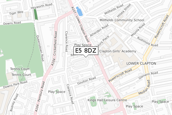
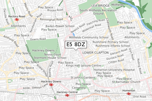
E5 8DZ is located in the Hackney Downs electoral ward, within the London borough of Hackney and the English Parliamentary constituency of Hackney North and Stoke Newington. The Sub Integrated Care Board (ICB) Location is NHS North East London ICB - A3A8R and the police force is Metropolitan Police. This postcode has been in use since April 2019.
E5 8DZ maps


Source: OS Open Zoomstack (Ordnance Survey)
Licence: Open Government Licence (requires attribution)
Attribution: Contains OS data © Crown copyright and database right 2025
Source: Open Postcode GeoLicence: Open Government Licence (requires attribution)
Attribution: Contains OS data © Crown copyright and database right 2025; Contains Royal Mail data © Royal Mail copyright and database right 2025; Source: Office for National Statistics licensed under the Open Government Licence v.3.0
E5 8DZ geodata
| Easting | 534975 |
| Northing | 185653 |
| Latitude | 51.553626 |
| Longitude | -0.054527 |
Where is E5 8DZ?
| Country | England |
| Postcode District | E5 |
Politics
| Ward | Hackney Downs |
|---|
| Constituency | Hackney North And Stoke Newington |
|---|
Transport
Nearest bus stops to E5 8DZ
| Clapton Girls' Tech College (Lower Clapton Road) | Lower Clapton | 77m |
| Clapton Girls' Tech College (Lower Clapton Road) | Lower Clapton | 104m |
| Clapton Girls' Tech College | Lower Clapton | 147m |
| Millfields Road Lower Clapton (Lower Clapton Road) | Lower Clapton | 150m |
| Cricketfield Road | Lower Clapton | 208m |
Nearest railway stations to E5 8DZ
| Hackney Downs Station | 0.7km |
| Hackney Central Station | 0.7km |
| Clapton Station | 0.9km |
Broadband
Broadband access in E5 8DZ (2020 data)
| Percentage of properties with Next Generation Access | 0.0% |
| Percentage of properties with Superfast Broadband | 0.0% |
| Percentage of properties with Ultrafast Broadband | 0.0% |
| Percentage of properties with Full Fibre Broadband | 0.0% |
Superfast Broadband is between 30Mbps and 300Mbps
Ultrafast Broadband is > 300Mbps
Broadband limitations in E5 8DZ (2020 data)
| Percentage of properties unable to receive 2Mbps | 0.0% |
| Percentage of properties unable to receive 5Mbps | 0.0% |
| Percentage of properties unable to receive 10Mbps | 0.0% |
| Percentage of properties unable to receive 30Mbps | 0.0% |
Deprivation
81.7% of English postcodes are less deprived than
E5 8DZ:
Food Standards Agency
Three nearest food hygiene ratings to E5 8DZ (metres)
HAP
24 Kinnoull Mansions Rowhill Road
38m
Clapton Food Centre
155 Lower Clapton Road
48m
Salad Etc
➜ Get more ratings from the Food Standards Agency
Nearest post box to E5 8DZ
| | Last Collection | |
|---|
| Location | Mon-Fri | Sat | Distance |
|---|
| Clarence Road | 17:00 | 11:30 | 139m |
| 70 Lower Clapton Road | 17:00 | 11:30 | 160m |
| 28 Downs Road | 18:30 | 11:30 | 253m |
E5 8DZ ITL and E5 8DZ LAU
The below table lists the International Territorial Level (ITL) codes (formerly Nomenclature of Territorial Units for Statistics (NUTS) codes) and Local Administrative Units (LAU) codes for E5 8DZ:
| ITL 1 Code | Name |
|---|
| TLI | London |
| ITL 2 Code | Name |
|---|
| TLI4 | Inner London - East |
| ITL 3 Code | Name |
|---|
| TLI41 | Hackney and Newham |
| LAU 1 Code | Name |
|---|
| E09000012 | Hackney |
E5 8DZ census areas
The below table lists the Census Output Area (OA), Lower Layer Super Output Area (LSOA), and Middle Layer Super Output Area (MSOA) for E5 8DZ:
| Code | Name |
|---|
| OA | E00008807 | |
|---|
| LSOA | E01033703 | Hackney 010F |
|---|
| MSOA | E02000354 | Hackney 010 |
|---|
Nearest postcodes to E5 8DZ


