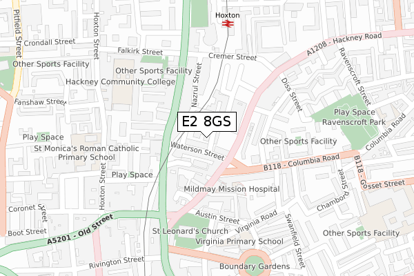
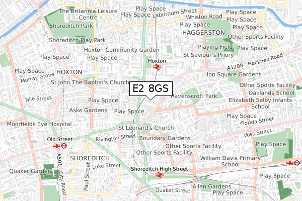
E2 8GS is located in the Haggerston electoral ward, within the London borough of Hackney and the English Parliamentary constituency of Hackney South and Shoreditch. The Sub Integrated Care Board (ICB) Location is NHS North East London ICB - A3A8R and the police force is Metropolitan Police. This postcode has been in use since November 2017.


GetTheData
Source: OS Open Zoomstack (Ordnance Survey)
Licence: Open Government Licence (requires attribution)
Attribution: Contains OS data © Crown copyright and database right 2025
Source: Open Postcode Geo
Licence: Open Government Licence (requires attribution)
Attribution: Contains OS data © Crown copyright and database right 2025; Contains Royal Mail data © Royal Mail copyright and database right 2025; Source: Office for National Statistics licensed under the Open Government Licence v.3.0
| Easting | 533533 |
| Northing | 182883 |
| Latitude | 51.529077 |
| Longitude | -0.076363 |
GetTheData
Source: Open Postcode Geo
Licence: Open Government Licence
| Country | England |
| Postcode District | E2 |
➜ See where E2 is on a map ➜ Where is London? | |
GetTheData
Source: Land Registry Price Paid Data
Licence: Open Government Licence
| Ward | Haggerston |
| Constituency | Hackney South And Shoreditch |
GetTheData
Source: ONS Postcode Database
Licence: Open Government Licence
| Falkirk Street | Hoxton | 94m |
| Hoxton Station | Hoxton | 96m |
| Hackney Road Columbia Road | Shoreditch | 133m |
| Hoxton Station Geffrye Museum (Kingsland Road) | Hoxton | 140m |
| Waterson Street (Kingsland Road) | Shoreditch | 145m |
| Old Street Underground Station | Old Street | 867m |
| Liverpool Street Underground Station | Liverpool Street | 1,385m |
| Bethnal Green Underground Station | Bethnal Green | 1,464m |
| Moorgate Underground Station | Moorgate | 1,468m |
| Whitechapel Underground Station | Whitechapel | 1,559m |
| Hoxton Station | 0.3km |
| Shoreditch High Street Station | 0.6km |
| Old Street Station | 0.9km |
GetTheData
Source: NaPTAN
Licence: Open Government Licence
| Percentage of properties with Next Generation Access | 100.0% |
| Percentage of properties with Superfast Broadband | 100.0% |
| Percentage of properties with Ultrafast Broadband | 100.0% |
| Percentage of properties with Full Fibre Broadband | 100.0% |
Superfast Broadband is between 30Mbps and 300Mbps
Ultrafast Broadband is > 300Mbps
Ofcom does not currently provide download speed data for E2 8GS. This is because there are less than four broadband connections in this postcode.
Ofcom does not currently provide upload speed data for E2 8GS. This is because there are less than four broadband connections in this postcode.
| Percentage of properties unable to receive 2Mbps | 0.0% |
| Percentage of properties unable to receive 5Mbps | 0.0% |
| Percentage of properties unable to receive 10Mbps | 0.0% |
| Percentage of properties unable to receive 30Mbps | 0.0% |
GetTheData
Source: Ofcom
Licence: Ofcom Terms of Use (requires attribution)
GetTheData
Source: ONS Postcode Database
Licence: Open Government Licence


➜ Get more ratings from the Food Standards Agency
GetTheData
Source: Food Standards Agency
Licence: FSA terms & conditions
| Last Collection | |||
|---|---|---|---|
| Location | Mon-Fri | Sat | Distance |
| 120 Kingsland Road | 17:00 | 11:30 | 162m |
| Hackney Road | 18:30 | 11:30 | 223m |
| 101 Hoxton Street | 18:30 | 12:00 | 285m |
GetTheData
Source: Dracos
Licence: Creative Commons Attribution-ShareAlike
The below table lists the International Territorial Level (ITL) codes (formerly Nomenclature of Territorial Units for Statistics (NUTS) codes) and Local Administrative Units (LAU) codes for E2 8GS:
| ITL 1 Code | Name |
|---|---|
| TLI | London |
| ITL 2 Code | Name |
| TLI4 | Inner London - East |
| ITL 3 Code | Name |
| TLI41 | Hackney and Newham |
| LAU 1 Code | Name |
| E09000012 | Hackney |
GetTheData
Source: ONS Postcode Directory
Licence: Open Government Licence
The below table lists the Census Output Area (OA), Lower Layer Super Output Area (LSOA), and Middle Layer Super Output Area (MSOA) for E2 8GS:
| Code | Name | |
|---|---|---|
| OA | E00176278 | |
| LSOA | E01033706 | Hackney 027F |
| MSOA | E02000371 | Hackney 027 |
GetTheData
Source: ONS Postcode Directory
Licence: Open Government Licence
| E2 8HS | Long Street | 29m |
| E2 8HQ | Long Street | 66m |
| E2 8HH | Waterson Street | 69m |
| E2 8HL | Waterson Street | 69m |
| E2 8ET | Hackney Road | 79m |
| E2 8FD | Hackney Road | 79m |
| E2 8DP | Kingsland Road | 84m |
| E2 8FE | Hackney Road | 87m |
| E2 7PD | Hackney Road | 100m |
| E2 8AB | Basing Place | 116m |
GetTheData
Source: Open Postcode Geo; Land Registry Price Paid Data
Licence: Open Government Licence