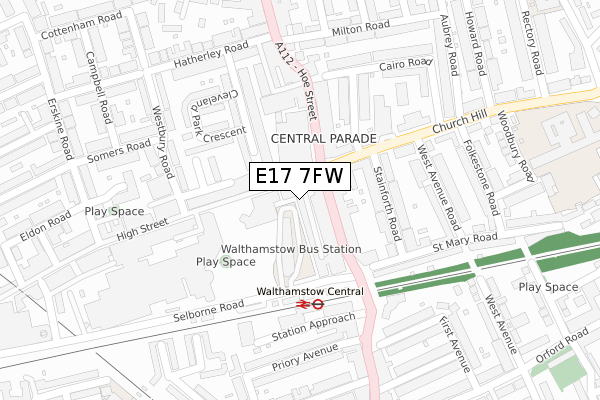
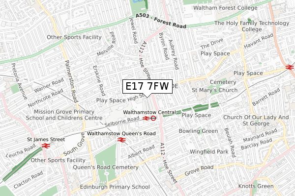
E17 7FW is located in the High Street electoral ward, within the London borough of Waltham Forest and the English Parliamentary constituency of Walthamstow. The Sub Integrated Care Board (ICB) Location is NHS North East London ICB - A3A8R and the police force is Metropolitan Police. This postcode has been in use since July 2019.


GetTheData
Source: OS Open Zoomstack (Ordnance Survey)
Licence: Open Government Licence (requires attribution)
Attribution: Contains OS data © Crown copyright and database right 2025
Source: Open Postcode Geo
Licence: Open Government Licence (requires attribution)
Attribution: Contains OS data © Crown copyright and database right 2025; Contains Royal Mail data © Royal Mail copyright and database right 2025; Source: Office for National Statistics licensed under the Open Government Licence v.3.0
| Easting | 537272 |
| Northing | 189146 |
| Latitude | 51.584461 |
| Longitude | -0.020053 |
GetTheData
Source: Open Postcode Geo
Licence: Open Government Licence
| Country | England |
| Postcode District | E17 |
➜ See where E17 is on a map ➜ Where is Walthamstow? | |
GetTheData
Source: Land Registry Price Paid Data
Licence: Open Government Licence
| Ward | High Street |
| Constituency | Walthamstow |
GetTheData
Source: ONS Postcode Database
Licence: Open Government Licence
| Walthamstow Bus Station | Walthamstow | 37m |
| Walthamstow Bus Station | Walthamstow | 42m |
| Walthamstow Bus Station | Walthamstow | 75m |
| Walthamstow Bus Station | Walthamstow | 94m |
| Walthamstow Market Hoe St (Hoe Street) | Walthamstow | 112m |
| Walthamstow Central Underground Station | Walthamstow Central | 167m |
| Blackhorse Road Underground Station | Blackhorse Road | 1,486m |
| Walthamstow Central Station | 0.2km |
| Walthamstow Queens Road Station | 0.4km |
| St James Street (London) Station | 1km |
GetTheData
Source: NaPTAN
Licence: Open Government Licence
| Percentage of properties with Next Generation Access | 0.0% |
| Percentage of properties with Superfast Broadband | 0.0% |
| Percentage of properties with Ultrafast Broadband | 0.0% |
| Percentage of properties with Full Fibre Broadband | 0.0% |
Superfast Broadband is between 30Mbps and 300Mbps
Ultrafast Broadband is > 300Mbps
| Percentage of properties unable to receive 2Mbps | 0.0% |
| Percentage of properties unable to receive 5Mbps | 0.0% |
| Percentage of properties unable to receive 10Mbps | 0.0% |
| Percentage of properties unable to receive 30Mbps | 100.0% |
GetTheData
Source: Ofcom
Licence: Ofcom Terms of Use (requires attribution)
GetTheData
Source: ONS Postcode Database
Licence: Open Government Licence


➜ Get more ratings from the Food Standards Agency
GetTheData
Source: Food Standards Agency
Licence: FSA terms & conditions
| Last Collection | |||
|---|---|---|---|
| Location | Mon-Fri | Sat | Distance |
| O/S 267 High Street | 18:30 | 12:00 | 85m |
| 267 High Street E17 | 18:30 | 12:00 | 85m |
| 267 High Street | 87m | ||
GetTheData
Source: Dracos
Licence: Creative Commons Attribution-ShareAlike
The below table lists the International Territorial Level (ITL) codes (formerly Nomenclature of Territorial Units for Statistics (NUTS) codes) and Local Administrative Units (LAU) codes for E17 7FW:
| ITL 1 Code | Name |
|---|---|
| TLI | London |
| ITL 2 Code | Name |
| TLI5 | Outer London - East and North East |
| ITL 3 Code | Name |
| TLI53 | Redbridge and Waltham Forest |
| LAU 1 Code | Name |
| E09000031 | Waltham Forest |
GetTheData
Source: ONS Postcode Directory
Licence: Open Government Licence
The below table lists the Census Output Area (OA), Lower Layer Super Output Area (LSOA), and Middle Layer Super Output Area (MSOA) for E17 7FW:
| Code | Name | |
|---|---|---|
| OA | E00022088 | |
| LSOA | E01004397 | Waltham Forest 017C |
| MSOA | E02000911 | Waltham Forest 017 |
GetTheData
Source: ONS Postcode Directory
Licence: Open Government Licence
| E17 7BF | Tower Mews | 22m |
| E17 3AY | Hoe Street | 36m |
| E17 7FD | High Street | 53m |
| E17 7JU | Tower Mews | 58m |
| E17 7JH | High Street | 68m |
| E17 7FB | Cleveland Park Avenue | 69m |
| E17 3AL | Hoe Street | 70m |
| E17 7JJ | Tower Mews | 72m |
| E17 3AX | Hoe Street | 90m |
| E17 3AP | Hoe Street | 107m |
GetTheData
Source: Open Postcode Geo; Land Registry Price Paid Data
Licence: Open Government Licence