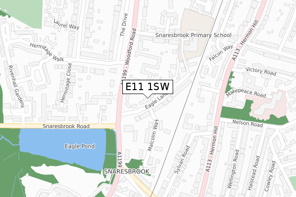
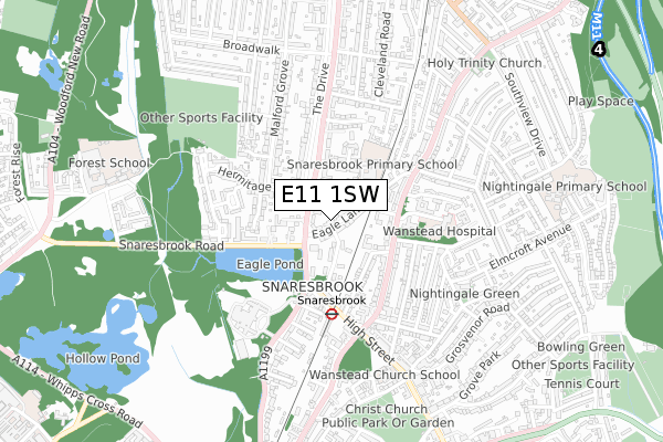
E11 1SW is located in the Wanstead Village electoral ward, within the London borough of Redbridge and the English Parliamentary constituency of Leyton and Wanstead. The Sub Integrated Care Board (ICB) Location is NHS North East London ICB - A3A8R and the police force is Metropolitan Police. This postcode has been in use since August 2018.


GetTheData
Source: OS Open Zoomstack (Ordnance Survey)
Licence: Open Government Licence (requires attribution)
Attribution: Contains OS data © Crown copyright and database right 2025
Source: Open Postcode Geo
Licence: Open Government Licence (requires attribution)
Attribution: Contains OS data © Crown copyright and database right 2025; Contains Royal Mail data © Royal Mail copyright and database right 2025; Source: Office for National Statistics licensed under the Open Government Licence v.3.0
| Easting | 540168 |
| Northing | 189176 |
| Latitude | 51.584018 |
| Longitude | 0.021730 |
GetTheData
Source: Open Postcode Geo
Licence: Open Government Licence
| Country | England |
| Postcode District | E11 |
➜ See where E11 is on a map ➜ Where is London? | |
GetTheData
Source: Land Registry Price Paid Data
Licence: Open Government Licence
| Ward | Wanstead Village |
| Constituency | Leyton And Wanstead |
GetTheData
Source: ONS Postcode Database
Licence: Open Government Licence
| Eagle Lane (Woodford Road) | Snaresbrook | 91m |
| Eagle Lane (Woodford Road) | Snaresbrook | 104m |
| Sylvan Road (Hermon Hill) | Snaresbrook | 256m |
| Heronwood Hospital | Snaresbrook | 261m |
| Heronwood Hospital | Snaresbrook | 275m |
| Snaresbrook Underground Station | Snaresbrook | 372m |
| South Woodford Underground Station | South Woodford | 960m |
| Wanstead Underground Station | Wanstead | 1,059m |
| Wood Street Station | 1.7km |
| Leytonstone High Road Station | 2.5km |
| Leyton Midland Road Station | 2.6km |
GetTheData
Source: NaPTAN
Licence: Open Government Licence
| Percentage of properties with Next Generation Access | 100.0% |
| Percentage of properties with Superfast Broadband | 100.0% |
| Percentage of properties with Ultrafast Broadband | 100.0% |
| Percentage of properties with Full Fibre Broadband | 0.0% |
Superfast Broadband is between 30Mbps and 300Mbps
Ultrafast Broadband is > 300Mbps
| Percentage of properties unable to receive 2Mbps | 0.0% |
| Percentage of properties unable to receive 5Mbps | 0.0% |
| Percentage of properties unable to receive 10Mbps | 0.0% |
| Percentage of properties unable to receive 30Mbps | 0.0% |
GetTheData
Source: Ofcom
Licence: Ofcom Terms of Use (requires attribution)
GetTheData
Source: ONS Postcode Database
Licence: Open Government Licence


➜ Get more ratings from the Food Standards Agency
GetTheData
Source: Food Standards Agency
Licence: FSA terms & conditions
| Last Collection | |||
|---|---|---|---|
| Location | Mon-Fri | Sat | Distance |
| Hermitage Walk | 17:30 | 11:30 | 137m |
| Sylvan Road | 17:30 | 11:30 | 254m |
| Snaresbrook Station | 17:30 | 11:30 | 266m |
GetTheData
Source: Dracos
Licence: Creative Commons Attribution-ShareAlike
The below table lists the International Territorial Level (ITL) codes (formerly Nomenclature of Territorial Units for Statistics (NUTS) codes) and Local Administrative Units (LAU) codes for E11 1SW:
| ITL 1 Code | Name |
|---|---|
| TLI | London |
| ITL 2 Code | Name |
| TLI5 | Outer London - East and North East |
| ITL 3 Code | Name |
| TLI53 | Redbridge and Waltham Forest |
| LAU 1 Code | Name |
| E09000026 | Redbridge |
GetTheData
Source: ONS Postcode Directory
Licence: Open Government Licence
The below table lists the Census Output Area (OA), Lower Layer Super Output Area (LSOA), and Middle Layer Super Output Area (MSOA) for E11 1SW:
| Code | Name | |
|---|---|---|
| OA | E00018962 | |
| LSOA | E01003775 | Redbridge 014B |
| MSOA | E02000764 | Redbridge 014 |
GetTheData
Source: ONS Postcode Directory
Licence: Open Government Licence
| E18 2ER | Gowan Lea | 61m |
| E18 2ES | Woodford Road | 70m |
| E11 1PF | Eagle Lane | 72m |
| E18 2EP | Woodford Road | 123m |
| E18 2EW | Woodford Road | 123m |
| E18 2DF | Hermitage Walk | 129m |
| E11 1PN | Deepdene Close | 130m |
| E11 1PG | Deepdene Close | 134m |
| E18 2DE | Hermitage Walk | 147m |
| E11 1PW | Malcolm Way | 171m |
GetTheData
Source: Open Postcode Geo; Land Registry Price Paid Data
Licence: Open Government Licence