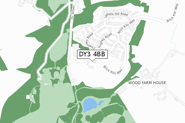
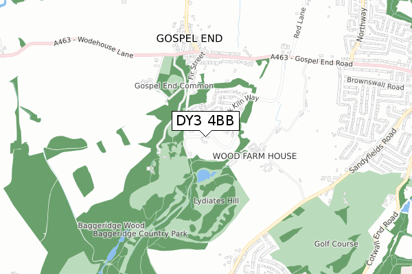
DY3 4BB is located in the Himley & Swindon electoral ward, within the local authority district of South Staffordshire and the English Parliamentary constituency of South Staffordshire. The Sub Integrated Care Board (ICB) Location is NHS Staffordshire and Stoke-on-Trent ICB - 05Q and the police force is Staffordshire. This postcode has been in use since April 2019.


GetTheData
Source: OS Open Zoomstack (Ordnance Survey)
Licence: Open Government Licence (requires attribution)
Attribution: Contains OS data © Crown copyright and database right 2025
Source: Open Postcode Geo
Licence: Open Government Licence (requires attribution)
Attribution: Contains OS data © Crown copyright and database right 2025; Contains Royal Mail data © Royal Mail copyright and database right 2025; Source: Office for National Statistics licensed under the Open Government Licence v.3.0
| Easting | 390032 |
| Northing | 293123 |
| Latitude | 52.535891 |
| Longitude | -2.148381 |
GetTheData
Source: Open Postcode Geo
Licence: Open Government Licence
| Country | England |
| Postcode District | DY3 |
➜ See where DY3 is on a map | |
GetTheData
Source: Land Registry Price Paid Data
Licence: Open Government Licence
| Ward | Himley & Swindon |
| Constituency | South Staffordshire |
GetTheData
Source: ONS Postcode Database
Licence: Open Government Licence
| Baggeridge Close (Gospel End Road) | Gospel End | 527m |
| Baggeridge Close (Gospel End Rd) | Gospel End | 533m |
| The Summerhouse Ph (Gospel End Road) | Gospel End | 564m |
| The Summerhouse Ph (Gospel End Rd) | Gospel End | 571m |
| Ruskin Avenue (Sandyfields Rd) | The Straits | 656m |
| Coseley Station | 4.4km |
GetTheData
Source: NaPTAN
Licence: Open Government Licence
GetTheData
Source: ONS Postcode Database
Licence: Open Government Licence


➜ Get more ratings from the Food Standards Agency
GetTheData
Source: Food Standards Agency
Licence: FSA terms & conditions
| Last Collection | |||
|---|---|---|---|
| Location | Mon-Fri | Sat | Distance |
| Southerndown Road | 17:30 | 11:00 | 946m |
| Sandyfields Road | 17:15 | 11:00 | 1,054m |
| Brownswall | 17:30 | 11:00 | 1,388m |
GetTheData
Source: Dracos
Licence: Creative Commons Attribution-ShareAlike
The below table lists the International Territorial Level (ITL) codes (formerly Nomenclature of Territorial Units for Statistics (NUTS) codes) and Local Administrative Units (LAU) codes for DY3 4BB:
| ITL 1 Code | Name |
|---|---|
| TLG | West Midlands (England) |
| ITL 2 Code | Name |
| TLG2 | Shropshire and Staffordshire |
| ITL 3 Code | Name |
| TLG24 | Staffordshire CC |
| LAU 1 Code | Name |
| E07000196 | South Staffordshire |
GetTheData
Source: ONS Postcode Directory
Licence: Open Government Licence
The below table lists the Census Output Area (OA), Lower Layer Super Output Area (LSOA), and Middle Layer Super Output Area (MSOA) for DY3 4BB:
| Code | Name | |
|---|---|---|
| OA | E00151046 | |
| LSOA | E01029645 | South Staffordshire 013A |
| MSOA | E02006186 | South Staffordshire 013 |
GetTheData
Source: ONS Postcode Directory
Licence: Open Government Licence
| DY3 4BJ | Chalmers Road | 204m |
| DY3 4BA | Brick Kiln Way | 221m |
| DY3 4BE | Gilt Stock Way | 271m |
| DY3 4BD | Ward Road | 299m |
| DY3 4BG | Lydiate Hill Road | 301m |
| DY3 4HA | Gospel End Road | 319m |
| DY3 4AD | Fir Street | 409m |
| DY3 4AJ | Baggeridge Close | 485m |
| DY3 4AL | Gospel End Road | 540m |
| DY3 4AE | Wodehouse Lane | 541m |
GetTheData
Source: Open Postcode Geo; Land Registry Price Paid Data
Licence: Open Government Licence