DY2 0AY maps, stats, and open data
- Home
- Postcode
- DY
- DY2
- DY2 0
DY2 0AY is located in the Quarry Bank and Dudley Wood electoral ward, within the metropolitan district of Dudley and the English Parliamentary constituency of Stourbridge. The Sub Integrated Care Board (ICB) Location is NHS Black Country ICB - D2P2L and the police force is West Midlands. This postcode has been in use since September 2017.
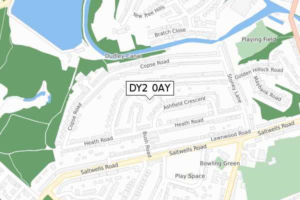
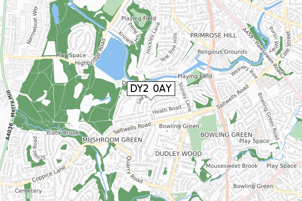
DY2 0AY maps


Source: OS Open Zoomstack (Ordnance Survey)
Licence: Open Government Licence (requires attribution)
Attribution: Contains OS data © Crown copyright and database right 2025
Source: Open Postcode GeoLicence: Open Government Licence (requires attribution)
Attribution: Contains OS data © Crown copyright and database right 2025; Contains Royal Mail data © Royal Mail copyright and database right 2025; Source: Office for National Statistics licensed under the Open Government Licence v.3.0
DY2 0AY geodata
| Easting | 394033 |
| Northing | 287088 |
| Latitude | 52.481696 |
| Longitude | -2.089285 |
Where is DY2 0AY?
| Country | England |
| Postcode District | DY2 |
Politics
| Ward | Quarry Bank And Dudley Wood |
|---|
| Constituency | Stourbridge |
|---|
Transport
Nearest bus stops to DY2 0AY
| Flats (Copse Rd) | Saltwells | 120m |
| Heath Road (Bush Rd) | Saltwells | 138m |
| Lea Bank Road (Heath Rd) | Saltwells | 197m |
| Crabourne Rd (Saltwells Rd) | Saltwells | 198m |
| Crabourne Rd (Saltwells Rd) | Saltwells | 212m |
Nearest railway stations to DY2 0AY
| Cradley Heath Station | 1.3km |
| Old Hill Station | 2.5km |
| Lye (West Midlands) Station | 3km |
Broadband
Broadband access in DY2 0AY (2020 data)
| Percentage of properties with Next Generation Access | 100.0% |
| Percentage of properties with Superfast Broadband | 100.0% |
| Percentage of properties with Ultrafast Broadband | 100.0% |
| Percentage of properties with Full Fibre Broadband | 0.0% |
Superfast Broadband is between 30Mbps and 300Mbps
Ultrafast Broadband is > 300Mbps
Broadband limitations in DY2 0AY (2020 data)
| Percentage of properties unable to receive 2Mbps | 0.0% |
| Percentage of properties unable to receive 5Mbps | 0.0% |
| Percentage of properties unable to receive 10Mbps | 0.0% |
| Percentage of properties unable to receive 30Mbps | 0.0% |
Deprivation
90.8% of English postcodes are less deprived than
DY2 0AY:
Food Standards Agency
Three nearest food hygiene ratings to DY2 0AY (metres)
7 Till Late Conveninence Store
Netherton tasty bites
Best Price Mini Supermarket
➜ Get more ratings from the Food Standards Agency
Nearest post box to DY2 0AY
| | Last Collection | |
|---|
| Location | Mon-Fri | Sat | Distance |
|---|
| Saltwells Post Office | 17:30 | 12:00 | 265m |
| Bratch Close | 17:30 | 11:00 | 349m |
| Dudley Wood Road | 17:30 | 11:00 | 500m |
DY2 0AY ITL and DY2 0AY LAU
The below table lists the International Territorial Level (ITL) codes (formerly Nomenclature of Territorial Units for Statistics (NUTS) codes) and Local Administrative Units (LAU) codes for DY2 0AY:
| ITL 1 Code | Name |
|---|
| TLG | West Midlands (England) |
| ITL 2 Code | Name |
|---|
| TLG3 | West Midlands |
| ITL 3 Code | Name |
|---|
| TLG36 | Dudley |
| LAU 1 Code | Name |
|---|
| E08000027 | Dudley |
DY2 0AY census areas
The below table lists the Census Output Area (OA), Lower Layer Super Output Area (LSOA), and Middle Layer Super Output Area (MSOA) for DY2 0AY:
| Code | Name |
|---|
| OA | E00049957 | |
|---|
| LSOA | E01009877 | Dudley 020E |
|---|
| MSOA | E02002019 | Dudley 020 |
|---|
Nearest postcodes to DY2 0AY


