DY1 4SX maps, stats, and open data
DY1 4SX is located in the Castle and Priory electoral ward, within the metropolitan district of Dudley and the English Parliamentary constituency of Dudley North. The Sub Integrated Care Board (ICB) Location is NHS Black Country ICB - D2P2L and the police force is West Midlands. This postcode has been in use since August 2017.
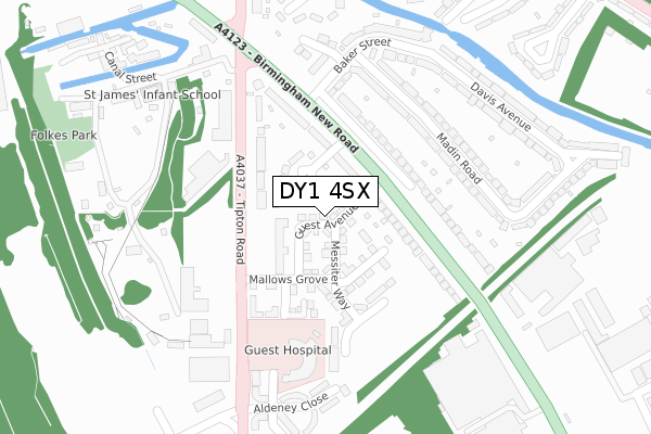
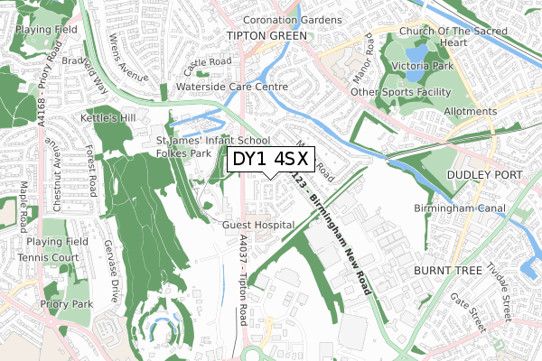
DY1 4SX maps


Licence: Open Government Licence (requires attribution)
Attribution: Contains OS data © Crown copyright and database right 2025
Source: Open Postcode Geo
Licence: Open Government Licence (requires attribution)
Attribution: Contains OS data © Crown copyright and database right 2025; Contains Royal Mail data © Royal Mail copyright and database right 2025; Source: Office for National Statistics licensed under the Open Government Licence v.3.0
DY1 4SX geodata
| Easting | 395202 |
| Northing | 291451 |
| Latitude | 52.520931 |
| Longitude | -2.072136 |
Where is DY1 4SX?
| Country | England |
| Postcode District | DY1 |
Politics
| Ward | Castle And Priory |
|---|---|
| Constituency | Dudley North |
House Prices
Sales of detached houses in DY1 4SX
7, GUEST AVENUE, DUDLEY, DY1 4SX 2018 20 SEP £230,000 |
14, GUEST AVENUE, DUDLEY, DY1 4SX 2018 30 AUG £205,950 |
6, GUEST AVENUE, DUDLEY, DY1 4SX 2018 17 AUG £210,950 |
8, GUEST AVENUE, DUDLEY, DY1 4SX 2018 3 AUG £210,950 |
Licence: Contains HM Land Registry data © Crown copyright and database right 2025. This data is licensed under the Open Government Licence v3.0.
Transport
Nearest bus stops to DY1 4SX
| Black Country Museum (Tipton Rd) | Dudley | 164m |
| Black Country Museum (Tipton Rd) | Dudley | 168m |
| Tipton Cross Rds (Tipton Rd) | Tipton | 222m |
| Tipton Cross Roads (Birmingham New Rd) | Tipton | 351m |
| Tipton Cross Roads (Dudley Rd) | Tipton | 378m |
Nearest railway stations to DY1 4SX
| Tipton Station | 1.1km |
| Dudley Port Station | 1.6km |
| Coseley Station | 2.8km |
Broadband
Broadband access in DY1 4SX (2020 data)
| Percentage of properties with Next Generation Access | 4.3% |
| Percentage of properties with Superfast Broadband | 4.3% |
| Percentage of properties with Ultrafast Broadband | 4.3% |
| Percentage of properties with Full Fibre Broadband | 0.0% |
Superfast Broadband is between 30Mbps and 300Mbps
Ultrafast Broadband is > 300Mbps
Broadband speed in DY1 4SX (2019 data)
Download
| Median download speed | 9.6Mbps |
| Average download speed | 9.1Mbps |
| Maximum download speed | 11.47Mbps |
Upload
| Median upload speed | 1.0Mbps |
| Average upload speed | 1.0Mbps |
| Maximum upload speed | 1.17Mbps |
Broadband limitations in DY1 4SX (2020 data)
| Percentage of properties unable to receive 2Mbps | 0.0% |
| Percentage of properties unable to receive 5Mbps | 0.0% |
| Percentage of properties unable to receive 10Mbps | 0.0% |
| Percentage of properties unable to receive 30Mbps | 95.7% |
Deprivation
84.8% of English postcodes are less deprived than DY1 4SX:Food Standards Agency
Three nearest food hygiene ratings to DY1 4SX (metres)


➜ Get more ratings from the Food Standards Agency
Nearest post box to DY1 4SX
| Last Collection | |||
|---|---|---|---|
| Location | Mon-Fri | Sat | Distance |
| Tipton Arms | 17:30 | 11:00 | 175m |
| Park Lane | 17:30 | 11:00 | 555m |
| Union Street | 18:15 | 12:00 | 961m |
DY1 4SX ITL and DY1 4SX LAU
The below table lists the International Territorial Level (ITL) codes (formerly Nomenclature of Territorial Units for Statistics (NUTS) codes) and Local Administrative Units (LAU) codes for DY1 4SX:
| ITL 1 Code | Name |
|---|---|
| TLG | West Midlands (England) |
| ITL 2 Code | Name |
| TLG3 | West Midlands |
| ITL 3 Code | Name |
| TLG36 | Dudley |
| LAU 1 Code | Name |
| E08000027 | Dudley |
DY1 4SX census areas
The below table lists the Census Output Area (OA), Lower Layer Super Output Area (LSOA), and Middle Layer Super Output Area (MSOA) for DY1 4SX:
| Code | Name | |
|---|---|---|
| OA | E00049371 | |
| LSOA | E01009757 | Dudley 006C |
| MSOA | E02002005 | Dudley 006 |
Nearest postcodes to DY1 4SX
| DY1 4SL | The Crescent | 65m |
| DY1 4SJ | Birmingham New Road | 84m |
| DY1 4SH | Tipton Road | 148m |
| DY4 8JP | Birmingham New Road | 157m |
| DY4 8JT | Madin Road | 202m |
| DY4 8JR | Baker Street | 208m |
| DY1 4SQ | Tipton Road | 225m |
| DY4 8JS | Madin Road | 230m |
| DY4 8JX | Baker Street | 264m |
| DY4 8JL | Tipps Stone Close | 280m |