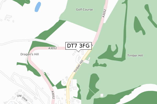
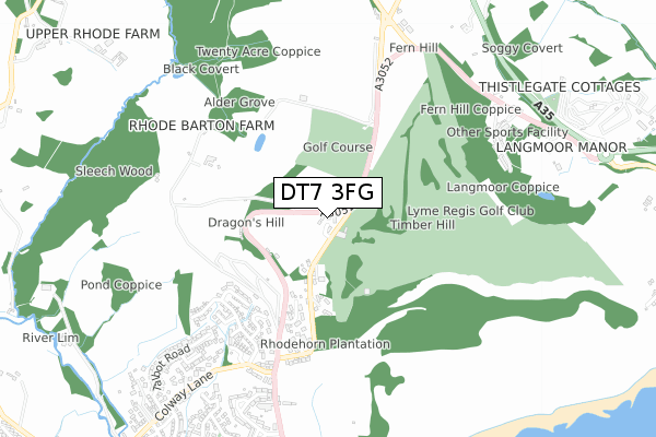
DT7 3FG is located in the Lyme & Charmouth electoral ward, within the unitary authority of Dorset and the English Parliamentary constituency of West Dorset. The Sub Integrated Care Board (ICB) Location is NHS Dorset ICB - 11J and the police force is Dorset. This postcode has been in use since March 2018.


GetTheData
Source: OS Open Zoomstack (Ordnance Survey)
Licence: Open Government Licence (requires attribution)
Attribution: Contains OS data © Crown copyright and database right 2025
Source: Open Postcode Geo
Licence: Open Government Licence (requires attribution)
Attribution: Contains OS data © Crown copyright and database right 2025; Contains Royal Mail data © Royal Mail copyright and database right 2025; Source: Office for National Statistics licensed under the Open Government Licence v.3.0
| Easting | 334498 |
| Northing | 93653 |
| Latitude | 50.738766 |
| Longitude | -2.929630 |
GetTheData
Source: Open Postcode Geo
Licence: Open Government Licence
| Country | England |
| Postcode District | DT7 |
➜ See where DT7 is on a map ➜ Where is Lyme Regis? | |
GetTheData
Source: Land Registry Price Paid Data
Licence: Open Government Licence
| Ward | Lyme & Charmouth |
| Constituency | West Dorset |
GetTheData
Source: ONS Postcode Database
Licence: Open Government Licence
| Honeyfields P&r | Lyme Regis | 148m |
| Golf Club | Lyme Regis | 287m |
| Golf Club | Lyme Regis | 299m |
| Frosts Corner (A3052) | Lyme Regis | 461m |
| Frosts Corner (A3052) | Lyme Regis | 541m |
GetTheData
Source: NaPTAN
Licence: Open Government Licence
| Percentage of properties with Next Generation Access | 100.0% |
| Percentage of properties with Superfast Broadband | 100.0% |
| Percentage of properties with Ultrafast Broadband | 0.0% |
| Percentage of properties with Full Fibre Broadband | 0.0% |
Superfast Broadband is between 30Mbps and 300Mbps
Ultrafast Broadband is > 300Mbps
| Median download speed | 10.9Mbps |
| Average download speed | 10.9Mbps |
| Maximum download speed | 13.02Mbps |
| Median upload speed | 1.1Mbps |
| Average upload speed | 1.0Mbps |
| Maximum upload speed | 1.16Mbps |
| Percentage of properties unable to receive 2Mbps | 0.0% |
| Percentage of properties unable to receive 5Mbps | 0.0% |
| Percentage of properties unable to receive 10Mbps | 0.0% |
| Percentage of properties unable to receive 30Mbps | 0.0% |
GetTheData
Source: Ofcom
Licence: Ofcom Terms of Use (requires attribution)
GetTheData
Source: ONS Postcode Database
Licence: Open Government Licence


➜ Get more ratings from the Food Standards Agency
GetTheData
Source: Food Standards Agency
Licence: FSA terms & conditions
| Last Collection | |||
|---|---|---|---|
| Location | Mon-Fri | Sat | Distance |
| Wood Farm Caravan Park | 17:00 | 09:30 | 1,014m |
| Anning Road | 16:15 | 11:45 | 1,283m |
| The Square | 16:15 | 12:00 | 1,615m |
GetTheData
Source: Dracos
Licence: Creative Commons Attribution-ShareAlike
The below table lists the International Territorial Level (ITL) codes (formerly Nomenclature of Territorial Units for Statistics (NUTS) codes) and Local Administrative Units (LAU) codes for DT7 3FG:
| ITL 1 Code | Name |
|---|---|
| TLK | South West (England) |
| ITL 2 Code | Name |
| TLK2 | Dorset and Somerset |
| ITL 3 Code | Name |
| TLK25 | Dorset |
| LAU 1 Code | Name |
| E06000059 | Dorset |
GetTheData
Source: ONS Postcode Directory
Licence: Open Government Licence
The below table lists the Census Output Area (OA), Lower Layer Super Output Area (LSOA), and Middle Layer Super Output Area (MSOA) for DT7 3FG:
| Code | Name | |
|---|---|---|
| OA | E00104121 | |
| LSOA | E01020533 | West Dorset 005C |
| MSOA | E02004273 | West Dorset 005 |
GetTheData
Source: ONS Postcode Directory
Licence: Open Government Licence
| DT7 3HW | Dragons Hill | 396m |
| DT7 3HQ | Timber Hill | 432m |
| DT7 3QT | Woodberry Down Way | 505m |
| DT7 3UE | 510m | |
| DT7 3QU | Woodberry Down Way | 538m |
| DT7 3HF | Colway Lane | 554m |
| DT7 3HP | Pine Ridge | 610m |
| DT7 3HJ | Colway Rise | 685m |
| DT6 6AU | Fernhill Heights | 723m |
| DT7 3DJ | Charmouth Close | 733m |
GetTheData
Source: Open Postcode Geo; Land Registry Price Paid Data
Licence: Open Government Licence