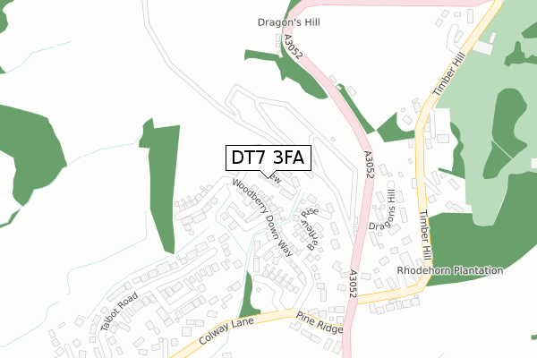
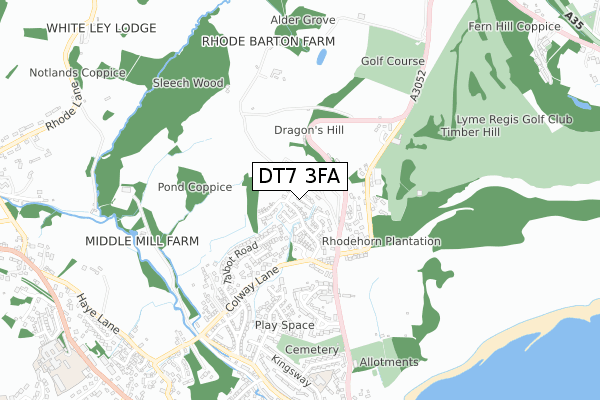
DT7 3FA is located in the Lyme & Charmouth electoral ward, within the unitary authority of Dorset and the English Parliamentary constituency of West Dorset. The Sub Integrated Care Board (ICB) Location is NHS Dorset ICB - 11J and the police force is Dorset. This postcode has been in use since January 2018.


GetTheData
Source: OS Open Zoomstack (Ordnance Survey)
Licence: Open Government Licence (requires attribution)
Attribution: Contains OS data © Crown copyright and database right 2025
Source: Open Postcode Geo
Licence: Open Government Licence (requires attribution)
Attribution: Contains OS data © Crown copyright and database right 2025; Contains Royal Mail data © Royal Mail copyright and database right 2025; Source: Office for National Statistics licensed under the Open Government Licence v.3.0
| Easting | 334148 |
| Northing | 93346 |
| Latitude | 50.735966 |
| Longitude | -2.934534 |
GetTheData
Source: Open Postcode Geo
Licence: Open Government Licence
| Country | England |
| Postcode District | DT7 |
➜ See where DT7 is on a map ➜ Where is Lyme Regis? | |
GetTheData
Source: Land Registry Price Paid Data
Licence: Open Government Licence
| Ward | Lyme & Charmouth |
| Constituency | West Dorset |
GetTheData
Source: ONS Postcode Database
Licence: Open Government Licence
2024 23 SEP £1,100,000 |
2024 16 MAY £750,000 |
2023 26 JUL £545,000 |
2021 31 MAR £575,000 |
1, OAK VIEW, LYME REGIS, DT7 3FA 2019 29 MAR £900,000 |
2019 28 FEB £830,000 |
7, OAK VIEW, LYME REGIS, DT7 3FA 2018 5 DEC £615,000 |
2018 30 NOV £604,950 |
3, OAK VIEW, LYME REGIS, DT7 3FA 2018 30 NOV £869,950 |
11, OAK VIEW, LYME REGIS, DT7 3FA 2018 28 AUG £599,950 |
GetTheData
Source: HM Land Registry Price Paid Data
Licence: Contains HM Land Registry data © Crown copyright and database right 2025. This data is licensed under the Open Government Licence v3.0.
| Talbot Road | Lyme Regis | 169m |
| Frosts Corner (A3052) | Lyme Regis | 203m |
| Frosts Corner (A3052) | Lyme Regis | 259m |
| Pine Ridge | Lyme Regis | 302m |
| Honeyfields P&r | Lyme Regis | 364m |
| Axminster Station | 6.9km |
GetTheData
Source: NaPTAN
Licence: Open Government Licence
| Percentage of properties with Next Generation Access | 100.0% |
| Percentage of properties with Superfast Broadband | 100.0% |
| Percentage of properties with Ultrafast Broadband | 0.0% |
| Percentage of properties with Full Fibre Broadband | 0.0% |
Superfast Broadband is between 30Mbps and 300Mbps
Ultrafast Broadband is > 300Mbps
| Median download speed | 60.6Mbps |
| Average download speed | 61.2Mbps |
| Maximum download speed | 74.71Mbps |
| Median upload speed | 18.1Mbps |
| Average upload speed | 16.5Mbps |
| Maximum upload speed | 20.00Mbps |
| Percentage of properties unable to receive 2Mbps | 0.0% |
| Percentage of properties unable to receive 5Mbps | 0.0% |
| Percentage of properties unable to receive 10Mbps | 0.0% |
| Percentage of properties unable to receive 30Mbps | 0.0% |
GetTheData
Source: Ofcom
Licence: Ofcom Terms of Use (requires attribution)
GetTheData
Source: ONS Postcode Database
Licence: Open Government Licence

➜ Get more ratings from the Food Standards Agency
GetTheData
Source: Food Standards Agency
Licence: FSA terms & conditions
| Last Collection | |||
|---|---|---|---|
| Location | Mon-Fri | Sat | Distance |
| Anning Road | 16:15 | 11:45 | 992m |
| The Square | 16:15 | 12:00 | 1,283m |
| Wood Farm Caravan Park | 17:00 | 09:30 | 1,456m |
GetTheData
Source: Dracos
Licence: Creative Commons Attribution-ShareAlike
The below table lists the International Territorial Level (ITL) codes (formerly Nomenclature of Territorial Units for Statistics (NUTS) codes) and Local Administrative Units (LAU) codes for DT7 3FA:
| ITL 1 Code | Name |
|---|---|
| TLK | South West (England) |
| ITL 2 Code | Name |
| TLK2 | Dorset and Somerset |
| ITL 3 Code | Name |
| TLK25 | Dorset |
| LAU 1 Code | Name |
| E06000059 | Dorset |
GetTheData
Source: ONS Postcode Directory
Licence: Open Government Licence
The below table lists the Census Output Area (OA), Lower Layer Super Output Area (LSOA), and Middle Layer Super Output Area (MSOA) for DT7 3FA:
| Code | Name | |
|---|---|---|
| OA | E00104121 | |
| LSOA | E01020533 | West Dorset 005C |
| MSOA | E02004273 | West Dorset 005 |
GetTheData
Source: ONS Postcode Directory
Licence: Open Government Licence
| DT7 3QT | Woodberry Down Way | 75m |
| DT7 3QU | Woodberry Down Way | 102m |
| DT7 3HW | Dragons Hill | 214m |
| DT7 3HJ | Colway Rise | 240m |
| DT7 3HF | Colway Lane | 246m |
| DT7 3HP | Pine Ridge | 270m |
| DT7 3HQ | Timber Hill | 282m |
| DT7 3BB | Talbot Road | 289m |
| DT7 3BE | Colway Close | 291m |
| DT7 3BA | Talbot Road | 311m |
GetTheData
Source: Open Postcode Geo; Land Registry Price Paid Data
Licence: Open Government Licence