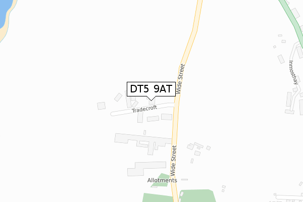
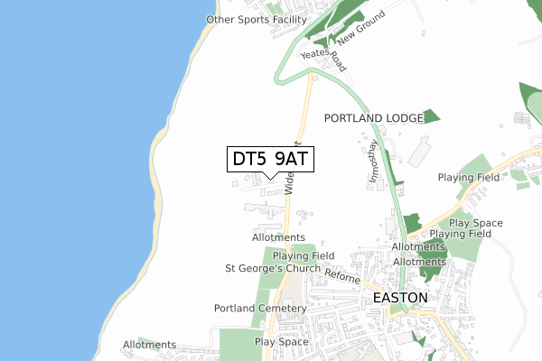
DT5 9AT is located in the Portland electoral ward, within the unitary authority of Dorset and the English Parliamentary constituency of South Dorset. The Sub Integrated Care Board (ICB) Location is NHS Dorset ICB - 11J and the police force is Dorset. This postcode has been in use since June 2019.


GetTheData
Source: OS Open Zoomstack (Ordnance Survey)
Licence: Open Government Licence (requires attribution)
Attribution: Contains OS data © Crown copyright and database right 2025
Source: Open Postcode Geo
Licence: Open Government Licence (requires attribution)
Attribution: Contains OS data © Crown copyright and database right 2025; Contains Royal Mail data © Royal Mail copyright and database right 2025; Source: Office for National Statistics licensed under the Open Government Licence v.3.0
| Easting | 368598 |
| Northing | 72402 |
| Latitude | 50.550518 |
| Longitude | -2.444590 |
GetTheData
Source: Open Postcode Geo
Licence: Open Government Licence
| Country | England |
| Postcode District | DT5 |
➜ See where DT5 is on a map ➜ Where is Weston? | |
GetTheData
Source: Land Registry Price Paid Data
Licence: Open Government Licence
| Ward | Portland |
| Constituency | South Dorset |
GetTheData
Source: ONS Postcode Database
Licence: Open Government Licence
| Tradecroft Industrial Estate (Tradecroft) | Reforne | 37m |
| The George | Reforne | 428m |
| The George (Reforne) | Reforne | 457m |
| Portland Heights | Fortuneswell | 539m |
| Portland Heights (Easton Lane) | Fortuneswell | 551m |
GetTheData
Source: NaPTAN
Licence: Open Government Licence
GetTheData
Source: ONS Postcode Database
Licence: Open Government Licence


➜ Get more ratings from the Food Standards Agency
GetTheData
Source: Food Standards Agency
Licence: FSA terms & conditions
| Last Collection | |||
|---|---|---|---|
| Location | Mon-Fri | Sat | Distance |
| Portland Ldo | 17:30 | 12:30 | 4m |
| Grosvenor Road | 16:15 | 11:15 | 570m |
| Pound Piece | 17:15 | 11:15 | 878m |
GetTheData
Source: Dracos
Licence: Creative Commons Attribution-ShareAlike
The below table lists the International Territorial Level (ITL) codes (formerly Nomenclature of Territorial Units for Statistics (NUTS) codes) and Local Administrative Units (LAU) codes for DT5 9AT:
| ITL 1 Code | Name |
|---|---|
| TLK | South West (England) |
| ITL 2 Code | Name |
| TLK2 | Dorset and Somerset |
| ITL 3 Code | Name |
| TLK25 | Dorset |
| LAU 1 Code | Name |
| E06000059 | Dorset |
GetTheData
Source: ONS Postcode Directory
Licence: Open Government Licence
The below table lists the Census Output Area (OA), Lower Layer Super Output Area (LSOA), and Middle Layer Super Output Area (MSOA) for DT5 9AT:
| Code | Name | |
|---|---|---|
| OA | E00104309 | |
| LSOA | E01020564 | Weymouth and Portland 009B |
| MSOA | E02004289 | Weymouth and Portland 009 |
GetTheData
Source: ONS Postcode Directory
Licence: Open Government Licence
| DT5 2AR | Railway Cottages | 451m |
| DT5 2JU | Inmosthay | 453m |
| DT5 2AP | Reforne | 486m |
| DT5 1BW | Easton Lane | 518m |
| DT5 2AT | St Georges Road | 547m |
| DT5 2AN | Reforne | 565m |
| DT5 2AJ | Fancys Close | 567m |
| DT5 2AW | Reforne | 578m |
| DT5 2BH | Grosvenor Road | 596m |
| DT5 2BQ | Grosvenor Road | 617m |
GetTheData
Source: Open Postcode Geo; Land Registry Price Paid Data
Licence: Open Government Licence