Property/Postcode Data Search:
DT2 8GD maps, stats, and open data
DT2 8GD is located in the Puddletown & Lower Winterborne electoral ward, within the unitary authority of Dorset and the English Parliamentary constituency of West Dorset. The Sub Integrated Care Board (ICB) Location is NHS Dorset ICB - 11J and the police force is Dorset. This postcode has been in use since July 2018.
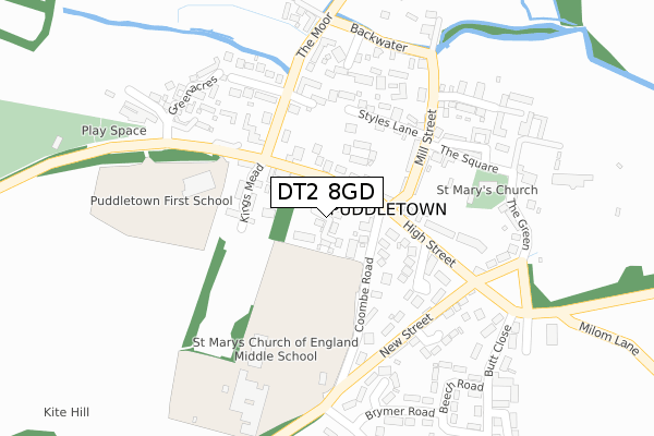
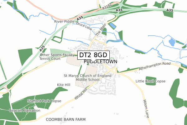
DT2 8GD maps


Source: OS Open Zoomstack (Ordnance Survey)
Licence: Open Government Licence (requires attribution)
Attribution: Contains OS data © Crown copyright and database right 2025
Source: Open Postcode Geo
Licence: Open Government Licence (requires attribution)
Attribution: Contains OS data © Crown copyright and database right 2025; Contains Royal Mail data © Royal Mail copyright and database right 2025; Source: Office for National Statistics licensed under the Open Government Licence v.3.0
Licence: Open Government Licence (requires attribution)
Attribution: Contains OS data © Crown copyright and database right 2025
Source: Open Postcode Geo
Licence: Open Government Licence (requires attribution)
Attribution: Contains OS data © Crown copyright and database right 2025; Contains Royal Mail data © Royal Mail copyright and database right 2025; Source: Office for National Statistics licensed under the Open Government Licence v.3.0
DT2 8GD geodata
| Easting | 375635 |
| Northing | 94291 |
| Latitude | 50.747697 |
| Longitude | -2.346713 |
Where is DT2 8GD?
| Country | England |
| Postcode District | DT2 |
Politics
| Ward | Puddletown & Lower Winterborne |
|---|---|
| Constituency | West Dorset |
Transport
Nearest bus stops to DT2 8GD
| Coombe Road | Puddletown | 68m |
| Coombe Road (High Street) | Puddletown | 88m |
| First School (High Street) | Puddletown | 155m |
| The Square | Puddletown | 193m |
| The Square | Puddletown | 199m |
Deprivation
33% of English postcodes are less deprived than DT2 8GD:Food Standards Agency
Three nearest food hygiene ratings to DT2 8GD (metres)
Spar

27 - 29 High Street
55m
Puddletown Village Lunch

Puddletown Village Hall High Street
159m
Puddletown Church of England First School

Puddletown First School Dorchester Road
220m
➜ Get more ratings from the Food Standards Agency
Nearest post box to DT2 8GD
| Last Collection | |||
|---|---|---|---|
| Location | Mon-Fri | Sat | Distance |
| Puddletown P.o. | 17:00 | 11:00 | 96m |
| Athelhampton | 13:00 | 11:00 | 1,452m |
| Burleston | 12:30 | 11:00 | 1,997m |
DT2 8GD ITL and DT2 8GD LAU
The below table lists the International Territorial Level (ITL) codes (formerly Nomenclature of Territorial Units for Statistics (NUTS) codes) and Local Administrative Units (LAU) codes for DT2 8GD:
| ITL 1 Code | Name |
|---|---|
| TLK | South West (England) |
| ITL 2 Code | Name |
| TLK2 | Dorset and Somerset |
| ITL 3 Code | Name |
| TLK25 | Dorset |
| LAU 1 Code | Name |
| E06000059 | Dorset |
DT2 8GD census areas
The below table lists the Census Output Area (OA), Lower Layer Super Output Area (LSOA), and Middle Layer Super Output Area (MSOA) for DT2 8GD:
| Code | Name | |
|---|---|---|
| OA | E00104174 | |
| LSOA | E01020540 | West Dorset 004E |
| MSOA | E02004272 | West Dorset 004 |
Nearest postcodes to DT2 8GD
| DT2 8RT | High Street | 64m |
| DT2 8RU | High Street | 78m |
| DT2 8WY | High Street | 81m |
| DT2 8RZ | Coombe Road | 120m |
| DT2 8RX | High Street | 127m |
| DT2 8XH | Kingsmead | 131m |
| DT2 8UE | High Street | 133m |
| DT2 8RS | Blandford Road | 157m |
| DT2 8SQ | Mill Street | 161m |
| DT2 8SG | Bellbury Close | 179m |