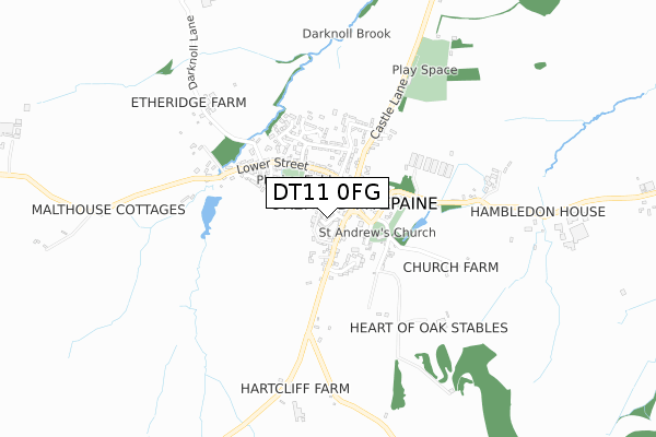
DT11 0FG is located in the Blackmore Vale electoral ward, within the unitary authority of Dorset and the English Parliamentary constituency of North Dorset. The Sub Integrated Care Board (ICB) Location is NHS Dorset ICB - 11J and the police force is Dorset. This postcode has been in use since March 2019.


GetTheData
Source: OS Open Zoomstack (Ordnance Survey)
Licence: Open Government Licence (requires attribution)
Attribution: Contains OS data © Crown copyright and database right 2025
Source: Open Postcode Geo
Licence: Open Government Licence (requires attribution)
Attribution: Contains OS data © Crown copyright and database right 2025; Contains Royal Mail data © Royal Mail copyright and database right 2025; Source: Office for National Statistics licensed under the Open Government Licence v.3.0
| Easting | 381047 |
| Northing | 111936 |
| Latitude | 50.906572 |
| Longitude | -2.270921 |
GetTheData
Source: Open Postcode Geo
Licence: Open Government Licence
| Country | England |
| Postcode District | DT11 |
➜ See where DT11 is on a map | |
GetTheData
Source: Land Registry Price Paid Data
Licence: Open Government Licence
| Ward | Blackmore Vale |
| Constituency | North Dorset |
GetTheData
Source: ONS Postcode Database
Licence: Open Government Licence
| The Royal Oak (Castle Lane) | Okeford Fitzpaine | 986m |
| The Royal Oak (Castle Lane) | Okeford Fitzpaine | 988m |
| Post Office (Castle Lane) | Okeford Fitzpaine | 1,071m |
| Post Office (Castle Lane) | Okeford Fitzpaine | 1,075m |
| Post Office (Castle Lane) | Okeford Fitzpaine | 1,090m |
GetTheData
Source: NaPTAN
Licence: Open Government Licence
GetTheData
Source: ONS Postcode Database
Licence: Open Government Licence


➜ Get more ratings from the Food Standards Agency
GetTheData
Source: Food Standards Agency
Licence: FSA terms & conditions
| Last Collection | |||
|---|---|---|---|
| Location | Mon-Fri | Sat | Distance |
| Oakford Fitzpaine P.o. | 16:00 | 09:00 | 1,043m |
| Wooland | 12:00 | 11:00 | 5,610m |
| Durweston P.o. | 16:00 | 09:45 | 5,885m |
GetTheData
Source: Dracos
Licence: Creative Commons Attribution-ShareAlike
The below table lists the International Territorial Level (ITL) codes (formerly Nomenclature of Territorial Units for Statistics (NUTS) codes) and Local Administrative Units (LAU) codes for DT11 0FG:
| ITL 1 Code | Name |
|---|---|
| TLK | South West (England) |
| ITL 2 Code | Name |
| TLK2 | Dorset and Somerset |
| ITL 3 Code | Name |
| TLK25 | Dorset |
| LAU 1 Code | Name |
| E06000059 | Dorset |
GetTheData
Source: ONS Postcode Directory
Licence: Open Government Licence
The below table lists the Census Output Area (OA), Lower Layer Super Output Area (LSOA), and Middle Layer Super Output Area (MSOA) for DT11 0FG:
| Code | Name | |
|---|---|---|
| OA | E00103590 | |
| LSOA | E01020441 | North Dorset 008D |
| MSOA | E02004262 | North Dorset 008 |
GetTheData
Source: ONS Postcode Directory
Licence: Open Government Licence
| DT11 0RL | Castle Lane | 782m |
| DT11 0RY | Castle Avenue | 859m |
| DT11 0RJ | Castle Lane | 930m |
| DT11 0RB | Shillingstone Lane | 946m |
| DT11 0RX | Mary Gardens | 952m |
| DT11 0TP | Nether Mead | 996m |
| DT11 0RN | Lower Street | 1025m |
| DT11 0RW | Lower Street | 1095m |
| DT11 0RF | The Cross | 1100m |
| DT11 0RG | High Street | 1127m |
GetTheData
Source: Open Postcode Geo; Land Registry Price Paid Data
Licence: Open Government Licence