Property/Postcode Data Search:
DT10 1FX maps, stats, and open data
DT10 1FX is located in the Stalbridge & Marnhull electoral ward, within the unitary authority of Dorset and the English Parliamentary constituency of North Dorset. The Sub Integrated Care Board (ICB) Location is NHS Dorset ICB - 11J and the police force is Dorset. This postcode has been in use since February 2020.
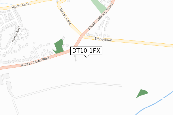
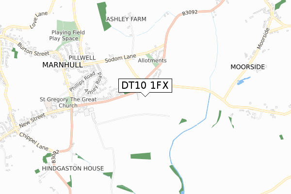
DT10 1FX maps


Source: OS Open Zoomstack (Ordnance Survey)
Licence: Open Government Licence (requires attribution)
Attribution: Contains OS data © Crown copyright and database right 2025
Source: Open Postcode Geo
Licence: Open Government Licence (requires attribution)
Attribution: Contains OS data © Crown copyright and database right 2025; Contains Royal Mail data © Royal Mail copyright and database right 2025; Source: Office for National Statistics licensed under the Open Government Licence v.3.0
Licence: Open Government Licence (requires attribution)
Attribution: Contains OS data © Crown copyright and database right 2025
Source: Open Postcode Geo
Licence: Open Government Licence (requires attribution)
Attribution: Contains OS data © Crown copyright and database right 2025; Contains Royal Mail data © Royal Mail copyright and database right 2025; Source: Office for National Statistics licensed under the Open Government Licence v.3.0
DT10 1FX geodata
| Easting | 378803 |
| Northing | 118809 |
| Latitude | 50.968298 |
| Longitude | -2.303238 |
Where is DT10 1FX?
| Country | England |
| Postcode District | DT10 |
Politics
| Ward | Stalbridge & Marnhull |
|---|---|
| Constituency | North Dorset |
Transport
Nearest bus stops to DT10 1FX
| Telephone Box (Stoneylawn) | Pillwell | 99m |
| Stoneylawn (Crown Road) | Pillwell | 106m |
| Telephone Box (Stoneylawn) | Pillwell | 110m |
| Stoneylawn (Crown Road) | Pillwell | 116m |
| Corner Close | Pillwell | 429m |
Deprivation
37.1% of English postcodes are less deprived than DT10 1FX:Food Standards Agency
Three nearest food hygiene ratings to DT10 1FX (metres)
Crown Inn

The Crown Inn Crown Road
337m
Royal British Legion
The Royal British Legion Sodom Lane
361m
Marnhull Pharmacy
Marnhull Pharmacy Church Hill
780m
➜ Get more ratings from the Food Standards Agency
Nearest post box to DT10 1FX
| Last Collection | |||
|---|---|---|---|
| Location | Mon-Fri | Sat | Distance |
| Todber | 12:15 | 10:30 | 1,811m |
| Dover Street | 16:15 | 10:15 | 3,053m |
| Stour Lane | 16:15 | 09:30 | 3,992m |
DT10 1FX ITL and DT10 1FX LAU
The below table lists the International Territorial Level (ITL) codes (formerly Nomenclature of Territorial Units for Statistics (NUTS) codes) and Local Administrative Units (LAU) codes for DT10 1FX:
| ITL 1 Code | Name |
|---|---|
| TLK | South West (England) |
| ITL 2 Code | Name |
| TLK2 | Dorset and Somerset |
| ITL 3 Code | Name |
| TLK25 | Dorset |
| LAU 1 Code | Name |
| E06000059 | Dorset |
DT10 1FX census areas
The below table lists the Census Output Area (OA), Lower Layer Super Output Area (LSOA), and Middle Layer Super Output Area (MSOA) for DT10 1FX:
| Code | Name | |
|---|---|---|
| OA | E00103643 | |
| LSOA | E01020449 | North Dorset 004C |
| MSOA | E02004258 | North Dorset 004 |
Nearest postcodes to DT10 1FX
| DT10 1HW | Stoneylawn | 169m |
| DT10 1LN | Crown Road | 337m |
| DT10 1HP | Salisbury Street | 340m |
| DT10 1LL | Barnes Close | 355m |
| DT10 1LJ | Carent Close | 384m |
| DT10 1LQ | Ashley Road | 441m |
| DT10 1LH | Flanders Close | 532m |
| DT10 1LF | Phillips Road | 541m |
| DT10 1LG | Hardy Close | 563m |
| DT10 1LD | Sodom Lane | 574m |