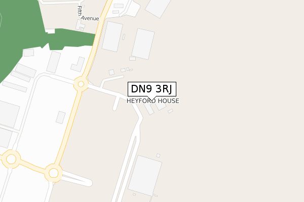
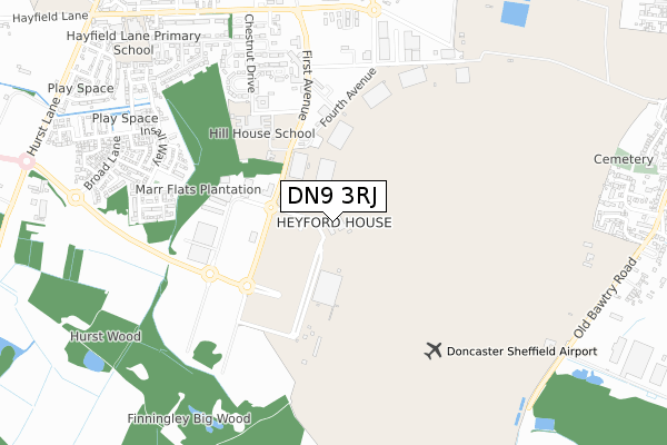
DN9 3RJ is located in the Finningley electoral ward, within the metropolitan district of Doncaster and the English Parliamentary constituency of Don Valley. The Sub Integrated Care Board (ICB) Location is NHS South Yorkshire ICB - 02X and the police force is South Yorkshire. This postcode has been in use since April 2020.


GetTheData
Source: OS Open Zoomstack (Ordnance Survey)
Licence: Open Government Licence (requires attribution)
Attribution: Contains OS data © Crown copyright and database right 2025
Source: Open Postcode Geo
Licence: Open Government Licence (requires attribution)
Attribution: Contains OS data © Crown copyright and database right 2025; Contains Royal Mail data © Royal Mail copyright and database right 2025; Source: Office for National Statistics licensed under the Open Government Licence v.3.0
| Easting | 465313 |
| Northing | 399020 |
| Latitude | 53.483875 |
| Longitude | -1.017228 |
GetTheData
Source: Open Postcode Geo
Licence: Open Government Licence
| Country | England |
| Postcode District | DN9 |
➜ See where DN9 is on a map | |
GetTheData
Source: Land Registry Price Paid Data
Licence: Open Government Licence
| Ward | Finningley |
| Constituency | Don Valley |
GetTheData
Source: ONS Postcode Database
Licence: Open Government Licence
| Doncaster Sheffield Airport (First Avenue) | Doncaster Sheffield Airport | 294m |
| Terminal Stand 1 (Doncaster Sheffield Airport) | Doncaster Sheffield Airport | 499m |
| Terminal Stand 2 (Doncaster Sheffield Airport) | Doncaster Sheffield Airport | 507m |
| Terminal Stand 3 (Doncaster Sheffield Airport) | Doncaster Sheffield Airport | 515m |
| Robin Hood Airport Link Road (First Avenue) | Finningley | 656m |
GetTheData
Source: NaPTAN
Licence: Open Government Licence
GetTheData
Source: ONS Postcode Database
Licence: Open Government Licence


➜ Get more ratings from the Food Standards Agency
GetTheData
Source: Food Standards Agency
Licence: FSA terms & conditions
| Last Collection | |||
|---|---|---|---|
| Location | Mon-Fri | Sat | Distance |
| Robin Hood Doncaster Sheffield | 17:00 | 10:00 | 519m |
| Auckley P.o. | 16:30 | 10:00 | 797m |
| Finningley P.o. | 16:45 | 10:00 | 1,784m |
GetTheData
Source: Dracos
Licence: Creative Commons Attribution-ShareAlike
The below table lists the International Territorial Level (ITL) codes (formerly Nomenclature of Territorial Units for Statistics (NUTS) codes) and Local Administrative Units (LAU) codes for DN9 3RJ:
| ITL 1 Code | Name |
|---|---|
| TLE | Yorkshire and The Humber |
| ITL 2 Code | Name |
| TLE3 | South Yorkshire |
| ITL 3 Code | Name |
| TLE31 | Barnsley, Doncaster and Rotherham |
| LAU 1 Code | Name |
| E08000017 | Doncaster |
GetTheData
Source: ONS Postcode Directory
Licence: Open Government Licence
The below table lists the Census Output Area (OA), Lower Layer Super Output Area (LSOA), and Middle Layer Super Output Area (MSOA) for DN9 3RJ:
| Code | Name | |
|---|---|---|
| OA | E00038555 | |
| LSOA | E01007602 | Doncaster 026D |
| MSOA | E02001564 | Doncaster 026 |
GetTheData
Source: ONS Postcode Directory
Licence: Open Government Licence
| DN9 3FZ | Insall Way | 233m |
| DN9 3QH | Insall Way | 260m |
| DN9 3FW | Meadow Lane | 323m |
| DN9 3FU | Brompton Lane | 332m |
| DN9 3FQ | Fairlands Grove | 380m |
| DN9 3FH | Broad Lane | 434m |
| DN9 3LP | Spruce Crescent | 440m |
| DN9 3LW | Chestnut Drive | 460m |
| DN9 3LT | Birch Avenue | 486m |
| DN9 3FT | Melrose Mews | 489m |
GetTheData
Source: Open Postcode Geo; Land Registry Price Paid Data
Licence: Open Government Licence