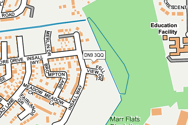
DN9 3QQ is located in the Finningley electoral ward, within the metropolitan district of Doncaster and the English Parliamentary constituency of Don Valley. The Sub Integrated Care Board (ICB) Location is NHS South Yorkshire ICB - 02X and the police force is South Yorkshire. This postcode has been in use since June 2017.


GetTheData
Source: OS OpenMap – Local (Ordnance Survey)
Source: OS VectorMap District (Ordnance Survey)
Licence: Open Government Licence (requires attribution)
| Easting | 465163 |
| Northing | 399246 |
| Latitude | 53.485925 |
| Longitude | -1.019442 |
GetTheData
Source: Open Postcode Geo
Licence: Open Government Licence
| Country | England |
| Postcode District | DN9 |
➜ See where DN9 is on a map ➜ Where is Hayfield Green? | |
GetTheData
Source: Land Registry Price Paid Data
Licence: Open Government Licence
| Ward | Finningley |
| Constituency | Don Valley |
GetTheData
Source: ONS Postcode Database
Licence: Open Government Licence
| Larch Avenue (Hurst Lane) | Finningley | 447m |
| Doncaster Sheffield Airport (First Avenue) | Doncaster Sheffield Airport | 451m |
| Hanging Carr Farm (Hurst Lane) | Finningley | 468m |
| Fir Tree Avenue (Hayfield Lane) | Finningley | 475m |
| Fir Tree Avenue (Hayfield Lane) | Finningley | 482m |
GetTheData
Source: NaPTAN
Licence: Open Government Licence
| Percentage of properties with Next Generation Access | 100.0% |
| Percentage of properties with Superfast Broadband | 100.0% |
| Percentage of properties with Ultrafast Broadband | 100.0% |
| Percentage of properties with Full Fibre Broadband | 100.0% |
Superfast Broadband is between 30Mbps and 300Mbps
Ultrafast Broadband is > 300Mbps
| Percentage of properties unable to receive 2Mbps | 0.0% |
| Percentage of properties unable to receive 5Mbps | 0.0% |
| Percentage of properties unable to receive 10Mbps | 0.0% |
| Percentage of properties unable to receive 30Mbps | 0.0% |
GetTheData
Source: Ofcom
Licence: Ofcom Terms of Use (requires attribution)
GetTheData
Source: ONS Postcode Database
Licence: Open Government Licence


➜ Get more ratings from the Food Standards Agency
GetTheData
Source: Food Standards Agency
Licence: FSA terms & conditions
| Last Collection | |||
|---|---|---|---|
| Location | Mon-Fri | Sat | Distance |
| Auckley P.o. | 16:30 | 10:00 | 526m |
| Robin Hood Doncaster Sheffield | 17:00 | 10:00 | 781m |
| Finningley P.o. | 16:45 | 10:00 | 1,898m |
GetTheData
Source: Dracos
Licence: Creative Commons Attribution-ShareAlike
The below table lists the International Territorial Level (ITL) codes (formerly Nomenclature of Territorial Units for Statistics (NUTS) codes) and Local Administrative Units (LAU) codes for DN9 3QQ:
| ITL 1 Code | Name |
|---|---|
| TLE | Yorkshire and The Humber |
| ITL 2 Code | Name |
| TLE3 | South Yorkshire |
| ITL 3 Code | Name |
| TLE31 | Barnsley, Doncaster and Rotherham |
| LAU 1 Code | Name |
| E08000017 | Doncaster |
GetTheData
Source: ONS Postcode Directory
Licence: Open Government Licence
The below table lists the Census Output Area (OA), Lower Layer Super Output Area (LSOA), and Middle Layer Super Output Area (MSOA) for DN9 3QQ:
| Code | Name | |
|---|---|---|
| OA | E00038523 | |
| LSOA | E01007608 | Doncaster 038A |
| MSOA | E02001576 | Doncaster 038 |
GetTheData
Source: ONS Postcode Directory
Licence: Open Government Licence
| DN9 3FZ | Insall Way | 90m |
| DN9 3FU | Brompton Lane | 139m |
| DN9 3QH | Insall Way | 184m |
| DN9 3FW | Meadow Lane | 196m |
| DN9 3FS | Merlin Drive | 243m |
| DN9 3FT | Melrose Mews | 253m |
| DN9 3LT | Birch Avenue | 255m |
| DN9 3FQ | Fairlands Grove | 272m |
| DN9 3FH | Broad Lane | 281m |
| DN9 3LY | Briar Close | 285m |
GetTheData
Source: Open Postcode Geo; Land Registry Price Paid Data
Licence: Open Government Licence