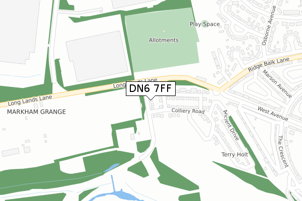
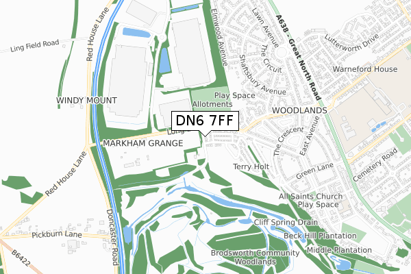
DN6 7FF is located in the Adwick le Street & Carcroft electoral ward, within the metropolitan district of Doncaster and the English Parliamentary constituency of Doncaster North. The Sub Integrated Care Board (ICB) Location is NHS South Yorkshire ICB - 02X and the police force is South Yorkshire. This postcode has been in use since August 2018.


GetTheData
Source: OS Open Zoomstack (Ordnance Survey)
Licence: Open Government Licence (requires attribution)
Attribution: Contains OS data © Crown copyright and database right 2025
Source: Open Postcode Geo
Licence: Open Government Licence (requires attribution)
Attribution: Contains OS data © Crown copyright and database right 2025; Contains Royal Mail data © Royal Mail copyright and database right 2025; Source: Office for National Statistics licensed under the Open Government Licence v.3.0
| Easting | 452512 |
| Northing | 407986 |
| Latitude | 53.565886 |
| Longitude | -1.208613 |
GetTheData
Source: Open Postcode Geo
Licence: Open Government Licence
| Country | England |
| Postcode District | DN6 |
➜ See where DN6 is on a map ➜ Where is Adwick le Street? | |
GetTheData
Source: Land Registry Price Paid Data
Licence: Open Government Licence
| Ward | Adwick Le Street & Carcroft |
| Constituency | Doncaster North |
GetTheData
Source: ONS Postcode Database
Licence: Open Government Licence
21, COUNTRY WAY, WOODLANDS, DONCASTER, DN6 7FF 2021 20 JUL £180,000 |
21, COUNTRY WAY, WOODLANDS, DONCASTER, DN6 7FF 2019 25 JUL £179,995 |
1, COUNTRY WAY, WOODLANDS, DONCASTER, DN6 7FF 2018 31 JUL £180,995 |
➜ Adwick le Street house prices
GetTheData
Source: HM Land Registry Price Paid Data
Licence: Contains HM Land Registry data © Crown copyright and database right 2025. This data is licensed under the Open Government Licence v3.0.
| West Avenue (The Crescent) | Woodlands | 427m |
| Fair View Avenue (Osborne Avenue) | Woodlands | 452m |
| Harewood Avenue (Shaftsbury Avenue) | Woodlands | 462m |
| The Ridge (The Crescent) | Woodlands | 477m |
| Osborne Avenue (Ridge Balk Lane) | Woodlands | 496m |
| Adwick Station | 2km |
| Bentley (S Yorks) Station | 4.5km |
| Doncaster Station | 6.7km |
GetTheData
Source: NaPTAN
Licence: Open Government Licence
| Percentage of properties with Next Generation Access | 100.0% |
| Percentage of properties with Superfast Broadband | 100.0% |
| Percentage of properties with Ultrafast Broadband | 100.0% |
| Percentage of properties with Full Fibre Broadband | 100.0% |
Superfast Broadband is between 30Mbps and 300Mbps
Ultrafast Broadband is > 300Mbps
| Percentage of properties unable to receive 2Mbps | 0.0% |
| Percentage of properties unable to receive 5Mbps | 0.0% |
| Percentage of properties unable to receive 10Mbps | 0.0% |
| Percentage of properties unable to receive 30Mbps | 0.0% |
GetTheData
Source: Ofcom
Licence: Ofcom Terms of Use (requires attribution)
GetTheData
Source: ONS Postcode Database
Licence: Open Government Licence


➜ Get more ratings from the Food Standards Agency
GetTheData
Source: Food Standards Agency
Licence: FSA terms & conditions
| Last Collection | |||
|---|---|---|---|
| Location | Mon-Fri | Sat | Distance |
| Central Avenue | 17:15 | 09:00 | 586m |
| The Circuit | 17:15 | 08:30 | 663m |
| Tenter Balk Lane | 17:15 | 08:45 | 939m |
GetTheData
Source: Dracos
Licence: Creative Commons Attribution-ShareAlike
The below table lists the International Territorial Level (ITL) codes (formerly Nomenclature of Territorial Units for Statistics (NUTS) codes) and Local Administrative Units (LAU) codes for DN6 7FF:
| ITL 1 Code | Name |
|---|---|
| TLE | Yorkshire and The Humber |
| ITL 2 Code | Name |
| TLE3 | South Yorkshire |
| ITL 3 Code | Name |
| TLE31 | Barnsley, Doncaster and Rotherham |
| LAU 1 Code | Name |
| E08000017 | Doncaster |
GetTheData
Source: ONS Postcode Directory
Licence: Open Government Licence
The below table lists the Census Output Area (OA), Lower Layer Super Output Area (LSOA), and Middle Layer Super Output Area (MSOA) for DN6 7FF:
| Code | Name | |
|---|---|---|
| OA | E00037842 | |
| LSOA | E01007466 | Doncaster 009C |
| MSOA | E02001547 | Doncaster 009 |
GetTheData
Source: ONS Postcode Directory
Licence: Open Government Licence
| DN6 7NR | Ridge Balk Lane | 300m |
| DN6 7PA | West Avenue | 337m |
| DN6 7PF | The Ridge | 370m |
| DN6 7NY | Marson Avenue | 398m |
| DN6 7SZ | Fair View Avenue | 410m |
| DN6 7SY | Osborne Avenue | 460m |
| DN6 7SX | Ridge Balk Lane | 460m |
| DN6 7PE | The Crescent | 470m |
| DN6 7TB | Shaftsbury Avenue | 479m |
| DN6 7TD | Shaftsbury Avenue | 483m |
GetTheData
Source: Open Postcode Geo; Land Registry Price Paid Data
Licence: Open Government Licence