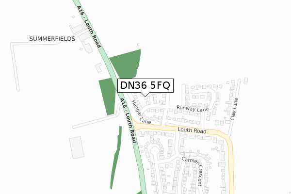
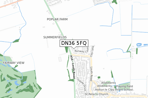
DN36 5FQ is located in the Holton-le-Clay & North Thoresby electoral ward, within the local authority district of East Lindsey and the English Parliamentary constituency of Louth and Horncastle. The Sub Integrated Care Board (ICB) Location is NHS Lincolnshire ICB - 71E and the police force is Lincolnshire. This postcode has been in use since April 2018.


GetTheData
Source: OS Open Zoomstack (Ordnance Survey)
Licence: Open Government Licence (requires attribution)
Attribution: Contains OS data © Crown copyright and database right 2025
Source: Open Postcode Geo
Licence: Open Government Licence (requires attribution)
Attribution: Contains OS data © Crown copyright and database right 2025; Contains Royal Mail data © Royal Mail copyright and database right 2025; Source: Office for National Statistics licensed under the Open Government Licence v.3.0
| Easting | 528264 |
| Northing | 403543 |
| Latitude | 53.512952 |
| Longitude | -0.067184 |
GetTheData
Source: Open Postcode Geo
Licence: Open Government Licence
| Country | England |
| Postcode District | DN36 |
➜ See where DN36 is on a map ➜ Where is Holton le Clay? | |
GetTheData
Source: Land Registry Price Paid Data
Licence: Open Government Licence
| Ward | Holton-le-clay & North Thoresby |
| Constituency | Louth And Horncastle |
GetTheData
Source: ONS Postcode Database
Licence: Open Government Licence
| Carmen Crescent (Louth Road) | Holton Le Clay | 183m |
| Carmen Crescent (Louth Road) | Holton Le Clay | 209m |
| Louth Road Letter Box (Louth Road) | Holton Le Clay | 404m |
| Louth Road Letter Box (Louth Road) | Holton Le Clay | 465m |
| Nisa Star Supermarket (Louth Road) | Holton Le Clay | 736m |
GetTheData
Source: NaPTAN
Licence: Open Government Licence
| Percentage of properties with Next Generation Access | 100.0% |
| Percentage of properties with Superfast Broadband | 100.0% |
| Percentage of properties with Ultrafast Broadband | 100.0% |
| Percentage of properties with Full Fibre Broadband | 100.0% |
Superfast Broadband is between 30Mbps and 300Mbps
Ultrafast Broadband is > 300Mbps
| Percentage of properties unable to receive 2Mbps | 0.0% |
| Percentage of properties unable to receive 5Mbps | 0.0% |
| Percentage of properties unable to receive 10Mbps | 0.0% |
| Percentage of properties unable to receive 30Mbps | 0.0% |
GetTheData
Source: Ofcom
Licence: Ofcom Terms of Use (requires attribution)
GetTheData
Source: ONS Postcode Database
Licence: Open Government Licence


➜ Get more ratings from the Food Standards Agency
GetTheData
Source: Food Standards Agency
Licence: FSA terms & conditions
| Last Collection | |||
|---|---|---|---|
| Location | Mon-Fri | Sat | Distance |
| Church Corner | 16:00 | 09:00 | 1,067m |
| Cardiff Avenue | 16:00 | 11:15 | 1,140m |
| Humberstone Avenue | 16:15 | 11:15 | 1,735m |
GetTheData
Source: Dracos
Licence: Creative Commons Attribution-ShareAlike
The below table lists the International Territorial Level (ITL) codes (formerly Nomenclature of Territorial Units for Statistics (NUTS) codes) and Local Administrative Units (LAU) codes for DN36 5FQ:
| ITL 1 Code | Name |
|---|---|
| TLF | East Midlands (England) |
| ITL 2 Code | Name |
| TLF3 | Lincolnshire |
| ITL 3 Code | Name |
| TLF30 | Lincolnshire CC |
| LAU 1 Code | Name |
| E07000137 | East Lindsey |
GetTheData
Source: ONS Postcode Directory
Licence: Open Government Licence
The below table lists the Census Output Area (OA), Lower Layer Super Output Area (LSOA), and Middle Layer Super Output Area (MSOA) for DN36 5FQ:
| Code | Name | |
|---|---|---|
| OA | E00132254 | |
| LSOA | E01026063 | East Lindsey 001D |
| MSOA | E02005424 | East Lindsey 001 |
GetTheData
Source: ONS Postcode Directory
Licence: Open Government Licence
| DN36 4RX | Louth Road | 252m |
| DN36 5DF | Edinburgh Drive | 270m |
| DN36 5AF | Louth Road | 278m |
| DN36 5AG | Clay Lane | 294m |
| DN36 5DD | Carmen Crescent | 320m |
| DN36 5DE | Cambrian Way | 335m |
| DN36 5AE | Louth Road | 360m |
| DN36 4RY | Louth Road | 377m |
| DN36 5YA | Glebe Close | 449m |
| DN36 5EX | Lindsey Drive | 475m |
GetTheData
Source: Open Postcode Geo; Land Registry Price Paid Data
Licence: Open Government Licence