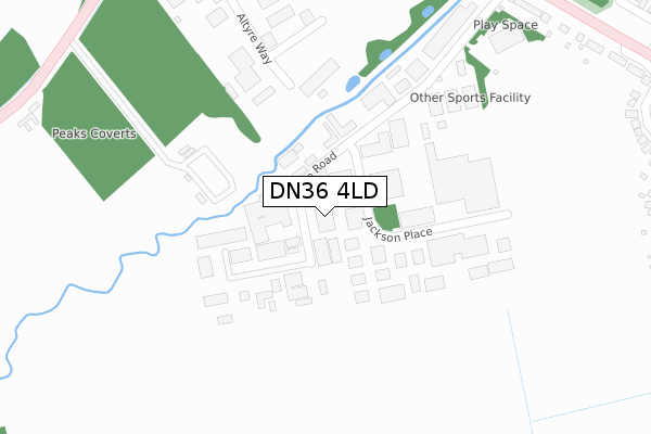
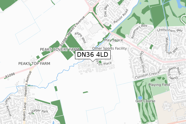
DN36 4LD is located in the Humberston and New Waltham electoral ward, within the unitary authority of North East Lincolnshire and the English Parliamentary constituency of Cleethorpes. The Sub Integrated Care Board (ICB) Location is NHS Humber and North Yorkshire ICB - 03H and the police force is Humberside. This postcode has been in use since July 2018.


GetTheData
Source: OS Open Zoomstack (Ordnance Survey)
Licence: Open Government Licence (requires attribution)
Attribution: Contains OS data © Crown copyright and database right 2025
Source: Open Postcode Geo
Licence: Open Government Licence (requires attribution)
Attribution: Contains OS data © Crown copyright and database right 2025; Contains Royal Mail data © Royal Mail copyright and database right 2025; Source: Office for National Statistics licensed under the Open Government Licence v.3.0
| Easting | 529599 |
| Northing | 406042 |
| Latitude | 53.535074 |
| Longitude | -0.046031 |
GetTheData
Source: Open Postcode Geo
Licence: Open Government Licence
| Country | England |
| Postcode District | DN36 |
➜ See where DN36 is on a map ➜ Where is Humberston? | |
GetTheData
Source: Land Registry Price Paid Data
Licence: Open Government Licence
| Ward | Humberston And New Waltham |
| Constituency | Cleethorpes |
GetTheData
Source: ONS Postcode Database
Licence: Open Government Licence
| Wilton Road (Grimsby Road) | Humberston | 472m |
| Wilton Road (Grimsby Road) | Humberston | 479m |
| Tesco (Car Park) | Old Clee | 548m |
| Windermere Crescent (Grimsby Road) | Humberston | 595m |
| Ash Court (Belvoir Road) | Old Clee | 613m |
| Cleethorpes Station | 3.2km |
| Grimsby Town Station | 4.2km |
| New Clee Station | 4.5km |
GetTheData
Source: NaPTAN
Licence: Open Government Licence
GetTheData
Source: ONS Postcode Database
Licence: Open Government Licence


➜ Get more ratings from the Food Standards Agency
GetTheData
Source: Food Standards Agency
Licence: FSA terms & conditions
| Last Collection | |||
|---|---|---|---|
| Location | Mon-Fri | Sat | Distance |
| Wilton | 17:45 | 10:45 | 358m |
| Grimsby Road | 16:30 | 10:45 | 760m |
| Oxford St Post Office | 18:30 | 12:00 | 1,120m |
GetTheData
Source: Dracos
Licence: Creative Commons Attribution-ShareAlike
The below table lists the International Territorial Level (ITL) codes (formerly Nomenclature of Territorial Units for Statistics (NUTS) codes) and Local Administrative Units (LAU) codes for DN36 4LD:
| ITL 1 Code | Name |
|---|---|
| TLE | Yorkshire and The Humber |
| ITL 2 Code | Name |
| TLE1 | East Yorkshire and Northern Lincolnshire |
| ITL 3 Code | Name |
| TLE13 | North and North East Lincolnshire |
| LAU 1 Code | Name |
| E06000012 | North East Lincolnshire |
GetTheData
Source: ONS Postcode Directory
Licence: Open Government Licence
The below table lists the Census Output Area (OA), Lower Layer Super Output Area (LSOA), and Middle Layer Super Output Area (MSOA) for DN36 4LD:
| Code | Name | |
|---|---|---|
| OA | E00066448 | |
| LSOA | E01013168 | North East Lincolnshire 022A |
| MSOA | E02002747 | North East Lincolnshire 022 |
GetTheData
Source: ONS Postcode Directory
Licence: Open Government Licence
| DN36 4AW | Wilton Road | 25m |
| DN36 4AS | Jackson Place | 104m |
| DN36 4BG | Bradleys Corner | 123m |
| DN36 4BJ | Wilton Road | 265m |
| DN36 4AH | Grimsby Road | 441m |
| DN36 4RS | Hewitts Avenue | 479m |
| DN36 4AQ | Grimsby Road | 479m |
| DN36 4AY | Coniston Crescent | 554m |
| DN36 4AX | Windermere Crescent | 555m |
| DN35 0RJ | Buck Beck Way | 568m |
GetTheData
Source: Open Postcode Geo; Land Registry Price Paid Data
Licence: Open Government Licence