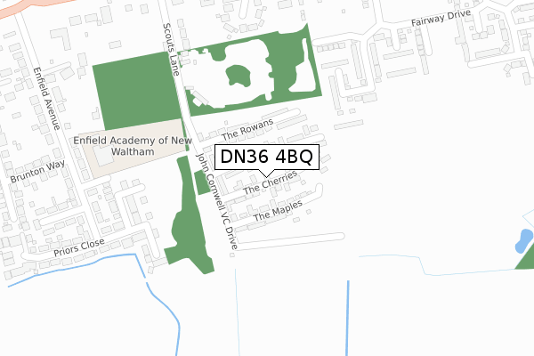
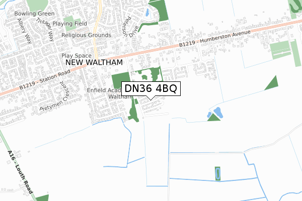
DN36 4BQ is located in the Humberston and New Waltham electoral ward, within the unitary authority of North East Lincolnshire and the English Parliamentary constituency of Cleethorpes. The Sub Integrated Care Board (ICB) Location is NHS Humber and North Yorkshire ICB - 03H and the police force is Humberside. This postcode has been in use since October 2018.


GetTheData
Source: OS Open Zoomstack (Ordnance Survey)
Licence: Open Government Licence (requires attribution)
Attribution: Contains OS data © Crown copyright and database right 2025
Source: Open Postcode Geo
Licence: Open Government Licence (requires attribution)
Attribution: Contains OS data © Crown copyright and database right 2025; Contains Royal Mail data © Royal Mail copyright and database right 2025; Source: Office for National Statistics licensed under the Open Government Licence v.3.0
| Easting | 529109 |
| Northing | 404467 |
| Latitude | 53.521046 |
| Longitude | -0.054069 |
GetTheData
Source: Open Postcode Geo
Licence: Open Government Licence
| Country | England |
| Postcode District | DN36 |
➜ See where DN36 is on a map ➜ Where is New Waltham? | |
GetTheData
Source: Land Registry Price Paid Data
Licence: Open Government Licence
| Ward | Humberston And New Waltham |
| Constituency | Cleethorpes |
GetTheData
Source: ONS Postcode Database
Licence: Open Government Licence
| Cannon Oakes Court (Humberston Avenue) | New Waltham | 426m |
| Cannon Oakes Court (Humberston Avenue) | New Waltham | 435m |
| Scouts Lane (Humberston Avenue) | New Waltham | 450m |
| Scouts Lane (Humberston Avenue) | New Waltham | 463m |
| Abbotts Grange (Humberston Avenue) | New Waltham | 496m |
| Cleethorpes Station | 4.8km |
| Grimsby Town Station | 5.2km |
GetTheData
Source: NaPTAN
Licence: Open Government Licence
| Percentage of properties with Next Generation Access | 100.0% |
| Percentage of properties with Superfast Broadband | 100.0% |
| Percentage of properties with Ultrafast Broadband | 100.0% |
| Percentage of properties with Full Fibre Broadband | 0.0% |
Superfast Broadband is between 30Mbps and 300Mbps
Ultrafast Broadband is > 300Mbps
| Median download speed | 50.0Mbps |
| Average download speed | 83.0Mbps |
| Maximum download speed | 200.00Mbps |
| Median upload speed | 1.0Mbps |
| Average upload speed | 1.0Mbps |
| Maximum upload speed | 1.08Mbps |
| Percentage of properties unable to receive 2Mbps | 0.0% |
| Percentage of properties unable to receive 5Mbps | 0.0% |
| Percentage of properties unable to receive 10Mbps | 0.0% |
| Percentage of properties unable to receive 30Mbps | 0.0% |
GetTheData
Source: Ofcom
Licence: Ofcom Terms of Use (requires attribution)
GetTheData
Source: ONS Postcode Database
Licence: Open Government Licence


➜ Get more ratings from the Food Standards Agency
GetTheData
Source: Food Standards Agency
Licence: FSA terms & conditions
| Last Collection | |||
|---|---|---|---|
| Location | Mon-Fri | Sat | Distance |
| Humberstone Avenue | 16:15 | 11:15 | 509m |
| Cardiff Avenue | 16:00 | 11:15 | 1,028m |
| Church Corner | 16:00 | 09:00 | 1,260m |
GetTheData
Source: Dracos
Licence: Creative Commons Attribution-ShareAlike
The below table lists the International Territorial Level (ITL) codes (formerly Nomenclature of Territorial Units for Statistics (NUTS) codes) and Local Administrative Units (LAU) codes for DN36 4BQ:
| ITL 1 Code | Name |
|---|---|
| TLE | Yorkshire and The Humber |
| ITL 2 Code | Name |
| TLE1 | East Yorkshire and Northern Lincolnshire |
| ITL 3 Code | Name |
| TLE13 | North and North East Lincolnshire |
| LAU 1 Code | Name |
| E06000012 | North East Lincolnshire |
GetTheData
Source: ONS Postcode Directory
Licence: Open Government Licence
The below table lists the Census Output Area (OA), Lower Layer Super Output Area (LSOA), and Middle Layer Super Output Area (MSOA) for DN36 4BQ:
| Code | Name | |
|---|---|---|
| OA | E00066443 | |
| LSOA | E01013168 | North East Lincolnshire 022A |
| MSOA | E02002747 | North East Lincolnshire 022 |
GetTheData
Source: ONS Postcode Directory
Licence: Open Government Licence
| DN36 4BN | The Rowans | 108m |
| DN36 4TB | Canon Oakes Court | 303m |
| DN36 4SF | Scouts Lane | 316m |
| DN36 4QZ | Priors Close | 329m |
| DN36 4RA | Priors Close | 334m |
| DN36 4RB | Enfield Avenue | 337m |
| DN36 4QX | Enfield Avenue | 386m |
| DN36 4RD | Enfield Avenue | 390m |
| DN36 4SJ | Humberston Avenue | 404m |
| DN36 4SP | Humberston Avenue | 408m |
GetTheData
Source: Open Postcode Geo; Land Registry Price Paid Data
Licence: Open Government Licence