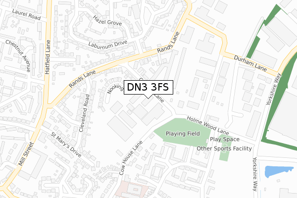
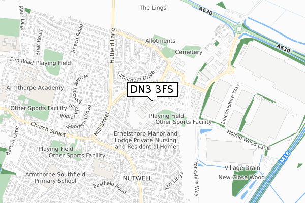
DN3 3FS is located in the Armthorpe electoral ward, within the metropolitan district of Doncaster and the English Parliamentary constituency of Doncaster Central. The Sub Integrated Care Board (ICB) Location is NHS South Yorkshire ICB - 02X and the police force is South Yorkshire. This postcode has been in use since September 2018.


GetTheData
Source: OS Open Zoomstack (Ordnance Survey)
Licence: Open Government Licence (requires attribution)
Attribution: Contains OS data © Crown copyright and database right 2025
Source: Open Postcode Geo
Licence: Open Government Licence (requires attribution)
Attribution: Contains OS data © Crown copyright and database right 2025; Contains Royal Mail data © Royal Mail copyright and database right 2025; Source: Office for National Statistics licensed under the Open Government Licence v.3.0
| Easting | 463402 |
| Northing | 405001 |
| Latitude | 53.537861 |
| Longitude | -1.044817 |
GetTheData
Source: Open Postcode Geo
Licence: Open Government Licence
| Country | England |
| Postcode District | DN3 |
➜ See where DN3 is on a map ➜ Where is Armthorpe? | |
GetTheData
Source: Land Registry Price Paid Data
Licence: Open Government Licence
| Ward | Armthorpe |
| Constituency | Doncaster Central |
GetTheData
Source: ONS Postcode Database
Licence: Open Government Licence
| Cow House Lane (Holme Wood Lane) | Armthorpe | 219m |
| Cow House Lane (Wickett Hern Road) | Armthorpe | 260m |
| Yorkshire Way (Durham Lane) | Armthorpe | 329m |
| Rands Lane (Hatfield Lane) | Armthorpe | 335m |
| Chestnut Avenue (Hatfield Lane) | Armthorpe | 361m |
| Kirk Sandall Station | 3.5km |
GetTheData
Source: NaPTAN
Licence: Open Government Licence
GetTheData
Source: ONS Postcode Database
Licence: Open Government Licence


➜ Get more ratings from the Food Standards Agency
GetTheData
Source: Food Standards Agency
Licence: FSA terms & conditions
| Last Collection | |||
|---|---|---|---|
| Location | Mon-Fri | Sat | Distance |
| Palm Avenue | 16:30 | 08:30 | 213m |
| Wicket Hern Road | 16:30 | 08:30 | 348m |
| Mill Street | 16:30 | 08:00 | 431m |
GetTheData
Source: Dracos
Licence: Creative Commons Attribution-ShareAlike
The below table lists the International Territorial Level (ITL) codes (formerly Nomenclature of Territorial Units for Statistics (NUTS) codes) and Local Administrative Units (LAU) codes for DN3 3FS:
| ITL 1 Code | Name |
|---|---|
| TLE | Yorkshire and The Humber |
| ITL 2 Code | Name |
| TLE3 | South Yorkshire |
| ITL 3 Code | Name |
| TLE31 | Barnsley, Doncaster and Rotherham |
| LAU 1 Code | Name |
| E08000017 | Doncaster |
GetTheData
Source: ONS Postcode Directory
Licence: Open Government Licence
The below table lists the Census Output Area (OA), Lower Layer Super Output Area (LSOA), and Middle Layer Super Output Area (MSOA) for DN3 3FS:
| Code | Name | |
|---|---|---|
| OA | E00037906 | |
| LSOA | E01007484 | Doncaster 017B |
| MSOA | E02001555 | Doncaster 017 |
GetTheData
Source: ONS Postcode Directory
Licence: Open Government Licence
| DN3 3EB | Gunhills Lane | 75m |
| DN3 3EF | Gunhills Lane Industrial Estate | 133m |
| DN3 3GU | Mews Court | 137m |
| DN3 3ER | Nooking Close | 147m |
| DN3 3DY | Rands Lane | 163m |
| DN3 3DZ | Rands Lane | 166m |
| DN3 3HH | Cedar Road | 185m |
| DN3 3DU | Cleveland Road | 206m |
| DN3 3TF | Walbank Road | 226m |
| DN3 3DX | Cleveland Road | 232m |
GetTheData
Source: Open Postcode Geo; Land Registry Price Paid Data
Licence: Open Government Licence