DN22 7ZU maps, stats, and open data
DN22 7ZU is located in the East Retford East electoral ward, within the local authority district of Bassetlaw and the English Parliamentary constituency of Bassetlaw. The Sub Integrated Care Board (ICB) Location is NHS Nottingham and Nottinghamshire ICB - 02Q and the police force is Nottinghamshire. This postcode has been in use since November 2019.
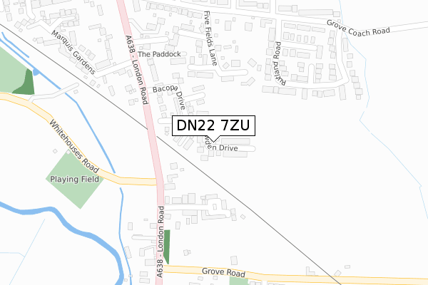
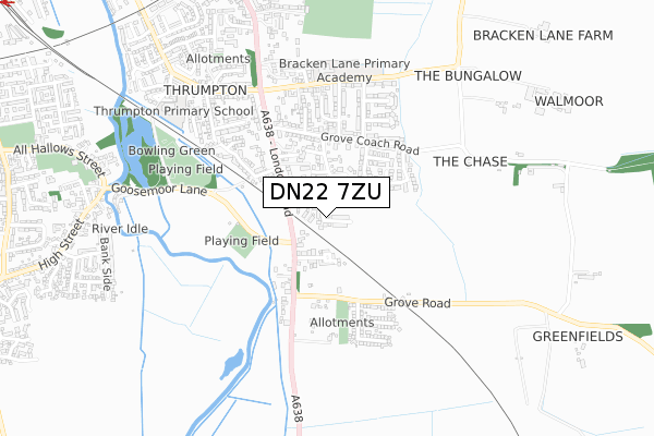
DN22 7ZU maps


Licence: Open Government Licence (requires attribution)
Attribution: Contains OS data © Crown copyright and database right 2025
Source: Open Postcode Geo
Licence: Open Government Licence (requires attribution)
Attribution: Contains OS data © Crown copyright and database right 2025; Contains Royal Mail data © Royal Mail copyright and database right 2025; Source: Office for National Statistics licensed under the Open Government Licence v.3.0
DN22 7ZU geodata
| Easting | 471440 |
| Northing | 379479 |
| Latitude | 53.307466 |
| Longitude | -0.929327 |
Where is DN22 7ZU?
| Country | England |
| Postcode District | DN22 |
Politics
| Ward | East Retford East |
|---|---|
| Constituency | Bassetlaw |
House Prices
Sales of detached houses in DN22 7ZU
2024 12 JUL £410,000 |
30, SNOWDEN DRIVE, RETFORD, DN22 7ZU 2024 1 MAY £379,495 |
2023 22 AUG £340,000 |
27, SNOWDEN DRIVE, RETFORD, DN22 7ZU 2023 21 JUL £428,995 |
32, SNOWDEN DRIVE, RETFORD, DN22 7ZU 2023 30 JUN £418,495 |
2022 9 DEC £325,000 |
2022 28 OCT £425,000 |
2022 29 JUL £325,000 |
2022 22 JUL £335,000 |
28, SNOWDEN DRIVE, RETFORD, DN22 7ZU 2020 4 DEC £429,995 |
Licence: Contains HM Land Registry data © Crown copyright and database right 2025. This data is licensed under the Open Government Licence v3.0.
Transport
Nearest bus stops to DN22 7ZU
| Goosemoor Lane | White Houses | 215m |
| Goosemoor Lane | White Houses | 235m |
| Allison Avenue (Grove Road) | White Houses | 288m |
| Mount Vernon Park (London Road) | Retford | 307m |
| Allison Avenue (Grove Road) | White Houses | 322m |
Nearest railway stations to DN22 7ZU
| Retford Low Level Station | 1.3km |
| Retford Station | 1.5km |
Broadband
Broadband access in DN22 7ZU (2020 data)
| Percentage of properties with Next Generation Access | 100.0% |
| Percentage of properties with Superfast Broadband | 100.0% |
| Percentage of properties with Ultrafast Broadband | 0.0% |
| Percentage of properties with Full Fibre Broadband | 0.0% |
Superfast Broadband is between 30Mbps and 300Mbps
Ultrafast Broadband is > 300Mbps
Broadband limitations in DN22 7ZU (2020 data)
| Percentage of properties unable to receive 2Mbps | 0.0% |
| Percentage of properties unable to receive 5Mbps | 0.0% |
| Percentage of properties unable to receive 10Mbps | 0.0% |
| Percentage of properties unable to receive 30Mbps | 0.0% |
Deprivation
19.6% of English postcodes are less deprived than DN22 7ZU:Food Standards Agency
Three nearest food hygiene ratings to DN22 7ZU (metres)


➜ Get more ratings from the Food Standards Agency
Nearest post box to DN22 7ZU
| Last Collection | |||
|---|---|---|---|
| Location | Mon-Fri | Sat | Distance |
| Whitehouses | 17:30 | 11:00 | 233m |
| Allison Avenue | 17:30 | 11:30 | 360m |
| Grove Coach Road | 17:30 | 11:30 | 454m |
DN22 7ZU ITL and DN22 7ZU LAU
The below table lists the International Territorial Level (ITL) codes (formerly Nomenclature of Territorial Units for Statistics (NUTS) codes) and Local Administrative Units (LAU) codes for DN22 7ZU:
| ITL 1 Code | Name |
|---|---|
| TLF | East Midlands (England) |
| ITL 2 Code | Name |
| TLF1 | Derbyshire and Nottinghamshire |
| ITL 3 Code | Name |
| TLF15 | North Nottinghamshire |
| LAU 1 Code | Name |
| E07000171 | Bassetlaw |
DN22 7ZU census areas
The below table lists the Census Output Area (OA), Lower Layer Super Output Area (LSOA), and Middle Layer Super Output Area (MSOA) for DN22 7ZU:
| Code | Name | |
|---|---|---|
| OA | E00142712 | |
| LSOA | E01028010 | Bassetlaw 008C |
| MSOA | E02005842 | Bassetlaw 008 |
Nearest postcodes to DN22 7ZU
| DN22 7JF | London Road | 162m |
| DN22 7HP | Grosvenor Close | 200m |
| DN22 7HW | Harcourt Place | 210m |
| DN22 7HF | Rutland Road | 232m |
| DN22 7HQ | Five Fields Lane | 247m |
| DN22 7JD | The Paddock | 248m |
| DN22 7JL | Grove Road | 255m |
| DN22 7JE | London Road | 262m |
| DN22 7HE | Haddon Road | 284m |
| DN22 7BF | Mount Vernon Park | 286m |