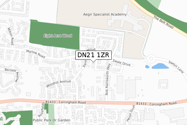
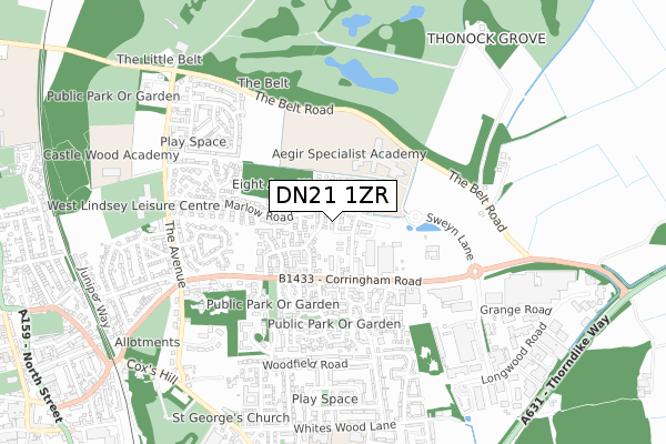
DN21 1ZR is located in the Gainsborough North electoral ward, within the local authority district of West Lindsey and the English Parliamentary constituency of Gainsborough. The Sub Integrated Care Board (ICB) Location is NHS Lincolnshire ICB - 71E and the police force is Lincolnshire. This postcode has been in use since January 2018.


GetTheData
Source: OS Open Zoomstack (Ordnance Survey)
Licence: Open Government Licence (requires attribution)
Attribution: Contains OS data © Crown copyright and database right 2025
Source: Open Postcode Geo
Licence: Open Government Licence (requires attribution)
Attribution: Contains OS data © Crown copyright and database right 2025; Contains Royal Mail data © Royal Mail copyright and database right 2025; Source: Office for National Statistics licensed under the Open Government Licence v.3.0
| Easting | 482653 |
| Northing | 390703 |
| Latitude | 53.406703 |
| Longitude | -0.758165 |
GetTheData
Source: Open Postcode Geo
Licence: Open Government Licence
| Country | England |
| Postcode District | DN21 |
➜ See where DN21 is on a map ➜ Where is Gainsborough? | |
GetTheData
Source: Land Registry Price Paid Data
Licence: Open Government Licence
| Ward | Gainsborough North |
| Constituency | Gainsborough |
GetTheData
Source: ONS Postcode Database
Licence: Open Government Licence
16, CALDER AVENUE, GAINSBOROUGH, DN21 1ZR 2018 13 JUL £187,995 |
7, CALDER AVENUE, GAINSBOROUGH, DN21 1ZR 2018 20 APR £199,995 |
9, CALDER AVENUE, GAINSBOROUGH, DN21 1ZR 2018 2 MAR £224,995 |
GetTheData
Source: HM Land Registry Price Paid Data
Licence: Contains HM Land Registry data © Crown copyright and database right 2025. This data is licensed under the Open Government Licence v3.0.
| Trent Valley Academy (Corringham Road) | Gainsborough | 272m |
| The Peacock Ph (Corringham Road) | Gainsborough | 333m |
| The Peacock Ph (Corringham Road) | Gainsborough | 442m |
| Danes Road (Woodfield Road) | Gainsborough | 531m |
| 87 Woodfield Road (Woodfield Road) | Gainsborough | 534m |
| Gainsborough Central Station | 1.1km |
| Gainsborough Lea Road Station | 2.4km |
GetTheData
Source: NaPTAN
Licence: Open Government Licence
| Percentage of properties with Next Generation Access | 100.0% |
| Percentage of properties with Superfast Broadband | 100.0% |
| Percentage of properties with Ultrafast Broadband | 100.0% |
| Percentage of properties with Full Fibre Broadband | 100.0% |
Superfast Broadband is between 30Mbps and 300Mbps
Ultrafast Broadband is > 300Mbps
| Percentage of properties unable to receive 2Mbps | 0.0% |
| Percentage of properties unable to receive 5Mbps | 0.0% |
| Percentage of properties unable to receive 10Mbps | 0.0% |
| Percentage of properties unable to receive 30Mbps | 0.0% |
GetTheData
Source: Ofcom
Licence: Ofcom Terms of Use (requires attribution)
GetTheData
Source: ONS Postcode Database
Licence: Open Government Licence


➜ Get more ratings from the Food Standards Agency
GetTheData
Source: Food Standards Agency
Licence: FSA terms & conditions
| Last Collection | |||
|---|---|---|---|
| Location | Mon-Fri | Sat | Distance |
| Corringham Road | 18:45 | 411m | |
| Corringham Road | 18:45 | 11:00 | 428m |
| Eastern Avenue | 17:00 | 12:00 | 779m |
GetTheData
Source: Dracos
Licence: Creative Commons Attribution-ShareAlike
The below table lists the International Territorial Level (ITL) codes (formerly Nomenclature of Territorial Units for Statistics (NUTS) codes) and Local Administrative Units (LAU) codes for DN21 1ZR:
| ITL 1 Code | Name |
|---|---|
| TLF | East Midlands (England) |
| ITL 2 Code | Name |
| TLF3 | Lincolnshire |
| ITL 3 Code | Name |
| TLF30 | Lincolnshire CC |
| LAU 1 Code | Name |
| E07000142 | West Lindsey |
GetTheData
Source: ONS Postcode Directory
Licence: Open Government Licence
The below table lists the Census Output Area (OA), Lower Layer Super Output Area (LSOA), and Middle Layer Super Output Area (MSOA) for DN21 1ZR:
| Code | Name | |
|---|---|---|
| OA | E00168567 | |
| LSOA | E01026380 | West Lindsey 002A |
| MSOA | E02005493 | West Lindsey 002 |
GetTheData
Source: ONS Postcode Directory
Licence: Open Government Licence
| DN21 1FT | Bob Rainsforth Way | 95m |
| DN21 1YB | Harrow Close | 107m |
| DN21 1FF | Oak Tree Avenue | 164m |
| DN21 1FE | Laurel Close | 195m |
| DN21 1YA | Grasmere Close | 217m |
| DN21 1FB | Woodhill Avenue | 220m |
| DN21 1FG | Aspen Court | 220m |
| DN21 1FH | Larch Court | 235m |
| DN21 1WF | The Spinney | 241m |
| DN21 1FD | Sycamore Drive | 243m |
GetTheData
Source: Open Postcode Geo; Land Registry Price Paid Data
Licence: Open Government Licence