DN16 3FU maps, stats, and open data
DN16 3FU is located in the Ashby Lakeside electoral ward, within the unitary authority of North Lincolnshire and the English Parliamentary constituency of Scunthorpe. The Sub Integrated Care Board (ICB) Location is NHS Humber and North Yorkshire ICB - 03K and the police force is Humberside. This postcode has been in use since March 2018.
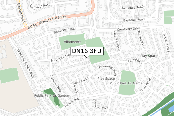
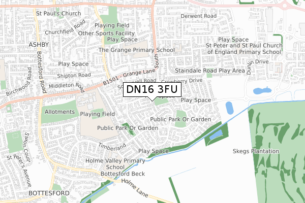
DN16 3FU maps


Licence: Open Government Licence (requires attribution)
Attribution: Contains OS data © Crown copyright and database right 2025
Source: Open Postcode Geo
Licence: Open Government Licence (requires attribution)
Attribution: Contains OS data © Crown copyright and database right 2025; Contains Royal Mail data © Royal Mail copyright and database right 2025; Source: Office for National Statistics licensed under the Open Government Licence v.3.0
DN16 3FU geodata
| Easting | 490661 |
| Northing | 407857 |
| Latitude | 53.559534 |
| Longitude | -0.632794 |
Where is DN16 3FU?
| Country | England |
| Postcode District | DN16 |
Politics
| Ward | Ashby Lakeside |
|---|---|
| Constituency | Scunthorpe |
House Prices
Sales of detached houses in DN16 3FU
1, ALPINA CLOSE, SCUNTHORPE, DN16 3FU 2025 19 SEP £160,104 |
2022 17 JUN £340,500 |
2021 2 DEC £315,000 |
2020 2 MAR £207,500 |
2018 20 DEC £205,000 |
9, ALPINA CLOSE, SCUNTHORPE, DN16 3FU 2018 19 DEC £237,500 |
11, ALPINA CLOSE, SCUNTHORPE, DN16 3FU 2018 19 DEC £249,950 |
15, ALPINA CLOSE, SCUNTHORPE, DN16 3FU 2018 28 SEP £249,950 |
17, ALPINA CLOSE, SCUNTHORPE, DN16 3FU 2018 24 SEP £249,950 |
2018 10 AUG £179,950 |
Licence: Contains HM Land Registry data © Crown copyright and database right 2025. This data is licensed under the Open Government Licence v3.0.
Transport
Nearest bus stops to DN16 3FU
| Pinewood Close (Timberland) | Bottesford | 224m |
| Pinewood Close (Timberland) | Bottesford | 230m |
| Mallory Road (Grange Lane South) | Ashby | 251m |
| Mallory Road (Grange Lane South) | Ashby | 261m |
| Clematis Way (Timberland) | Bottesford | 283m |
Nearest railway stations to DN16 3FU
| Scunthorpe Station | 3.2km |
Broadband
Broadband access in DN16 3FU (2020 data)
| Percentage of properties with Next Generation Access | 100.0% |
| Percentage of properties with Superfast Broadband | 100.0% |
| Percentage of properties with Ultrafast Broadband | 100.0% |
| Percentage of properties with Full Fibre Broadband | 0.0% |
Superfast Broadband is between 30Mbps and 300Mbps
Ultrafast Broadband is > 300Mbps
Broadband speed in DN16 3FU (2019 data)
Download
| Median download speed | 44.0Mbps |
| Average download speed | 102.8Mbps |
| Maximum download speed | 350.00Mbps |
Upload
| Median upload speed | 7.4Mbps |
| Average upload speed | 6.9Mbps |
| Maximum upload speed | 7.66Mbps |
Broadband limitations in DN16 3FU (2020 data)
| Percentage of properties unable to receive 2Mbps | 0.0% |
| Percentage of properties unable to receive 5Mbps | 0.0% |
| Percentage of properties unable to receive 10Mbps | 0.0% |
| Percentage of properties unable to receive 30Mbps | 0.0% |
Deprivation
13.7% of English postcodes are less deprived than DN16 3FU:Food Standards Agency
Three nearest food hygiene ratings to DN16 3FU (metres)


➜ Get more ratings from the Food Standards Agency
Nearest post box to DN16 3FU
| Last Collection | |||
|---|---|---|---|
| Location | Mon-Fri | Sat | Distance |
| Crowberry Drive | 17:30 | 11:45 | 349m |
| Baysdale Road | 17:30 | 11:15 | 368m |
| Manifold Road | 17:30 | 11:45 | 594m |
DN16 3FU ITL and DN16 3FU LAU
The below table lists the International Territorial Level (ITL) codes (formerly Nomenclature of Territorial Units for Statistics (NUTS) codes) and Local Administrative Units (LAU) codes for DN16 3FU:
| ITL 1 Code | Name |
|---|---|
| TLE | Yorkshire and The Humber |
| ITL 2 Code | Name |
| TLE1 | East Yorkshire and Northern Lincolnshire |
| ITL 3 Code | Name |
| TLE13 | North and North East Lincolnshire |
| LAU 1 Code | Name |
| E06000013 | North Lincolnshire |
DN16 3FU census areas
The below table lists the Census Output Area (OA), Lower Layer Super Output Area (LSOA), and Middle Layer Super Output Area (MSOA) for DN16 3FU:
| Code | Name | |
|---|---|---|
| OA | E00066799 | |
| LSOA | E01033297 | North Lincolnshire 018G |
| MSOA | E02002766 | North Lincolnshire 018 |
Nearest postcodes to DN16 3FU
| DN16 3GN | Nutwood View | 60m |
| DN16 3GP | Tilia Close | 128m |
| DN16 3UR | Plantain Close | 144m |
| DN16 3DA | Honeysuckle Court | 165m |
| DN16 3UP | Burdock Road | 166m |
| DN16 3GL | Nutwell Court | 167m |
| DN16 3FB | Pinewood Close | 169m |
| DN16 3GR | Peach Tree Close | 171m |
| DN16 3FD | Oakwell Close | 171m |
| DN16 3GQ | Weeping Elm Way | 172m |