DN14 9FF maps, stats, and open data
DN14 9FF is located in the Snaith, Airmyn, Rawcliffe and Marshland electoral ward, within the unitary authority of East Riding of Yorkshire and the English Parliamentary constituency of Brigg and Goole. The Sub Integrated Care Board (ICB) Location is NHS Humber and North Yorkshire ICB - 02Y and the police force is Humberside. This postcode has been in use since December 2017.
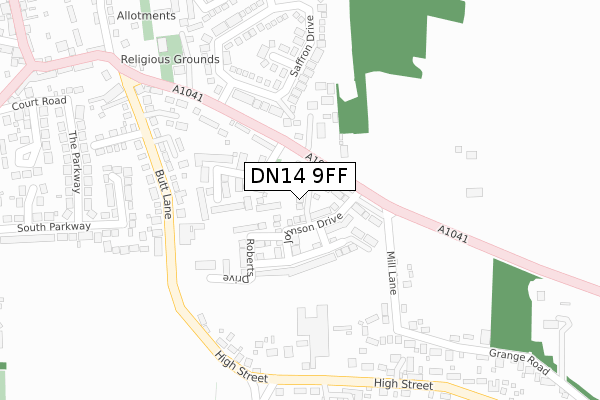
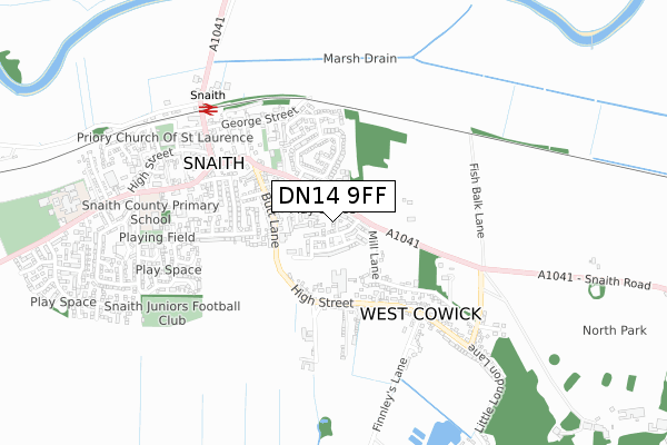
DN14 9FF maps


Licence: Open Government Licence (requires attribution)
Attribution: Contains OS data © Crown copyright and database right 2025
Source: Open Postcode Geo
Licence: Open Government Licence (requires attribution)
Attribution: Contains OS data © Crown copyright and database right 2025; Contains Royal Mail data © Royal Mail copyright and database right 2025; Source: Office for National Statistics licensed under the Open Government Licence v.3.0
DN14 9FF geodata
| Easting | 464725 |
| Northing | 421869 |
| Latitude | 53.689290 |
| Longitude | -1.021358 |
Where is DN14 9FF?
| Country | England |
| Postcode District | DN14 |
Politics
| Ward | Snaith, Airmyn, Rawcliffe And Marshland |
|---|---|
| Constituency | Brigg And Goole |
House Prices
Sales of detached houses in DN14 9FF
2, LAUGHTON GARTH, SNAITH, GOOLE, DN14 9FF 2021 17 JUN £370,000 |
3, LAUGHTON GARTH, SNAITH, GOOLE, DN14 9FF 2018 19 JAN £322,045 |
1, LAUGHTON GARTH, SNAITH, GOOLE, DN14 9FF 2018 15 JAN £267,995 |
2, LAUGHTON GARTH, SNAITH, GOOLE, DN14 9FF 2018 15 JAN £321,095 |
4, LAUGHTON GARTH, SNAITH, GOOLE, DN14 9FF 2017 30 NOV £284,995 |
Licence: Contains HM Land Registry data © Crown copyright and database right 2025. This data is licensed under the Open Government Licence v3.0.
Transport
Nearest bus stops to DN14 9FF
| West Cowick High Street (High Street) | West Cowick | 296m |
| Snaith Butt Lane (Butt Lane) | Snaith | 301m |
| West Cowick High Street (High Street) | West Cowick | 307m |
| Snaith Butt Lane (Butt Lane) | Snaith | 333m |
| West Cowick High Street (High Street) | West Cowick | 454m |
Nearest railway stations to DN14 9FF
| Snaith Station | 0.6km |
| Rawcliffe Station | 4km |
Broadband
Broadband access in DN14 9FF (2020 data)
| Percentage of properties with Next Generation Access | 100.0% |
| Percentage of properties with Superfast Broadband | 100.0% |
| Percentage of properties with Ultrafast Broadband | 100.0% |
| Percentage of properties with Full Fibre Broadband | 100.0% |
Superfast Broadband is between 30Mbps and 300Mbps
Ultrafast Broadband is > 300Mbps
Broadband limitations in DN14 9FF (2020 data)
| Percentage of properties unable to receive 2Mbps | 0.0% |
| Percentage of properties unable to receive 5Mbps | 0.0% |
| Percentage of properties unable to receive 10Mbps | 0.0% |
| Percentage of properties unable to receive 30Mbps | 0.0% |
Deprivation
21.2% of English postcodes are less deprived than DN14 9FF:Food Standards Agency
Three nearest food hygiene ratings to DN14 9FF (metres)


➜ Get more ratings from the Food Standards Agency
Nearest post box to DN14 9FF
| Last Collection | |||
|---|---|---|---|
| Location | Mon-Fri | Sat | Distance |
| Beast Fair, Cowick Road | 17:15 | 09:45 | 408m |
| High Street | 17:15 | 09:45 | 447m |
| Snaith Post Office | 17:00 | 10:00 | 607m |
DN14 9FF ITL and DN14 9FF LAU
The below table lists the International Territorial Level (ITL) codes (formerly Nomenclature of Territorial Units for Statistics (NUTS) codes) and Local Administrative Units (LAU) codes for DN14 9FF:
| ITL 1 Code | Name |
|---|---|
| TLE | Yorkshire and The Humber |
| ITL 2 Code | Name |
| TLE1 | East Yorkshire and Northern Lincolnshire |
| ITL 3 Code | Name |
| TLE12 | East Riding of Yorkshire |
| LAU 1 Code | Name |
| E06000011 | East Riding of Yorkshire |
DN14 9FF census areas
The below table lists the Census Output Area (OA), Lower Layer Super Output Area (LSOA), and Middle Layer Super Output Area (MSOA) for DN14 9FF:
| Code | Name | |
|---|---|---|
| OA | E00065982 | |
| LSOA | E01013073 | East Riding of Yorkshire 042B |
| MSOA | E02002725 | East Riding of Yorkshire 042 |
Nearest postcodes to DN14 9FF
| DN14 9DN | Cowick Road | 106m |
| DN14 9TL | Brierley Close | 111m |
| DN14 9RF | Laburnum Close | 130m |
| DN14 9DW | Cowick Road | 159m |
| DN14 9FG | Fairholme Gardens | 170m |
| DN14 9DY | Butt Lane | 202m |
| DN14 9DU | Field Close | 219m |
| DN14 9RA | Saffron Drive | 228m |
| DN14 9DL | Mill Lane | 228m |
| DN14 9EX | The Hollies | 241m |