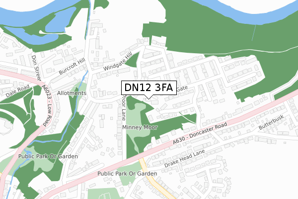
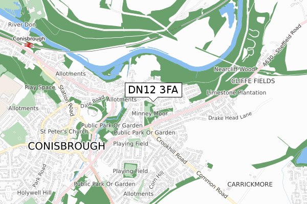
DN12 3FA is located in the Conisbrough electoral ward, within the metropolitan district of Doncaster and the English Parliamentary constituency of Don Valley. The Sub Integrated Care Board (ICB) Location is NHS South Yorkshire ICB - 02X and the police force is South Yorkshire. This postcode has been in use since March 2019.


GetTheData
Source: OS Open Zoomstack (Ordnance Survey)
Licence: Open Government Licence (requires attribution)
Attribution: Contains OS data © Crown copyright and database right 2025
Source: Open Postcode Geo
Licence: Open Government Licence (requires attribution)
Attribution: Contains OS data © Crown copyright and database right 2025; Contains Royal Mail data © Royal Mail copyright and database right 2025; Source: Office for National Statistics licensed under the Open Government Licence v.3.0
| Easting | 451950 |
| Northing | 398989 |
| Latitude | 53.485081 |
| Longitude | -1.218586 |
GetTheData
Source: Open Postcode Geo
Licence: Open Government Licence
| Country | England |
| Postcode District | DN12 |
➜ See where DN12 is on a map ➜ Where is Conisbrough? | |
GetTheData
Source: Land Registry Price Paid Data
Licence: Open Government Licence
| Ward | Conisbrough |
| Constituency | Don Valley |
GetTheData
Source: ONS Postcode Database
Licence: Open Government Licence
2023 1 DEC £545,000 |
THE OLD NURSERY, ORCHARD COURT, MINNEYMOOR LANE, CONISBROUGH, DONCASTER, DN12 3FA 2022 15 JUL £395,000 |
GetTheData
Source: HM Land Registry Price Paid Data
Licence: Contains HM Land Registry data © Crown copyright and database right 2025. This data is licensed under the Open Government Licence v3.0.
| Crookhill Road (Doncaster Road) | Conisbrough | 171m |
| Crookhill Road (Doncaster Road) | Conisbrough | 225m |
| Drake Head Lane (Doncaster Road) | Conisbrough | 227m |
| Milner Gate Lane (Doncaster Road) | Conisbrough | 250m |
| Worthing Crescent (Windmill Avenue) | Conisbrough | 308m |
| Conisbrough Station | 1.1km |
| Mexborough Station | 4.7km |
GetTheData
Source: NaPTAN
Licence: Open Government Licence
GetTheData
Source: ONS Postcode Database
Licence: Open Government Licence


➜ Get more ratings from the Food Standards Agency
GetTheData
Source: Food Standards Agency
Licence: FSA terms & conditions
| Last Collection | |||
|---|---|---|---|
| Location | Mon-Fri | Sat | Distance |
| Doncaster Road | 16:45 | 09:00 | 327m |
| Burcroft | 16:00 | 09:00 | 344m |
| Windmill Ave P.o. | 16:45 | 09:45 | 426m |
GetTheData
Source: Dracos
Licence: Creative Commons Attribution-ShareAlike
The below table lists the International Territorial Level (ITL) codes (formerly Nomenclature of Territorial Units for Statistics (NUTS) codes) and Local Administrative Units (LAU) codes for DN12 3FA:
| ITL 1 Code | Name |
|---|---|
| TLE | Yorkshire and The Humber |
| ITL 2 Code | Name |
| TLE3 | South Yorkshire |
| ITL 3 Code | Name |
| TLE31 | Barnsley, Doncaster and Rotherham |
| LAU 1 Code | Name |
| E08000017 | Doncaster |
GetTheData
Source: ONS Postcode Directory
Licence: Open Government Licence
The below table lists the Census Output Area (OA), Lower Layer Super Output Area (LSOA), and Middle Layer Super Output Area (MSOA) for DN12 3FA:
| Code | Name | |
|---|---|---|
| OA | E00038562 | |
| LSOA | E01007620 | Doncaster 020D |
| MSOA | E02001558 | Doncaster 020 |
GetTheData
Source: ONS Postcode Directory
Licence: Open Government Licence
| DN12 3AZ | Milner Gate Lane | 60m |
| DN12 3EJ | Minney Moor Lane | 78m |
| DN12 3BW | Milnergate Court | 82m |
| DN12 3BB | Beltoft Way | 91m |
| DN12 3AY | Cranswick Way | 109m |
| DN12 3BA | Lockton Way | 126m |
| DN12 3EL | Minney Moor Lane | 135m |
| DN12 3AL | Doncaster Road | 145m |
| DN12 3BJ | Windgate Hill | 152m |
| DN12 3EN | Minney Moor Hill | 164m |
GetTheData
Source: Open Postcode Geo; Land Registry Price Paid Data
Licence: Open Government Licence