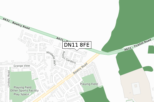
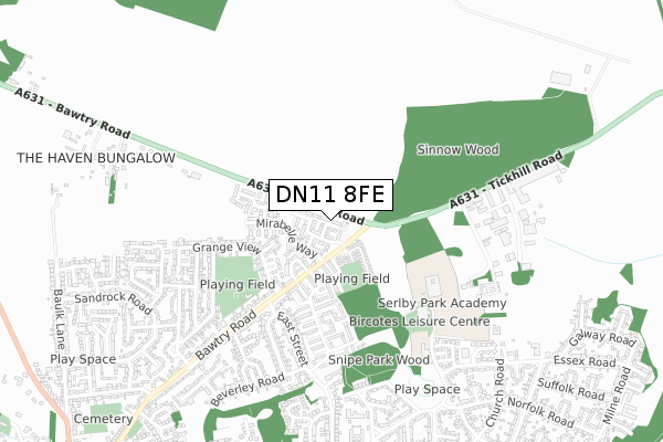
DN11 8FE is located in the Harworth electoral ward, within the local authority district of Bassetlaw and the English Parliamentary constituency of Bassetlaw. The Sub Integrated Care Board (ICB) Location is NHS Nottingham and Nottinghamshire ICB - 02Q and the police force is Nottinghamshire. This postcode has been in use since October 2019.


GetTheData
Source: OS Open Zoomstack (Ordnance Survey)
Licence: Open Government Licence (requires attribution)
Attribution: Contains OS data © Crown copyright and database right 2025
Source: Open Postcode Geo
Licence: Open Government Licence (requires attribution)
Attribution: Contains OS data © Crown copyright and database right 2025; Contains Royal Mail data © Royal Mail copyright and database right 2025; Source: Office for National Statistics licensed under the Open Government Licence v.3.0
| Easting | 462604 |
| Northing | 392494 |
| Latitude | 53.425552 |
| Longitude | -1.059342 |
GetTheData
Source: Open Postcode Geo
Licence: Open Government Licence
| Country | England |
| Postcode District | DN11 |
➜ See where DN11 is on a map ➜ Where is Harworth? | |
GetTheData
Source: Land Registry Price Paid Data
Licence: Open Government Licence
| Ward | Harworth |
| Constituency | Bassetlaw |
GetTheData
Source: ONS Postcode Database
Licence: Open Government Licence
2024 20 DEC £236,500 |
14, PERSHORE DRIVE, HARWORTH, DONCASTER, DN11 8FE 2020 9 OCT £195,000 |
8, PERSHORE DRIVE, HARWORTH, DONCASTER, DN11 8FE 2020 31 JUL £190,000 |
39, PERSHORE DRIVE, HARWORTH, DONCASTER, DN11 8FE 2020 11 JUN £189,999 |
2020 24 APR £197,999 |
43, PERSHORE DRIVE, HARWORTH, DONCASTER, DN11 8FE 2019 20 DEC £234,999 |
41, PERSHORE DRIVE, HARWORTH, DONCASTER, DN11 8FE 2019 19 DEC £204,999 |
GetTheData
Source: HM Land Registry Price Paid Data
Licence: Contains HM Land Registry data © Crown copyright and database right 2025. This data is licensed under the Open Government Licence v3.0.
| Plumtree Caravan Park (Bawtry Road) | Harworth | 111m |
| Plumtree Caravan Park (Bawtry Road) | Harworth | 126m |
| Plumtree Caravan Park (Bawtry Road) | Bawtry | 202m |
| Plumtree Caravan Park (Bawtry Road) | Bawtry | 202m |
| East Street | Harworth | 401m |
GetTheData
Source: NaPTAN
Licence: Open Government Licence
GetTheData
Source: ONS Postcode Database
Licence: Open Government Licence


➜ Get more ratings from the Food Standards Agency
GetTheData
Source: Food Standards Agency
Licence: FSA terms & conditions
| Last Collection | |||
|---|---|---|---|
| Location | Mon-Fri | Sat | Distance |
| Bawtry Road | 17:15 | 10:45 | 559m |
| Dorchester Road | 17:15 | 10:45 | 595m |
| Beech Road | 17:15 | 10:00 | 697m |
GetTheData
Source: Dracos
Licence: Creative Commons Attribution-ShareAlike
The below table lists the International Territorial Level (ITL) codes (formerly Nomenclature of Territorial Units for Statistics (NUTS) codes) and Local Administrative Units (LAU) codes for DN11 8FE:
| ITL 1 Code | Name |
|---|---|
| TLF | East Midlands (England) |
| ITL 2 Code | Name |
| TLF1 | Derbyshire and Nottinghamshire |
| ITL 3 Code | Name |
| TLF15 | North Nottinghamshire |
| LAU 1 Code | Name |
| E07000171 | Bassetlaw |
GetTheData
Source: ONS Postcode Directory
Licence: Open Government Licence
The below table lists the Census Output Area (OA), Lower Layer Super Output Area (LSOA), and Middle Layer Super Output Area (MSOA) for DN11 8FE:
| Code | Name | |
|---|---|---|
| OA | E00142785 | |
| LSOA | E01028028 | Bassetlaw 001F |
| MSOA | E02005835 | Bassetlaw 001 |
GetTheData
Source: ONS Postcode Directory
Licence: Open Government Licence
| DN11 8QS | Balmoral Court | 189m |
| DN11 8QT | Dorchester Road | 213m |
| DN11 8NZ | Buckingham Court | 224m |
| DN11 8QW | Grange Drive | 250m |
| DN11 8QX | Dorchester Road | 295m |
| DN11 8QU | Sandringham Court | 297m |
| DN11 8RA | Chatsworth Court | 318m |
| DN11 8QY | Arundel Walk | 369m |
| DN11 8RE | Strathmore Court | 371m |
| DN11 8QP | Grange View | 378m |
GetTheData
Source: Open Postcode Geo; Land Registry Price Paid Data
Licence: Open Government Licence