DL3 0AP maps, stats, and open data
DL3 0AP is located in the Brinkburn & Faverdale electoral ward, within the unitary authority of Darlington and the English Parliamentary constituency of Darlington. The Sub Integrated Care Board (ICB) Location is NHS North East and North Cumbria ICB - 16C and the police force is Durham. This postcode has been in use since January 2018.
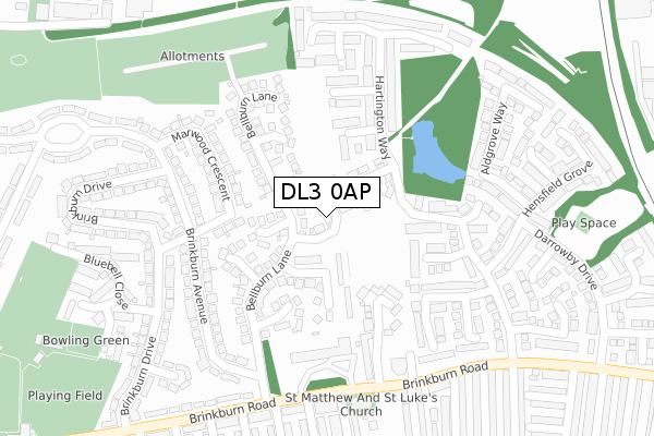
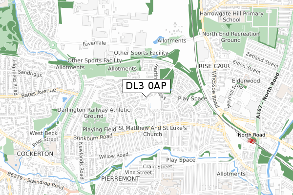
DL3 0AP maps


Licence: Open Government Licence (requires attribution)
Attribution: Contains OS data © Crown copyright and database right 2025
Source: Open Postcode Geo
Licence: Open Government Licence (requires attribution)
Attribution: Contains OS data © Crown copyright and database right 2025; Contains Royal Mail data © Royal Mail copyright and database right 2025; Source: Office for National Statistics licensed under the Open Government Licence v.3.0
DL3 0AP geodata
| Easting | 428092 |
| Northing | 516052 |
| Latitude | 54.538972 |
| Longitude | -1.567344 |
Where is DL3 0AP?
| Country | England |
| Postcode District | DL3 |
Politics
| Ward | Brinkburn & Faverdale |
|---|---|
| Constituency | Darlington |
House Prices
Sales of detached houses in DL3 0AP
2022 20 MAY £225,000 |
1, ROSEWOOD COURT, DARLINGTON, DL3 0AP 2018 14 DEC £178,995 |
8, ROSEWOOD COURT, DARLINGTON, DL3 0AP 2018 30 NOV £189,995 |
2018 29 OCT £178,995 |
7, ROSEWOOD COURT, DARLINGTON, DL3 0AP 2018 15 OCT £203,995 |
Licence: Contains HM Land Registry data © Crown copyright and database right 2025. This data is licensed under the Open Government Licence v3.0.
Transport
Nearest bus stops to DL3 0AP
| Wayland Terrace (Brinkburn Avenue) | Brinkburn | 207m |
| Wayland Terrace (Brinkburn Avenue) | Brinkburn | 213m |
| Stooperdale Offices (Brinkburn Road) | Brinkburn | 257m |
| Stooperdale Offices (Brinkburn Road) | Brinkburn | 274m |
| Harrison Terrace (Brinkburn Road) | Brinkburn | 318m |
Nearest railway stations to DL3 0AP
| North Road Station | 0.9km |
| Darlington Station | 2.4km |
Broadband
Broadband access in DL3 0AP (2020 data)
| Percentage of properties with Next Generation Access | 100.0% |
| Percentage of properties with Superfast Broadband | 100.0% |
| Percentage of properties with Ultrafast Broadband | 100.0% |
| Percentage of properties with Full Fibre Broadband | 0.0% |
Superfast Broadband is between 30Mbps and 300Mbps
Ultrafast Broadband is > 300Mbps
Broadband speed in DL3 0AP (2019 data)
Download
| Median download speed | 39.1Mbps |
| Average download speed | 42.6Mbps |
| Maximum download speed | 55.00Mbps |
Upload
| Median upload speed | 8.8Mbps |
| Average upload speed | 8.6Mbps |
| Maximum upload speed | 9.99Mbps |
Broadband limitations in DL3 0AP (2020 data)
| Percentage of properties unable to receive 2Mbps | 0.0% |
| Percentage of properties unable to receive 5Mbps | 0.0% |
| Percentage of properties unable to receive 10Mbps | 0.0% |
| Percentage of properties unable to receive 30Mbps | 0.0% |
Deprivation
24.5% of English postcodes are less deprived than DL3 0AP:Food Standards Agency
Three nearest food hygiene ratings to DL3 0AP (metres)


➜ Get more ratings from the Food Standards Agency
Nearest post box to DL3 0AP
| Last Collection | |||
|---|---|---|---|
| Location | Mon-Fri | Sat | Distance |
| Wayland Terrace | 17:30 | 11:00 | 217m |
| Major Street | 17:30 | 11:00 | 290m |
| Hopetown P.o. Brinkburn Road | 17:30 | 11:00 | 562m |
DL3 0AP ITL and DL3 0AP LAU
The below table lists the International Territorial Level (ITL) codes (formerly Nomenclature of Territorial Units for Statistics (NUTS) codes) and Local Administrative Units (LAU) codes for DL3 0AP:
| ITL 1 Code | Name |
|---|---|
| TLC | North East (England) |
| ITL 2 Code | Name |
| TLC1 | Tees Valley and Durham |
| ITL 3 Code | Name |
| TLC13 | Darlington |
| LAU 1 Code | Name |
| E06000005 | Darlington |
DL3 0AP census areas
The below table lists the Census Output Area (OA), Lower Layer Super Output Area (LSOA), and Middle Layer Super Output Area (MSOA) for DL3 0AP:
| Code | Name | |
|---|---|---|
| OA | E00062073 | |
| LSOA | E01012309 | Darlington 006A |
| MSOA | E02002564 | Darlington 006 |
Nearest postcodes to DL3 0AP
| DL3 0LN | Ivywood Court | 97m |
| DL3 0LL | Honeywood Gardens | 107m |
| DL3 0RE | Callum Close | 125m |
| DL3 0JP | Wayland Terrace | 147m |
| DL3 0LW | Bellburn Lane | 147m |
| DL3 0JT | Mornington Lane | 153m |
| DL3 0JS | Milkwood Court | 153m |
| DL3 0JR | Bellburn Lane | 164m |
| DL3 0YR | Lady Kathryn Grove | 171m |
| DL3 0GN | Mansley Court | 178m |