Property/Postcode Data Search:
DL17 0DZ maps, stats, and open data
DL17 0DZ is located in the Chilton electoral ward, within the unitary authority of County Durham and the English Parliamentary constituency of Sedgefield. The Sub Integrated Care Board (ICB) Location is NHS North East and North Cumbria ICB - 84H and the police force is Durham. This postcode has been in use since February 2020.
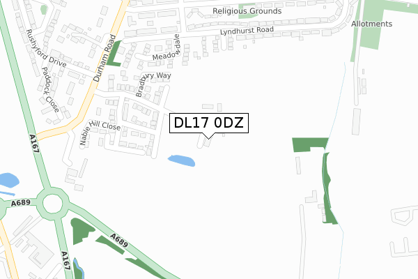
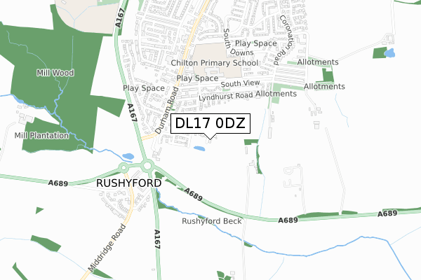
DL17 0DZ maps


Source: OS Open Zoomstack (Ordnance Survey)
Licence: Open Government Licence (requires attribution)
Attribution: Contains OS data © Crown copyright and database right 2025
Source: Open Postcode Geo
Licence: Open Government Licence (requires attribution)
Attribution: Contains OS data © Crown copyright and database right 2025; Contains Royal Mail data © Royal Mail copyright and database right 2025; Source: Office for National Statistics licensed under the Open Government Licence v.3.0
Licence: Open Government Licence (requires attribution)
Attribution: Contains OS data © Crown copyright and database right 2025
Source: Open Postcode Geo
Licence: Open Government Licence (requires attribution)
Attribution: Contains OS data © Crown copyright and database right 2025; Contains Royal Mail data © Royal Mail copyright and database right 2025; Source: Office for National Statistics licensed under the Open Government Licence v.3.0
DL17 0DZ geodata
| Easting | 428691 |
| Northing | 529036 |
| Latitude | 54.655618 |
| Longitude | -1.556823 |
Where is DL17 0DZ?
| Country | England |
| Postcode District | DL17 |
Politics
| Ward | Chilton |
|---|---|
| Constituency | Sedgefield |
House Prices
Sales of detached houses in DL17 0DZ
2025 23 JUL £308,000 |
2025 30 MAY £275,000 |
2024 21 NOV £320,000 |
2023 20 OCT £280,000 |
10, LOW AVENUE, CHILTON, FERRYHILL, DL17 0DZ 2023 21 APR £249,995 |
8, LOW AVENUE, CHILTON, FERRYHILL, DL17 0DZ 2023 27 JAN £264,995 |
7, LOW AVENUE, CHILTON, FERRYHILL, DL17 0DZ 2022 28 OCT £242,995 |
13, LOW AVENUE, CHILTON, FERRYHILL, DL17 0DZ 2022 2 SEP £199,995 |
12, LOW AVENUE, CHILTON, FERRYHILL, DL17 0DZ 2022 7 JUL £289,995 |
2022 30 JUN £299,995 |
Source: HM Land Registry Price Paid Data
Licence: Contains HM Land Registry data © Crown copyright and database right 2025. This data is licensed under the Open Government Licence v3.0.
Licence: Contains HM Land Registry data © Crown copyright and database right 2025. This data is licensed under the Open Government Licence v3.0.
Transport
Nearest bus stops to DL17 0DZ
| Rushyford Drive (Street Not Known) | Chilton | 301m |
| Rushyford Drive (Street Not Known) | Chilton | 323m |
| New South View | Windlestone | 351m |
| Rc Church (South View) | Windlestone | 353m |
| Rc Church (South View) | Windlestone | 354m |
Nearest railway stations to DL17 0DZ
| Newton Aycliffe Station | 5.1km |
Deprivation
54.1% of English postcodes are less deprived than DL17 0DZ:Food Standards Agency
Three nearest food hygiene ratings to DL17 0DZ (metres)
Chilton Catholic Club

Brooklyn Road
401m
Chilton Academy

New South View
436m
Chilton Community Sports & Social Club

Darlington Road
484m
➜ Get more ratings from the Food Standards Agency
Nearest post box to DL17 0DZ
| Last Collection | |||
|---|---|---|---|
| Location | Mon-Fri | Sat | Distance |
| Broomside | 16:45 | 10:45 | 3,205m |
| Linden Road | 16:45 | 10:45 | 3,250m |
| Dean Bank West | 17:30 | 11:00 | 3,331m |
DL17 0DZ ITL and DL17 0DZ LAU
The below table lists the International Territorial Level (ITL) codes (formerly Nomenclature of Territorial Units for Statistics (NUTS) codes) and Local Administrative Units (LAU) codes for DL17 0DZ:
| ITL 1 Code | Name |
|---|---|
| TLC | North East (England) |
| ITL 2 Code | Name |
| TLC1 | Tees Valley and Durham |
| ITL 3 Code | Name |
| TLC14 | Durham |
| LAU 1 Code | Name |
| E06000047 | County Durham |
DL17 0DZ census areas
The below table lists the Census Output Area (OA), Lower Layer Super Output Area (LSOA), and Middle Layer Super Output Area (MSOA) for DL17 0DZ:
| Code | Name | |
|---|---|---|
| OA | E00105582 | |
| LSOA | E01020803 | County Durham 053B |
| MSOA | E02004338 | County Durham 053 |
Nearest postcodes to DL17 0DZ
| DL17 0RW | Meadow Dale | 241m |
| DL17 0PJ | Woodham View | 292m |
| DL17 0PR | Shelley Terrace | 335m |
| DL17 0HA | 355m | |
| DL17 0EZ | Hillside Bungalows | 361m |
| DL17 0PS | New South View | 361m |
| DL17 0PN | Lyndhurst Road | 368m |
| DL17 0EE | Paddock Close | 389m |
| DL17 0PW | Brooklyn Road | 402m |
| DL17 0PH | John Herriotts Court | 409m |