Property/Postcode Data Search:
DL16 7GQ maps, stats, and open data
DL16 7GQ is located in the Spennymoor electoral ward, within the unitary authority of County Durham and the English Parliamentary constituency of Bishop Auckland. The Sub Integrated Care Board (ICB) Location is NHS North East and North Cumbria ICB - 84H and the police force is Durham. This postcode has been in use since February 2020.
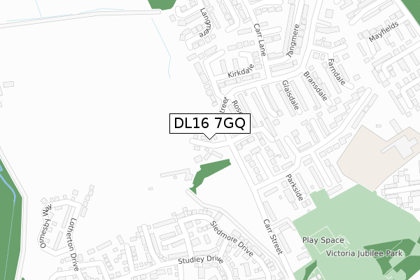
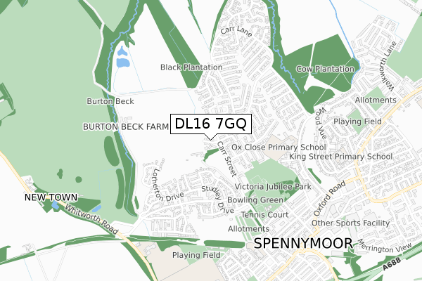
DL16 7GQ maps


Source: OS Open Zoomstack (Ordnance Survey)
Licence: Open Government Licence (requires attribution)
Attribution: Contains OS data © Crown copyright and database right 2025
Source: Open Postcode Geo
Licence: Open Government Licence (requires attribution)
Attribution: Contains OS data © Crown copyright and database right 2025; Contains Royal Mail data © Royal Mail copyright and database right 2025; Source: Office for National Statistics licensed under the Open Government Licence v.3.0
Licence: Open Government Licence (requires attribution)
Attribution: Contains OS data © Crown copyright and database right 2025
Source: Open Postcode Geo
Licence: Open Government Licence (requires attribution)
Attribution: Contains OS data © Crown copyright and database right 2025; Contains Royal Mail data © Royal Mail copyright and database right 2025; Source: Office for National Statistics licensed under the Open Government Licence v.3.0
DL16 7GQ geodata
| Easting | 424959 |
| Northing | 534312 |
| Latitude | 54.703228 |
| Longitude | -1.614218 |
Where is DL16 7GQ?
| Country | England |
| Postcode District | DL16 |
Politics
| Ward | Spennymoor |
|---|---|
| Constituency | Bishop Auckland |
House Prices
Sales of detached houses in DL16 7GQ
2025 23 JUN £281,000 |
2025 24 JAN £215,000 |
40, GIBSIDE WAY, SPENNYMOOR, DL16 7GQ 2023 15 DEC £279,995 |
2023 14 SEP £284,995 |
5, GIBSIDE WAY, SPENNYMOOR, DL16 7GQ 2023 31 AUG £259,995 |
38, GIBSIDE WAY, SPENNYMOOR, DL16 7GQ 2022 23 SEP £289,995 |
36, GIBSIDE WAY, SPENNYMOOR, DL16 7GQ 2022 26 AUG £224,995 |
12, GIBSIDE WAY, SPENNYMOOR, DL16 7GQ 2020 27 NOV £254,995 |
7, GIBSIDE WAY, SPENNYMOOR, DL16 7GQ 2020 30 OCT £176,995 |
2020 28 AUG £181,995 |
Source: HM Land Registry Price Paid Data
Licence: Contains HM Land Registry data © Crown copyright and database right 2025. This data is licensed under the Open Government Licence v3.0.
Licence: Contains HM Land Registry data © Crown copyright and database right 2025. This data is licensed under the Open Government Licence v3.0.
Transport
Nearest bus stops to DL16 7GQ
| Westfields (Carr Street) | Spennymoor | 243m |
| Glaisdale (Carr Lane) | Spennymoor | 269m |
| Westfields (Carr Street) | Spennymoor | 322m |
| Greenways Estate (Carr Lane) | Spennymoor | 331m |
| Greenways Estate (Carr Lane) | Spennymoor | 338m |
Deprivation
73.9% of English postcodes are less deprived than DL16 7GQ:Food Standards Agency
Three nearest food hygiene ratings to DL16 7GQ (metres)
The Ash Tree

Carr Lane
509m
The Meadows School 7000

Whitworth Road
678m
Express Coffee Shop & Candy Creations

14 Dundas Street
679m
➜ Get more ratings from the Food Standards Agency
Nearest post box to DL16 7GQ
| Last Collection | |||
|---|---|---|---|
| Location | Mon-Fri | Sat | Distance |
| Parkside | 17:30 | 10:30 | 227m |
| Mayfields | 17:30 | 10:30 | 539m |
| Wood View | 17:30 | 10:30 | 749m |
DL16 7GQ ITL and DL16 7GQ LAU
The below table lists the International Territorial Level (ITL) codes (formerly Nomenclature of Territorial Units for Statistics (NUTS) codes) and Local Administrative Units (LAU) codes for DL16 7GQ:
| ITL 1 Code | Name |
|---|---|
| TLC | North East (England) |
| ITL 2 Code | Name |
| TLC1 | Tees Valley and Durham |
| ITL 3 Code | Name |
| TLC14 | Durham |
| LAU 1 Code | Name |
| E06000047 | County Durham |
DL16 7GQ census areas
The below table lists the Census Output Area (OA), Lower Layer Super Output Area (LSOA), and Middle Layer Super Output Area (MSOA) for DL16 7GQ:
| Code | Name | |
|---|---|---|
| OA | E00171956 | |
| LSOA | E01020836 | County Durham 052E |
| MSOA | E02004337 | County Durham 052 |
Nearest postcodes to DL16 7GQ
| DL16 6UH | Kirkdale | 209m |
| DL16 7GH | Burton Constable Close | 215m |
| DL16 6SB | Rosedale | 216m |
| DL16 7GJ | Castle Howard Court | 222m |
| DL16 7GN | Newby Way | 249m |
| DL16 6UJ | Kirkdale | 262m |
| DL16 7FJ | Ripley Close | 266m |
| DL16 6SD | Westerdale | 277m |
| DL16 7GP | Sledmore Drive | 296m |
| DL16 7FF | Lotherton Drive | 302m |