DL16 7FU maps, stats, and open data
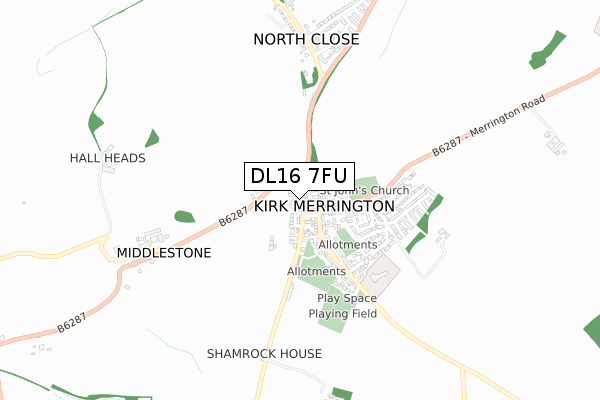
DL16 7FU is located in the Ferryhill electoral ward, within the unitary authority of County Durham and the English Parliamentary constituency of Bishop Auckland. The Sub Integrated Care Board (ICB) Location is NHS North East and North Cumbria ICB - 84H and the police force is Durham. This postcode has been in use since February 2018.
DL16 7FU maps


Licence: Open Government Licence (requires attribution)
Attribution: Contains OS data © Crown copyright and database right 2025
Source: Open Postcode Geo
Licence: Open Government Licence (requires attribution)
Attribution: Contains OS data © Crown copyright and database right 2025; Contains Royal Mail data © Royal Mail copyright and database right 2025; Source: Office for National Statistics licensed under the Open Government Licence v.3.0
DL16 7FU geodata
| Easting | 425971 |
| Northing | 531405 |
| Latitude | 54.677053 |
| Longitude | -1.598772 |
Where is DL16 7FU?
| Country | England |
| Postcode District | DL16 |
Politics
| Ward | Ferryhill |
|---|---|
| Constituency | Bishop Auckland |
House Prices
Sales of detached houses in DL16 7FU
4, CAMERON COURT, KIRK MERRINGTON, SPENNYMOOR, DL16 7FU 2022 30 MAY £200,000 |
3, CAMERON COURT, KIRK MERRINGTON, SPENNYMOOR, DL16 7FU 2018 29 NOV £225,000 |
➜ Kirk Merrington house prices
Licence: Contains HM Land Registry data © Crown copyright and database right 2025. This data is licensed under the Open Government Licence v3.0.
Transport
Nearest bus stops to DL16 7FU
| Green (Merrington Road) | Kirk Merrington | 79m |
| Green (Unclassified Road Opposite Half Moon Inn) | Kirk Merrington | 80m |
| Green (Merrington Road) | Kirk Merrington | 123m |
| Schools (Unclassified Road To Chilton) | Kirk Merrington | 318m |
| Schools (Unclassified Road To Chilton) | Kirk Merrington | 349m |
Broadband
Broadband access in DL16 7FU (2020 data)
| Percentage of properties with Next Generation Access | 100.0% |
| Percentage of properties with Superfast Broadband | 100.0% |
| Percentage of properties with Ultrafast Broadband | 0.0% |
| Percentage of properties with Full Fibre Broadband | 0.0% |
Superfast Broadband is between 30Mbps and 300Mbps
Ultrafast Broadband is > 300Mbps
Broadband limitations in DL16 7FU (2020 data)
| Percentage of properties unable to receive 2Mbps | 0.0% |
| Percentage of properties unable to receive 5Mbps | 0.0% |
| Percentage of properties unable to receive 10Mbps | 0.0% |
| Percentage of properties unable to receive 30Mbps | 0.0% |
Deprivation
39.9% of English postcodes are less deprived than DL16 7FU:Food Standards Agency
Three nearest food hygiene ratings to DL16 7FU (metres)


➜ Get more ratings from the Food Standards Agency
Nearest post box to DL16 7FU
| Last Collection | |||
|---|---|---|---|
| Location | Mon-Fri | Sat | Distance |
| Kirk Merrington | 17:15 | 09:00 | 76m |
| North Close | 17:15 | 09:15 | 790m |
| Central Drive | 17:00 | 11:15 | 1,758m |
DL16 7FU ITL and DL16 7FU LAU
The below table lists the International Territorial Level (ITL) codes (formerly Nomenclature of Territorial Units for Statistics (NUTS) codes) and Local Administrative Units (LAU) codes for DL16 7FU:
| ITL 1 Code | Name |
|---|---|
| TLC | North East (England) |
| ITL 2 Code | Name |
| TLC1 | Tees Valley and Durham |
| ITL 3 Code | Name |
| TLC14 | Durham |
| LAU 1 Code | Name |
| E06000047 | County Durham |
DL16 7FU census areas
The below table lists the Census Output Area (OA), Lower Layer Super Output Area (LSOA), and Middle Layer Super Output Area (MSOA) for DL16 7FU:
| Code | Name | |
|---|---|---|
| OA | E00105670 | |
| LSOA | E01020822 | County Durham 052B |
| MSOA | E02004337 | County Durham 052 |
Nearest postcodes to DL16 7FU
| DL16 7JL | Crowther Place | 50m |
| DL16 7HL | West View | 63m |
| DL16 7LA | Merrington Heights | 72m |
| DL16 7HN | Coulton Terrace | 74m |
| DL16 7JX | The Croft | 82m |
| DL16 7JJ | Hopkinson Place | 92m |
| DL16 7JH | Mission Place | 114m |
| DL16 7JU | St Johns Court | 125m |
| DL16 7HZ | Front Street | 147m |
| DL16 7JW | Leasingthorne Road | 156m |