Property/Postcode Data Search:
DL14 9FG maps, stats, and open data
DL14 9FG is located in the West Auckland electoral ward, within the unitary authority of County Durham and the English Parliamentary constituency of Bishop Auckland. The Sub Integrated Care Board (ICB) Location is NHS North East and North Cumbria ICB - 84H and the police force is Durham. This postcode has been in use since November 2019.
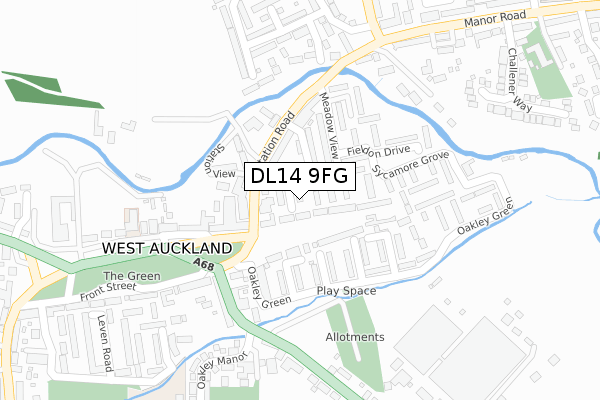
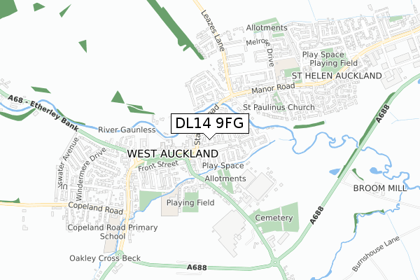
DL14 9FG maps


Source: OS Open Zoomstack (Ordnance Survey)
Licence: Open Government Licence (requires attribution)
Attribution: Contains OS data © Crown copyright and database right 2025
Source: Open Postcode Geo
Licence: Open Government Licence (requires attribution)
Attribution: Contains OS data © Crown copyright and database right 2025; Contains Royal Mail data © Royal Mail copyright and database right 2025; Source: Office for National Statistics licensed under the Open Government Licence v.3.0
Licence: Open Government Licence (requires attribution)
Attribution: Contains OS data © Crown copyright and database right 2025
Source: Open Postcode Geo
Licence: Open Government Licence (requires attribution)
Attribution: Contains OS data © Crown copyright and database right 2025; Contains Royal Mail data © Royal Mail copyright and database right 2025; Source: Office for National Statistics licensed under the Open Government Licence v.3.0
DL14 9FG geodata
| Easting | 418320 |
| Northing | 526417 |
| Latitude | 54.632562 |
| Longitude | -1.717731 |
Where is DL14 9FG?
| Country | England |
| Postcode District | DL14 |
Politics
| Ward | West Auckland |
|---|---|
| Constituency | Bishop Auckland |
Transport
Nearest bus stops to DL14 9FG
| Station Rd (A688 Station Road) | West Auckland | 119m |
| Meadow View | West Auckland | 121m |
| Club (A688 Front Street) | West Auckland | 141m |
| Post Office (Front Street) | West Auckland | 146m |
| Post Office (Front Street) | West Auckland | 150m |
Nearest railway stations to DL14 9FG
| Bishop Auckland Station | 3.8km |
Deprivation
86.9% of English postcodes are less deprived than DL14 9FG:Food Standards Agency
Three nearest food hygiene ratings to DL14 9FG (metres)
The Well

46 East Green
79m
Spar

The Old Church Hall
110m
Best One

46 Station Road
110m
➜ Get more ratings from the Food Standards Agency
Nearest post box to DL14 9FG
| Last Collection | |||
|---|---|---|---|
| Location | Mon-Fri | Sat | Distance |
| West Auckland Post Office | 17:15 | 11:15 | 144m |
| Monteith Close | 16:30 | 08:00 | 399m |
| Wheatsheaf | 17:15 | 11:15 | 432m |
DL14 9FG ITL and DL14 9FG LAU
The below table lists the International Territorial Level (ITL) codes (formerly Nomenclature of Territorial Units for Statistics (NUTS) codes) and Local Administrative Units (LAU) codes for DL14 9FG:
| ITL 1 Code | Name |
|---|---|
| TLC | North East (England) |
| ITL 2 Code | Name |
| TLC1 | Tees Valley and Durham |
| ITL 3 Code | Name |
| TLC14 | Durham |
| LAU 1 Code | Name |
| E06000047 | County Durham |
DL14 9FG census areas
The below table lists the Census Output Area (OA), Lower Layer Super Output Area (LSOA), and Middle Layer Super Output Area (MSOA) for DL14 9FG:
| Code | Name | |
|---|---|---|
| OA | E00106071 | |
| LSOA | E01020895 | County Durham 057C |
| MSOA | E02004354 | County Durham 057 |
Nearest postcodes to DL14 9FG
| DL14 9HN | Millbank Close | 56m |
| DL14 9HH | East Green | 80m |
| DL14 9HD | Arnold Street | 85m |
| DL14 9HJ | East Green | 86m |
| DL14 9HF | Station Road | 96m |
| DL14 9HE | Station Road | 110m |
| DL14 9JD | Oakley Green | 129m |
| DL14 9HG | Station View | 131m |
| DL14 9HQ | The Nursery | 140m |
| DL14 9HB | Meadow View | 140m |