DL12 8GY maps, stats, and open data
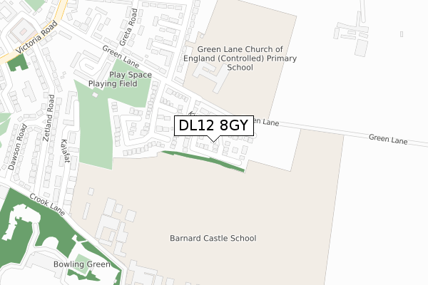
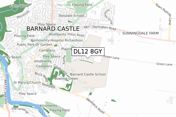
DL12 8GY is located in the Barnard Castle East electoral ward, within the unitary authority of County Durham and the English Parliamentary constituency of Bishop Auckland. The Sub Integrated Care Board (ICB) Location is NHS North East and North Cumbria ICB - 84H and the police force is Durham. This postcode has been in use since December 2018.
DL12 8GY maps


Licence: Open Government Licence (requires attribution)
Attribution: Contains OS data © Crown copyright and database right 2025
Source: Open Postcode Geo
Licence: Open Government Licence (requires attribution)
Attribution: Contains OS data © Crown copyright and database right 2025; Contains Royal Mail data © Royal Mail copyright and database right 2025; Source: Office for National Statistics licensed under the Open Government Licence v.3.0
DL12 8GY geodata
| Easting | 405957 |
| Northing | 516598 |
| Latitude | 54.544616 |
| Longitude | -1.909440 |
Where is DL12 8GY?
| Country | England |
| Postcode District | DL12 |
Politics
| Ward | Barnard Castle East |
|---|---|
| Constituency | Bishop Auckland |
House Prices
Sales of detached houses in DL12 8GY
2022 9 DEC £335,000 |
2022 29 APR £410,000 |
2022 8 FEB £440,000 |
2019 20 DEC £349,995 |
7, VAN DYCK CLOSE, BARNARD CASTLE, DL12 8GY 2019 29 NOV £309,995 |
2019 8 NOV £290,000 |
6, VAN DYCK CLOSE, BARNARD CASTLE, DL12 8GY 2019 31 OCT £299,995 |
25, VAN DYCK CLOSE, BARNARD CASTLE, DL12 8GY 2019 25 OCT £319,995 |
19, VAN DYCK CLOSE, BARNARD CASTLE, DL12 8GY 2019 18 OCT £284,995 |
24, VAN DYCK CLOSE, BARNARD CASTLE, DL12 8GY 2019 27 SEP £274,995 |
Licence: Contains HM Land Registry data © Crown copyright and database right 2025. This data is licensed under the Open Government Licence v3.0.
Transport
Nearest bus stops to DL12 8GY
| Green Lane - Dale Road (Green Lane) | Barnard Castle | 262m |
| Green Lane Hail And Ride (Green Lane) | Barnard Castle | 321m |
| Zetland Road Hail And Ride (Zetland Road) | Barnard Castle | 388m |
| Hilton Road Hail And Ride (Hilton Road) | Barnard Castle | 388m |
| Zetland Road Hail And Ride (Zetland Road) | Barnard Castle | 394m |
Broadband
Broadband access in DL12 8GY (2020 data)
| Percentage of properties with Next Generation Access | 100.0% |
| Percentage of properties with Superfast Broadband | 100.0% |
| Percentage of properties with Ultrafast Broadband | 0.0% |
| Percentage of properties with Full Fibre Broadband | 0.0% |
Superfast Broadband is between 30Mbps and 300Mbps
Ultrafast Broadband is > 300Mbps
Broadband speed in DL12 8GY (2019 data)
Download
| Median download speed | 22.0Mbps |
| Average download speed | 32.3Mbps |
| Maximum download speed | 62.33Mbps |
Upload
| Median upload speed | 1.3Mbps |
| Average upload speed | 4.4Mbps |
| Maximum upload speed | 11.16Mbps |
Broadband limitations in DL12 8GY (2020 data)
| Percentage of properties unable to receive 2Mbps | 0.0% |
| Percentage of properties unable to receive 5Mbps | 0.0% |
| Percentage of properties unable to receive 10Mbps | 0.0% |
| Percentage of properties unable to receive 30Mbps | 0.0% |
Deprivation
67.5% of English postcodes are less deprived than DL12 8GY:Food Standards Agency
Three nearest food hygiene ratings to DL12 8GY (metres)


➜ Get more ratings from the Food Standards Agency
Nearest post box to DL12 8GY
| Last Collection | |||
|---|---|---|---|
| Location | Mon-Fri | Sat | Distance |
| Darlington Road | 17:15 | 11:00 | 477m |
| Victoria Road | 17:30 | 11:00 | 500m |
| Dawson Road | 17:30 | 11:00 | 503m |
DL12 8GY ITL and DL12 8GY LAU
The below table lists the International Territorial Level (ITL) codes (formerly Nomenclature of Territorial Units for Statistics (NUTS) codes) and Local Administrative Units (LAU) codes for DL12 8GY:
| ITL 1 Code | Name |
|---|---|
| TLC | North East (England) |
| ITL 2 Code | Name |
| TLC1 | Tees Valley and Durham |
| ITL 3 Code | Name |
| TLC14 | Durham |
| LAU 1 Code | Name |
| E06000047 | County Durham |
DL12 8GY census areas
The below table lists the Census Output Area (OA), Lower Layer Super Output Area (LSOA), and Middle Layer Super Output Area (MSOA) for DL12 8GY:
| Code | Name | |
|---|---|---|
| OA | E00105830 | |
| LSOA | E01020852 | County Durham 066A |
| MSOA | E02004347 | County Durham 066 |
Nearest postcodes to DL12 8GY
| DL12 8LR | Bartlemere | 169m |
| DL12 8LF | Green Lane | 239m |
| DL12 8LQ | Dale Road | 265m |
| DL12 8LP | Kalafat | 337m |
| DL12 8LW | Sherwood Close | 338m |
| DL12 8LJ | Greta Road | 350m |
| DL12 8LB | Zetland Road | 376m |
| DL12 8LE | Green Lane | 380m |
| DL12 8JY | Crook Lane | 403m |
| DL12 8LH | Hilton Road | 406m |