Property/Postcode Data Search:
DL1 4EB maps, stats, and open data
DL1 4EB is located in the Red Hall & Lingfield electoral ward, within the unitary authority of Darlington and the English Parliamentary constituency of Darlington. The Sub Integrated Care Board (ICB) Location is NHS North East and North Cumbria ICB - 16C and the police force is Durham. This postcode has been in use since November 2019.
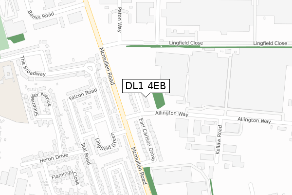
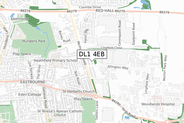
DL1 4EB maps


Source: OS Open Zoomstack (Ordnance Survey)
Licence: Open Government Licence (requires attribution)
Attribution: Contains OS data © Crown copyright and database right 2025
Source: Open Postcode Geo
Licence: Open Government Licence (requires attribution)
Attribution: Contains OS data © Crown copyright and database right 2025; Contains Royal Mail data © Royal Mail copyright and database right 2025; Source: Office for National Statistics licensed under the Open Government Licence v.3.0
Licence: Open Government Licence (requires attribution)
Attribution: Contains OS data © Crown copyright and database right 2025
Source: Open Postcode Geo
Licence: Open Government Licence (requires attribution)
Attribution: Contains OS data © Crown copyright and database right 2025; Contains Royal Mail data © Royal Mail copyright and database right 2025; Source: Office for National Statistics licensed under the Open Government Licence v.3.0
DL1 4EB geodata
| Easting | 431247 |
| Northing | 514659 |
| Latitude | 54.526270 |
| Longitude | -1.518731 |
Where is DL1 4EB?
| Country | England |
| Postcode District | DL1 |
Politics
| Ward | Red Hall & Lingfield |
|---|---|
| Constituency | Darlington |
Transport
Nearest bus stops to DL1 4EB
| Lingfield Point (Mcmullen Road) | Lingfield | 98m |
| Allington Way (Mcmullen Road) | Lingfield | 109m |
| The Beehive (Lingfield Close) | Lingfield | 121m |
| The Beehive (Lingfield Close) | Lingfield | 129m |
| Lingfield Point (Mcmullen Road) | Lingfield | 221m |
Nearest railway stations to DL1 4EB
| Darlington Station | 2km |
| North Road Station | 2.5km |
| Dinsdale Station | 3.6km |
Deprivation
48.5% of English postcodes are less deprived than DL1 4EB:Food Standards Agency
Three nearest food hygiene ratings to DL1 4EB (metres)
The Street Coffee Co

Unit 10
225m
Baxterstorey

Memphis Building
251m
Loom Cafe

Unit 10
315m
➜ Get more ratings from the Food Standards Agency
Nearest post box to DL1 4EB
| Last Collection | |||
|---|---|---|---|
| Location | Mon-Fri | Sat | Distance |
| Mcmullen Road | 17:00 | 11:15 | 122m |
| Royal Mail House | 375m | ||
| Lingfield Lane | 17:30 | 11:15 | 557m |
DL1 4EB ITL and DL1 4EB LAU
The below table lists the International Territorial Level (ITL) codes (formerly Nomenclature of Territorial Units for Statistics (NUTS) codes) and Local Administrative Units (LAU) codes for DL1 4EB:
| ITL 1 Code | Name |
|---|---|
| TLC | North East (England) |
| ITL 2 Code | Name |
| TLC1 | Tees Valley and Durham |
| ITL 3 Code | Name |
| TLC13 | Darlington |
| LAU 1 Code | Name |
| E06000005 | Darlington |
DL1 4EB census areas
The below table lists the Census Output Area (OA), Lower Layer Super Output Area (LSOA), and Middle Layer Super Output Area (MSOA) for DL1 4EB:
| Code | Name | |
|---|---|---|
| OA | E00062249 | |
| LSOA | E01012343 | Darlington 009D |
| MSOA | E02002567 | Darlington 009 |
Nearest postcodes to DL1 4EB
| DL1 1DA | Mcmullen Road | 122m |
| DL1 1DB | The Broadway South | 138m |
| DL1 1DE | Falcon Road | 218m |
| DL1 1DD | Lingfield Green | 265m |
| DL1 1EL | The Broadway | 277m |
| DL1 1DF | Teal Road | 280m |
| DL1 1LY | Spindle Grove | 287m |
| DL1 1BL | Kestrel Close | 308m |
| DL1 1NA | Carding Drive | 312m |
| DL1 1LP | Paton Way | 314m |