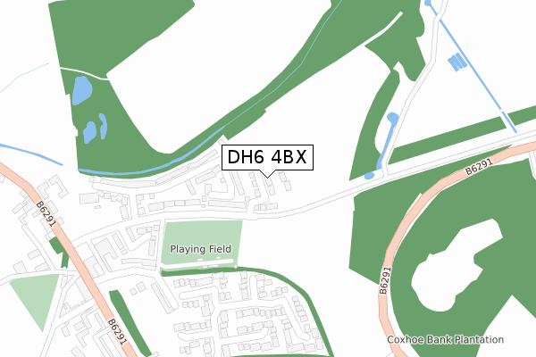
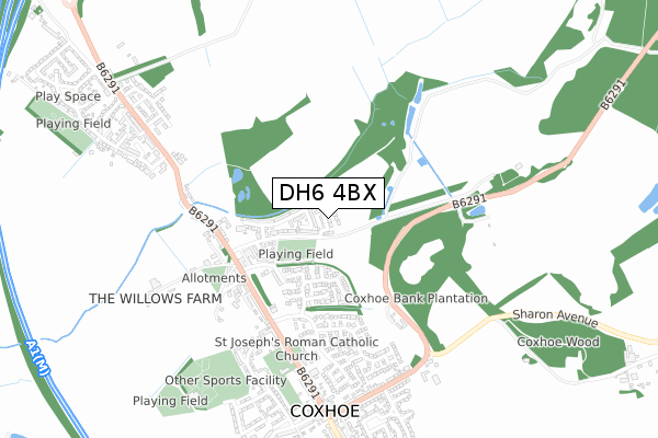
DH6 4BX is located in the Coxhoe electoral ward, within the unitary authority of County Durham and the English Parliamentary constituency of City of Durham. The Sub Integrated Care Board (ICB) Location is NHS North East and North Cumbria ICB - 84H and the police force is Durham. This postcode has been in use since December 2019.


GetTheData
Source: OS Open Zoomstack (Ordnance Survey)
Licence: Open Government Licence (requires attribution)
Attribution: Contains OS data © Crown copyright and database right 2025
Source: Open Postcode Geo
Licence: Open Government Licence (requires attribution)
Attribution: Contains OS data © Crown copyright and database right 2025; Contains Royal Mail data © Royal Mail copyright and database right 2025; Source: Office for National Statistics licensed under the Open Government Licence v.3.0
| Easting | 432196 |
| Northing | 536384 |
| Latitude | 54.721438 |
| Longitude | -1.501692 |
GetTheData
Source: Open Postcode Geo
Licence: Open Government Licence
| Country | England |
| Postcode District | DH6 |
➜ See where DH6 is on a map ➜ Where is Coxhoe? | |
GetTheData
Source: Land Registry Price Paid Data
Licence: Open Government Licence
| Ward | Coxhoe |
| Constituency | City Of Durham |
GetTheData
Source: ONS Postcode Database
Licence: Open Government Licence
30, LIME CLOSE, COXHOE, DURHAM, DH6 4BX 2022 14 JAN £199,995 |
12, LIME CLOSE, COXHOE, DURHAM, DH6 4BX 2021 26 MAR £189,995 |
2020 11 DEC £184,995 |
36, LIME CLOSE, COXHOE, DURHAM, DH6 4BX 2020 20 NOV £184,995 |
29, LIME CLOSE, COXHOE, DURHAM, DH6 4BX 2020 30 OCT £184,995 |
14, LIME CLOSE, COXHOE, DURHAM, DH6 4BX 2020 20 AUG £184,995 |
GetTheData
Source: HM Land Registry Price Paid Data
Licence: Contains HM Land Registry data © Crown copyright and database right 2025. This data is licensed under the Open Government Licence v3.0.
| Opp Tarka Centre (B6291) | Coxhoe | 411m |
| Adj Tarka Centre (B6291) | Coxhoe | 427m |
| Kicking Cuddy (B6291) | Coxhoe | 437m |
| Steetley Quarries (B6291) | Coxhoe | 456m |
| Kicking Cuddy (B6291) | Coxhoe | 467m |
GetTheData
Source: NaPTAN
Licence: Open Government Licence
GetTheData
Source: ONS Postcode Database
Licence: Open Government Licence


➜ Get more ratings from the Food Standards Agency
GetTheData
Source: Food Standards Agency
Licence: FSA terms & conditions
| Last Collection | |||
|---|---|---|---|
| Location | Mon-Fri | Sat | Distance |
| Coxhoe Post Office | 17:00 | 11:45 | 537m |
| Bogma Avenue, Coxhoe | 16:45 | 09:00 | 1,278m |
| Old Quarrington, | 17:00 | 08:00 | 1,351m |
GetTheData
Source: Dracos
Licence: Creative Commons Attribution-ShareAlike
The below table lists the International Territorial Level (ITL) codes (formerly Nomenclature of Territorial Units for Statistics (NUTS) codes) and Local Administrative Units (LAU) codes for DH6 4BX:
| ITL 1 Code | Name |
|---|---|
| TLC | North East (England) |
| ITL 2 Code | Name |
| TLC1 | Tees Valley and Durham |
| ITL 3 Code | Name |
| TLC14 | Durham |
| LAU 1 Code | Name |
| E06000047 | County Durham |
GetTheData
Source: ONS Postcode Directory
Licence: Open Government Licence
The below table lists the Census Output Area (OA), Lower Layer Super Output Area (LSOA), and Middle Layer Super Output Area (MSOA) for DH6 4BX:
| Code | Name | |
|---|---|---|
| OA | E00105036 | |
| LSOA | E01020699 | County Durham 044C |
| MSOA | E02004319 | County Durham 044 |
GetTheData
Source: ONS Postcode Directory
Licence: Open Government Licence
| DH6 4LN | Foundry Close | 135m |
| DH6 4SB | Beechfield Rise | 226m |
| DH6 4LA | Prospect Place | 253m |
| DH6 4SD | Beechfield Rise | 278m |
| DH6 4LB | Sandgate | 307m |
| DH6 4LF | Basic Cottages | 319m |
| DH6 4HB | Browning Hill | 421m |
| DH6 4HJ | Commercial Road West | 427m |
| DH6 4JY | Tyneside Cottages | 431m |
| DH6 4HG | Coronation Terrace | 444m |
GetTheData
Source: Open Postcode Geo; Land Registry Price Paid Data
Licence: Open Government Licence