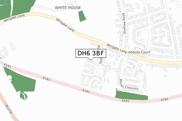
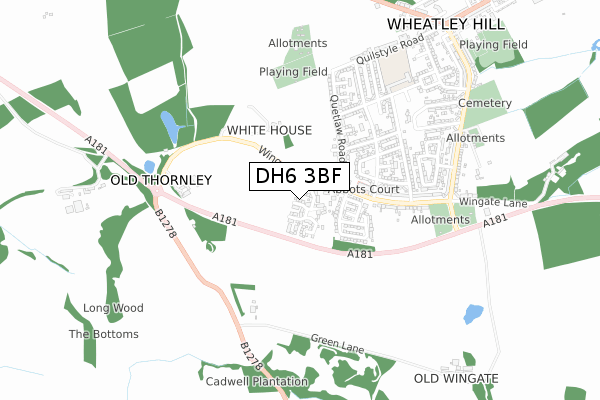
DH6 3BF is located in the Trimdon and Thornley electoral ward, within the unitary authority of County Durham and the English Parliamentary constituency of Sedgefield. The Sub Integrated Care Board (ICB) Location is NHS North East and North Cumbria ICB - 84H and the police force is Durham. This postcode has been in use since July 2018.


GetTheData
Source: OS Open Zoomstack (Ordnance Survey)
Licence: Open Government Licence (requires attribution)
Attribution: Contains OS data © Crown copyright and database right 2025
Source: Open Postcode Geo
Licence: Open Government Licence (requires attribution)
Attribution: Contains OS data © Crown copyright and database right 2025; Contains Royal Mail data © Royal Mail copyright and database right 2025; Source: Office for National Statistics licensed under the Open Government Licence v.3.0
| Easting | 437000 |
| Northing | 538353 |
| Latitude | 54.738802 |
| Longitude | -1.426866 |
GetTheData
Source: Open Postcode Geo
Licence: Open Government Licence
| Country | England |
| Postcode District | DH6 |
➜ See where DH6 is on a map ➜ Where is Wheatley Hill? | |
GetTheData
Source: Land Registry Price Paid Data
Licence: Open Government Licence
| Ward | Trimdon And Thornley |
| Constituency | Sedgefield |
GetTheData
Source: ONS Postcode Database
Licence: Open Government Licence
105, MARLEY FIELDS, WHEATLEY HILL, DURHAM, DH6 3BF 2021 18 OCT £221,000 |
2021 13 SEP £190,000 |
74, MARLEY FIELDS, WHEATLEY HILL, DURHAM, DH6 3BF 2019 4 OCT £232,500 |
82, MARLEY FIELDS, WHEATLEY HILL, DURHAM, DH6 3BF 2019 21 JUN £165,000 |
77, MARLEY FIELDS, WHEATLEY HILL, DURHAM, DH6 3BF 2019 31 MAY £243,500 |
78, MARLEY FIELDS, WHEATLEY HILL, DURHAM, DH6 3BF 2019 24 MAY £202,500 |
79, MARLEY FIELDS, WHEATLEY HILL, DURHAM, DH6 3BF 2019 24 MAY £199,500 |
80, MARLEY FIELDS, WHEATLEY HILL, DURHAM, DH6 3BF 2019 10 MAY £189,500 |
84, MARLEY FIELDS, WHEATLEY HILL, DURHAM, DH6 3BF 2019 9 MAY £179,950 |
85, MARLEY FIELDS, WHEATLEY HILL, DURHAM, DH6 3BF 2019 3 MAY £187,500 |
GetTheData
Source: HM Land Registry Price Paid Data
Licence: Contains HM Land Registry data © Crown copyright and database right 2025. This data is licensed under the Open Government Licence v3.0.
| New Tavern (Henderson Avenue) | Wheatley Hill | 319m |
| New Tavern (Henderson Avenue) | Wheatley Hill | 339m |
| Fire Station (Wingate Lane) | Wheatley Hill | 420m |
| Henderson Avenue | Wheatley Hill | 434m |
| Henderson Avenue | Wheatley Hill | 437m |
GetTheData
Source: NaPTAN
Licence: Open Government Licence
| Percentage of properties with Next Generation Access | 100.0% |
| Percentage of properties with Superfast Broadband | 100.0% |
| Percentage of properties with Ultrafast Broadband | 100.0% |
| Percentage of properties with Full Fibre Broadband | 100.0% |
Superfast Broadband is between 30Mbps and 300Mbps
Ultrafast Broadband is > 300Mbps
| Percentage of properties unable to receive 2Mbps | 0.0% |
| Percentage of properties unable to receive 5Mbps | 0.0% |
| Percentage of properties unable to receive 10Mbps | 0.0% |
| Percentage of properties unable to receive 30Mbps | 0.0% |
GetTheData
Source: Ofcom
Licence: Ofcom Terms of Use (requires attribution)
GetTheData
Source: ONS Postcode Database
Licence: Open Government Licence


➜ Get more ratings from the Food Standards Agency
GetTheData
Source: Food Standards Agency
Licence: FSA terms & conditions
| Last Collection | |||
|---|---|---|---|
| Location | Mon-Fri | Sat | Distance |
| Newlands Road | 16:30 | 09:30 | 860m |
| Thornlaw, Stanley Tce | 17:15 | 11:45 | 1,577m |
| Cassop P.o. | 16:30 | 11:30 | 2,571m |
GetTheData
Source: Dracos
Licence: Creative Commons Attribution-ShareAlike
The below table lists the International Territorial Level (ITL) codes (formerly Nomenclature of Territorial Units for Statistics (NUTS) codes) and Local Administrative Units (LAU) codes for DH6 3BF:
| ITL 1 Code | Name |
|---|---|
| TLC | North East (England) |
| ITL 2 Code | Name |
| TLC1 | Tees Valley and Durham |
| ITL 3 Code | Name |
| TLC14 | Durham |
| LAU 1 Code | Name |
| E06000047 | County Durham |
GetTheData
Source: ONS Postcode Directory
Licence: Open Government Licence
The below table lists the Census Output Area (OA), Lower Layer Super Output Area (LSOA), and Middle Layer Super Output Area (MSOA) for DH6 3BF:
| Code | Name | |
|---|---|---|
| OA | E00105499 | |
| LSOA | E01020789 | County Durham 040B |
| MSOA | E02004331 | County Durham 040 |
GetTheData
Source: ONS Postcode Directory
Licence: Open Government Licence
| DH6 3LZ | Wayside | 128m |
| DH6 3LW | Wingate Lane South | 212m |
| DH6 3LR | Andrew Terrace | 242m |
| DH6 3LT | Wharrier Square | 247m |
| DH6 3LS | Bevan Crescent | 257m |
| DH6 3RP | Stoker Crescent | 274m |
| DH6 3LP | Wingate Lane | 278m |
| DH6 3RS | Handel Terrace | 311m |
| DH6 3SB | Quetlaw Road | 323m |
| DH6 3RU | Jack Lawson Terrace | 360m |
GetTheData
Source: Open Postcode Geo; Land Registry Price Paid Data
Licence: Open Government Licence