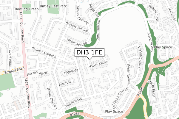
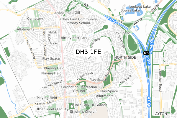
DH3 1FE is located in the Lamesley electoral ward, within the metropolitan district of Gateshead and the English Parliamentary constituency of Blaydon. The Sub Integrated Care Board (ICB) Location is NHS North East and North Cumbria ICB - 13T and the police force is Northumbria. This postcode has been in use since January 2018.


GetTheData
Source: OS Open Zoomstack (Ordnance Survey)
Licence: Open Government Licence (requires attribution)
Attribution: Contains OS data © Crown copyright and database right 2025
Source: Open Postcode Geo
Licence: Open Government Licence (requires attribution)
Attribution: Contains OS data © Crown copyright and database right 2025; Contains Royal Mail data © Royal Mail copyright and database right 2025; Source: Office for National Statistics licensed under the Open Government Licence v.3.0
| Easting | 427561 |
| Northing | 556343 |
| Latitude | 54.901066 |
| Longitude | -1.571756 |
GetTheData
Source: Open Postcode Geo
Licence: Open Government Licence
| Country | England |
| Postcode District | DH3 |
➜ See where DH3 is on a map ➜ Where is Birtley? | |
GetTheData
Source: Land Registry Price Paid Data
Licence: Open Government Licence
| Ward | Lamesley |
| Constituency | Blaydon |
GetTheData
Source: ONS Postcode Database
Licence: Open Government Licence
49, ASPEN CLOSE, BIRTLEY, CHESTER LE STREET, DH3 1FE 2025 13 APR £325,000 |
2024 18 APR £325,000 |
2, ASPEN CLOSE, BIRTLEY, CHESTER LE STREET, DH3 1FE 2021 26 MAR £292,960 |
57, ASPEN CLOSE, BIRTLEY, CHESTER LE STREET, DH3 1FE 2021 12 FEB £297,950 |
59, ASPEN CLOSE, BIRTLEY, CHESTER LE STREET, DH3 1FE 2021 22 JAN £299,650 |
14, ASPEN CLOSE, BIRTLEY, CHESTER LE STREET, DH3 1FE 2021 22 JAN £292,950 |
2020 18 DEC £249,950 |
54, ASPEN CLOSE, BIRTLEY, CHESTER LE STREET, DH3 1FE 2020 18 DEC £299,950 |
26, ASPEN CLOSE, BIRTLEY, CHESTER LE STREET, DH3 1FE 2020 18 DEC £294,950 |
44, ASPEN CLOSE, BIRTLEY, CHESTER LE STREET, DH3 1FE 2020 14 DEC £294,950 |
GetTheData
Source: HM Land Registry Price Paid Data
Licence: Contains HM Land Registry data © Crown copyright and database right 2025. This data is licensed under the Open Government Licence v3.0.
| Blackfell Way - Angel Way (Blackfell Way) | Birtley | 153m |
| Mount Road - Highridge (Mount Road) | Birtley | 223m |
| Blackfell Way | Birtley | 328m |
| Portmeads Road-uplands (Portmeads Road) | Birtley | 345m |
| Mount Pleasant Road (B1288) | Birtley | 345m |
GetTheData
Source: NaPTAN
Licence: Open Government Licence
| Percentage of properties with Next Generation Access | 20.0% |
| Percentage of properties with Superfast Broadband | 20.0% |
| Percentage of properties with Ultrafast Broadband | 0.0% |
| Percentage of properties with Full Fibre Broadband | 0.0% |
Superfast Broadband is between 30Mbps and 300Mbps
Ultrafast Broadband is > 300Mbps
| Percentage of properties unable to receive 2Mbps | 0.0% |
| Percentage of properties unable to receive 5Mbps | 0.0% |
| Percentage of properties unable to receive 10Mbps | 0.0% |
| Percentage of properties unable to receive 30Mbps | 0.0% |
GetTheData
Source: Ofcom
Licence: Ofcom Terms of Use (requires attribution)
GetTheData
Source: ONS Postcode Database
Licence: Open Government Licence


➜ Get more ratings from the Food Standards Agency
GetTheData
Source: Food Standards Agency
Licence: FSA terms & conditions
| Last Collection | |||
|---|---|---|---|
| Location | Mon-Fri | Sat | Distance |
| Selkirk Crescent | 17:15 | 11:45 | 386m |
| Town Centre, Birtley | 17:30 | 12:00 | 683m |
| Windsor Road | 17:15 | 11:45 | 810m |
GetTheData
Source: Dracos
Licence: Creative Commons Attribution-ShareAlike
The below table lists the International Territorial Level (ITL) codes (formerly Nomenclature of Territorial Units for Statistics (NUTS) codes) and Local Administrative Units (LAU) codes for DH3 1FE:
| ITL 1 Code | Name |
|---|---|
| TLC | North East (England) |
| ITL 2 Code | Name |
| TLC2 | Northumberland, and Tyne and Wear |
| ITL 3 Code | Name |
| TLC22 | Tyneside |
| LAU 1 Code | Name |
| E08000037 | Gateshead |
GetTheData
Source: ONS Postcode Directory
Licence: Open Government Licence
The below table lists the Census Output Area (OA), Lower Layer Super Output Area (LSOA), and Middle Layer Super Output Area (MSOA) for DH3 1FE:
| Code | Name | |
|---|---|---|
| OA | E00166218 | |
| LSOA | E01008224 | Gateshead 025C |
| MSOA | E02001706 | Gateshead 025 |
GetTheData
Source: ONS Postcode Directory
Licence: Open Government Licence
| DH3 1DA | Mount Court | 77m |
| DH3 1BD | Highridge | 113m |
| DH3 1BG | Highridge | 134m |
| DH3 1BJ | Mount Road | 134m |
| DH3 1BE | Highridge | 137m |
| DH3 1NB | Sanders Gardens | 161m |
| DH3 1NU | Wilson Avenue | 176m |
| DH3 1ND | Hillcroft | 187m |
| DH3 1BL | Mount Road | 205m |
| DH3 1BH | Fellcross | 215m |
GetTheData
Source: Open Postcode Geo; Land Registry Price Paid Data
Licence: Open Government Licence