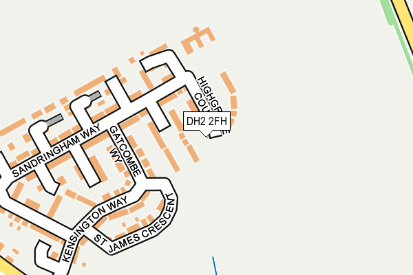
DH2 2FH is located in the Pelton electoral ward, within the unitary authority of County Durham and the English Parliamentary constituency of North Durham. The Sub Integrated Care Board (ICB) Location is NHS North East and North Cumbria ICB - 84H and the police force is Durham. This postcode has been in use since July 2017.


GetTheData
Source: OS OpenMap – Local (Ordnance Survey)
Source: OS VectorMap District (Ordnance Survey)
Licence: Open Government Licence (requires attribution)
| Easting | 424739 |
| Northing | 552498 |
| Latitude | 54.866661 |
| Longitude | -1.616090 |
GetTheData
Source: Open Postcode Geo
Licence: Open Government Licence
| Country | England |
| Postcode District | DH2 |
➜ See where DH2 is on a map ➜ Where is Newfield? | |
GetTheData
Source: Land Registry Price Paid Data
Licence: Open Government Licence
| Ward | Pelton |
| Constituency | North Durham |
GetTheData
Source: ONS Postcode Database
Licence: Open Government Licence
2024 26 APR £280,000 |
2022 2 SEP £195,000 |
7, HIGHGROVE COURT, NEWFIELD, CHESTER LE STREET, DH2 2FH 2019 29 MAR £259,950 |
27, HIGHGROVE COURT, NEWFIELD, CHESTER LE STREET, DH2 2FH 2018 31 OCT £209,950 |
3, HIGHGROVE COURT, NEWFIELD, CHESTER LE STREET, DH2 2FH 2018 16 JUL £244,950 |
1, HIGHGROVE COURT, NEWFIELD, CHESTER LE STREET, DH2 2FH 2018 29 JUN £229,950 |
29, HIGHGROVE COURT, NEWFIELD, CHESTER LE STREET, DH2 2FH 2018 25 MAY £224,950 |
5, HIGHGROVE COURT, NEWFIELD, CHESTER LE STREET, DH2 2FH 2018 2 MAY £274,950 |
9, HIGHGROVE COURT, NEWFIELD, CHESTER LE STREET, DH2 2FH 2018 30 APR £244,950 |
17, HIGHGROVE COURT, NEWFIELD, CHESTER LE STREET, DH2 2FH 2018 29 MAR £211,950 |
GetTheData
Source: HM Land Registry Price Paid Data
Licence: Contains HM Land Registry data © Crown copyright and database right 2025. This data is licensed under the Open Government Licence v3.0.
| North View (Front Street) | Newfield | 332m |
| Bernard Terrace (Station Lane) | Pelton Fell | 338m |
| North View (Front Street) | Newfield | 341m |
| Bernard Terrace (Station Lane) | Pelton Fell | 353m |
| Busty Bridge (Front Street) | Newfield | 401m |
| Chester-le-Street Station | 2.8km |
GetTheData
Source: NaPTAN
Licence: Open Government Licence
| Percentage of properties with Next Generation Access | 100.0% |
| Percentage of properties with Superfast Broadband | 100.0% |
| Percentage of properties with Ultrafast Broadband | 100.0% |
| Percentage of properties with Full Fibre Broadband | 100.0% |
Superfast Broadband is between 30Mbps and 300Mbps
Ultrafast Broadband is > 300Mbps
| Median download speed | 8.4Mbps |
| Average download speed | 9.7Mbps |
| Maximum download speed | 39.97Mbps |
| Median upload speed | 0.8Mbps |
| Average upload speed | 1.3Mbps |
| Maximum upload speed | 9.99Mbps |
| Percentage of properties unable to receive 2Mbps | 0.0% |
| Percentage of properties unable to receive 5Mbps | 0.0% |
| Percentage of properties unable to receive 10Mbps | 0.0% |
| Percentage of properties unable to receive 30Mbps | 0.0% |
GetTheData
Source: Ofcom
Licence: Ofcom Terms of Use (requires attribution)
GetTheData
Source: ONS Postcode Database
Licence: Open Government Licence


➜ Get more ratings from the Food Standards Agency
GetTheData
Source: Food Standards Agency
Licence: FSA terms & conditions
| Last Collection | |||
|---|---|---|---|
| Location | Mon-Fri | Sat | Distance |
| Newfield Post Office | 17:00 | 11:30 | 380m |
| Sandyford, Pelton | 17:00 | 09:00 | 591m |
| Front Street, Pelton | 17:15 | 08:30 | 728m |
GetTheData
Source: Dracos
Licence: Creative Commons Attribution-ShareAlike
The below table lists the International Territorial Level (ITL) codes (formerly Nomenclature of Territorial Units for Statistics (NUTS) codes) and Local Administrative Units (LAU) codes for DH2 2FH:
| ITL 1 Code | Name |
|---|---|
| TLC | North East (England) |
| ITL 2 Code | Name |
| TLC1 | Tees Valley and Durham |
| ITL 3 Code | Name |
| TLC14 | Durham |
| LAU 1 Code | Name |
| E06000047 | County Durham |
GetTheData
Source: ONS Postcode Directory
Licence: Open Government Licence
The below table lists the Census Output Area (OA), Lower Layer Super Output Area (LSOA), and Middle Layer Super Output Area (MSOA) for DH2 2FH:
| Code | Name | |
|---|---|---|
| OA | E00104599 | |
| LSOA | E01020617 | County Durham 005D |
| MSOA | E02004291 | County Durham 005 |
GetTheData
Source: ONS Postcode Directory
Licence: Open Government Licence
| DH2 2FF | Gatcombe Way | 98m |
| DH2 2FD | Sandringham Way | 121m |
| DH2 2FB | St James Crescent | 170m |
| DH2 2FE | Sandringham Way | 251m |
| DH2 2FA | Craigowan Walk | 257m |
| DH2 2BF | Kensington Way | 257m |
| DH2 2SN | Newfield Terrace | 356m |
| DH2 2RF | Pelton House Farm Estate | 360m |
| DH2 2SD | North View | 367m |
| DH2 2SL | Front Street | 376m |
GetTheData
Source: Open Postcode Geo; Land Registry Price Paid Data
Licence: Open Government Licence