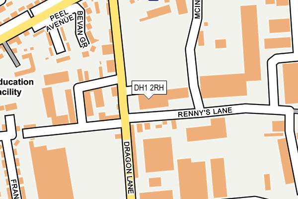
DH1 2RH is located in the Belmont electoral ward, within the unitary authority of County Durham and the English Parliamentary constituency of City of Durham. The Sub Integrated Care Board (ICB) Location is NHS North East and North Cumbria ICB - 84H and the police force is Durham. This postcode has been in use since July 2017.


GetTheData
Source: OS OpenMap – Local (Ordnance Survey)
Source: OS VectorMap District (Ordnance Survey)
Licence: Open Government Licence (requires attribution)
| Easting | 429768 |
| Northing | 542872 |
| Latitude | 54.779889 |
| Longitude | -1.538723 |
GetTheData
Source: Open Postcode Geo
Licence: Open Government Licence
| Country | England |
| Postcode District | DH1 |
➜ See where DH1 is on a map ➜ Where is Durham? | |
GetTheData
Source: Land Registry Price Paid Data
Licence: Open Government Licence
| Ward | Belmont |
| Constituency | City Of Durham |
GetTheData
Source: ONS Postcode Database
Licence: Open Government Licence
| Rennys Lane (Dragon Lane) | Gilesgate Moor | 91m |
| Dragon Lane Near Tesco (Dragon Lane) | Gilesgate Moor | 170m |
| Rennys Lane (Dragon Lane) | Gilesgate Moor | 173m |
| Tesco (Damson Way West) | Gilesgate Moor | 266m |
| Travellers Rest (Sunderland Road) | Gilesgate Moor | 277m |
| Durham Station | 2.8km |
GetTheData
Source: NaPTAN
Licence: Open Government Licence
GetTheData
Source: ONS Postcode Database
Licence: Open Government Licence


➜ Get more ratings from the Food Standards Agency
GetTheData
Source: Food Standards Agency
Licence: FSA terms & conditions
| Last Collection | |||
|---|---|---|---|
| Location | Mon-Fri | Sat | Distance |
| Rennys Lane | 17:15 | 12:00 | 76m |
| Dragonville Ind Est | 18:30 | 11:30 | 110m |
| Gilesgate Moor Post Office | 17:30 | 12:00 | 337m |
GetTheData
Source: Dracos
Licence: Creative Commons Attribution-ShareAlike
The below table lists the International Territorial Level (ITL) codes (formerly Nomenclature of Territorial Units for Statistics (NUTS) codes) and Local Administrative Units (LAU) codes for DH1 2RH:
| ITL 1 Code | Name |
|---|---|
| TLC | North East (England) |
| ITL 2 Code | Name |
| TLC1 | Tees Valley and Durham |
| ITL 3 Code | Name |
| TLC14 | Durham |
| LAU 1 Code | Name |
| E06000047 | County Durham |
GetTheData
Source: ONS Postcode Directory
Licence: Open Government Licence
The below table lists the Census Output Area (OA), Lower Layer Super Output Area (LSOA), and Middle Layer Super Output Area (MSOA) for DH1 2RH:
| Code | Name | |
|---|---|---|
| OA | E00105009 | |
| LSOA | E01020693 | County Durham 029A |
| MSOA | E02004313 | County Durham 029 |
GetTheData
Source: ONS Postcode Directory
Licence: Open Government Licence
| DH1 2RW | Rennys Lane | 69m |
| DH1 2RG | Adolphus Place | 115m |
| DH1 2RN | Teasdale Terrace | 119m |
| DH1 2XW | Dragonville Industrial Park | 144m |
| DH1 2RP | Durham City Retail Park | 152m |
| DH1 2HS | Providence Place | 203m |
| DH1 2LQ | Bevan Grove | 207m |
| DH1 2RS | Rennys Lane | 230m |
| DH1 2RE | Rennys Lane | 235m |
| DH1 2HU | Peel Avenue | 242m |
GetTheData
Source: Open Postcode Geo; Land Registry Price Paid Data
Licence: Open Government Licence