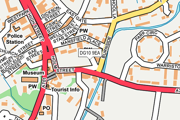
DG10 9EA is located in the Annandale North electoral ward, within the council area of Dumfries and Galloway and the Scottish Parliamentary constituency of Dumfriesshire, Clydesdale and Tweeddale. The Community Health Partnership is Dumfries & Galloway Community Health Partnership and the police force is Scotland. This postcode has been in use since January 1980.


GetTheData
Source: OS OpenMap – Local (Ordnance Survey)
Source: OS VectorMap District (Ordnance Survey)
Licence: Open Government Licence (requires attribution)
| Easting | 308646 |
| Northing | 605187 |
| Latitude | 55.332216 |
| Longitude | -3.441590 |
GetTheData
Source: Open Postcode Geo
Licence: Open Government Licence
| Country | Scotland |
| Postcode District | DG10 |
➜ See where DG10 is on a map ➜ Where is Moffat? | |
GetTheData
Source: Land Registry Price Paid Data
Licence: Open Government Licence
| Ward | Annandale North |
| Constituency | Dumfriesshire, Clydesdale And Tweeddale |
GetTheData
Source: ONS Postcode Database
Licence: Open Government Licence
| Millburn Bridge (Well Road) | Moffat | 41m |
| Millburn Bridge (Well Road) | Moffat | 50m |
| High Street (High Street) | Moffat | 199m |
| Esso Garage (High Street) | Moffat | 208m |
| Esso Garage (High Street) | Moffat | 209m |
GetTheData
Source: NaPTAN
Licence: Open Government Licence
| Percentage of properties with Next Generation Access | 100.0% |
| Percentage of properties with Superfast Broadband | 100.0% |
| Percentage of properties with Ultrafast Broadband | 0.0% |
| Percentage of properties with Full Fibre Broadband | 0.0% |
Superfast Broadband is between 30Mbps and 300Mbps
Ultrafast Broadband is > 300Mbps
| Percentage of properties unable to receive 2Mbps | 0.0% |
| Percentage of properties unable to receive 5Mbps | 0.0% |
| Percentage of properties unable to receive 10Mbps | 0.0% |
| Percentage of properties unable to receive 30Mbps | 0.0% |
GetTheData
Source: Ofcom
Licence: Ofcom Terms of Use (requires attribution)
GetTheData
Source: ONS Postcode Database
Licence: Open Government Licence


➜ Get more ratings from the Food Standards Agency
GetTheData
Source: Food Standards Agency
Licence: FSA terms & conditions
| Last Collection | |||
|---|---|---|---|
| Location | Mon-Fri | Sat | Distance |
| Hamilton Place | 16:00 | 11:30 | 145m |
| Church Place | 16:00 | 11:30 | 151m |
| High Street | 17:30 | 12:00 | 229m |
GetTheData
Source: Dracos
Licence: Creative Commons Attribution-ShareAlike
The below table lists the International Territorial Level (ITL) codes (formerly Nomenclature of Territorial Units for Statistics (NUTS) codes) and Local Administrative Units (LAU) codes for DG10 9EA:
| ITL 1 Code | Name |
|---|---|
| TLM | Scotland |
| ITL 2 Code | Name |
| TLM9 | Southern Scotland |
| ITL 3 Code | Name |
| TLM92 | Dumfries and Galloway |
| LAU 1 Code | Name |
| S30000016 | Dumfries and Galloway |
GetTheData
Source: ONS Postcode Directory
Licence: Open Government Licence
The below table lists the Census Output Area (OA), Lower Layer Super Output Area (LSOA), and Middle Layer Super Output Area (MSOA) for DG10 9EA:
| Code | Name | |
|---|---|---|
| OA | S00098118 | |
| LSOA | S01007643 | Moffat - 03 |
| MSOA | S02001437 | Moffat |
GetTheData
Source: ONS Postcode Directory
Licence: Open Government Licence